Curated OER
Wetlands: Pave or Save?
Young scholars discuss the characteristics of wetlands and how to make them more productive. Using a map, they locate the major wetlands in the United States and color them using a key. They read an article and in groups answer...
Curated OER
Wet Water, Dry Land
Pupils observe and examine relationship between landforms and bodies of water, recognizing differences between them. Students then define island, peninsula, isthmus, archipelago, lake, bay, straight, system of lakes, and identify land...
Curated OER
Alaska the Elephant
Students explore an Internet website, locating and matching the shape of an elephant's head to a state in the U.S. They complete an Alaska worksheet, identifying other geographical locations surrounding Alaska.
Curated OER
A Geopoem About Alaska
Sixth graders conduct Internet research on the physical and human characteristics of Alaska. They compose and write geopoems about the state of Alaska, using a template.
Curated OER
Africa's Geographic Features
Fourth graders work in pairs and use atlases to locate specific geographic features in Africa. They use the Internet to view these geographic features.
Curated OER
Geography: World Dynamics
Students discuss and examine how the world is changing. After reading an article, they discover the immediate changes that have taken place and how they have effected living things. They complete a worksheet identifying the changes as...
Curated OER
The Three Gorges Dam- Should it be Completed?
Students research and analyze the geographic problem of whether or not the Three Gorges Dam should be completed. Students take a position on the issue, gather information related to their position, present their conclusions, and write a...
Curated OER
Home: the Story of Maine "A Love for the Land": Where Are You? Who Are You?
Students investigate their neighborhood both as it is now and as it was 100 years ago. They take a walk around their neighborhood and fill out a worksheet before completing a worksheet.
Curated OER
BOUND TO BE NEW HAMPSHIRE
Learners identify neighborhood, town, and state boundaries. They distinguish between natural and man-made boundaries. They identify major state geological features and explain how NH boundaries have changed over time.
Curated OER
Country Flags Quiz
In this online interactive country flag quiz learning exercise, students examine the 20 pictured country flags and try to name all of the countries represented in 4 minutes.
Curated OER
Walking that Line
Students attempt to describe and use longitude and latitude. They will identify different countries, their neighbors, and borders around the world. Included in the lesson the students identify natural features that control the borders of...
Curated OER
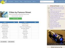
Famous Streets Quiz
In this online interactive geography quiz worksheet, students examine the chart that includes the names of 18 famous streets in the world. Students have 4 minutes to identify the names of the cities where the streets...
Curated OER
State Nicknames Quiz
In this online interactive geography quiz worksheet, students examine the chart that includes the names of 49 states. Students identify the nicknames of the states in 6 minutes.
Curated OER
Biggest Cities in Each State Quiz
In this online interactive geography quiz worksheet, students examine the chart that includes the names of 50 U.S. states. Students identify the names of the two largest cities in each state in 8...
Curated OER
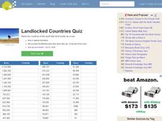
Landlocked Countries Quiz
In this online interactive geography quiz worksheet, students examine the chart that includes details about the population in 44 landlocked countries. Students identify the names of the countries in 5 minutes.
Curated OER
Famous Lakes Quiz
For this online interactive geography quiz worksheet, students examine the chart that includes details about 15 famous world lakes. Students identify the names of the lakes in 3 minutes.
Curated OER
Second Biggest Cities Quiz
In this online interactive geography quiz learning exercise, students examine the chart that includes details about 20 major cities in the world. Students identify the names of the cities in 4 minutes.
Curated OER
Highest Mountain Countries Quiz
In this online interactive geography quiz worksheet, learners examine the chart that includes the elevations of 20 world mountains. Students identify the names of the mountains in 4 minutes.
Curated OER
Biggest Cities in India Quiz
In this online interactive geography quiz worksheet, students examine the chart that includes the population of 20 Indian cities. Students identify the names of the largest...
Curated OER
City to Country Quiz
In this online interactive geography quiz activity, students examine the chart that includes 20 world cities. Students identify the names of the countries where the cities are located in 4 minutes.
Curated OER
Living By Water
Learners research a coastal community, locate it on a map and profile its physical, geography, climate, architecture and cultural characteristics. They envision this coastal community and make a detailed drawing of it by blending...
Curated OER
Geography and Ecology of the Inuit
Students examine environment and ecology of the Arctic region, and explore history and traditions of the Inuit.
Curated OER
Oregon Forest Management Policy Decision Making
Fifth graders explore forest lands in Oregon and how the population affects forest management. They discuss benefits of retaining forests and logging. Given a mini-biography, 5th graders role play the forest management policies and...
Curated OER
Cultural Anthropology Study Using the Fundamentals of Geography and GPS
Students, in groups, operate the GPS unit, plotting each head stone with accompanying description. Two other students to log in data that corresponds to the given points. One student to note general observations


