Curated OER
Louisiana Regional Foodways
Students strengthen their research techniques in locating, selecting, and synthesizing information from a variety of texts, media, references and internet resources to study regional food way traditions in Louisiana. They assess the...
Curated OER
Oh Canada!!
Fifth graders become familiar with the people, culture, government and geography of Canada. In this Canadian people and places lesson plan, 5th graders research and create a map of Canada reflecting their gathered...
Curated OER
Province and Territories Poster
Learners create a poster of a Canadian province or territory. In this Canadian geography lesson plan, students research a Canadian province or territory and create a poster to present the information explored in class.
Curated OER
Countries of Africa
Students investigate the different countries of Africa. In this African geography lesson, students choose an African country to investigate and construct the country's flag. Students use a map of Africa to color in their country.
Curated OER
Recycle, Reduce, Reuse and Save a Tree
Students examine how to save and protect trees. In this conservation lesson, students read books about the usefulness of trees, write ideas in their journals about how trees can be used, and make a book of ways to protect trees.
Curated OER
Japan
Second graders experience, through a hands-on approach, Japan's geography, daily life, language, foods, education, customs, art and literature. They discover all the exciting events that take place to make it really seem like they are...
Curated OER
Sense of Place
Students identify the major folk regions of Louisiana and the relationship between folklife, geography, and ecology. They give deeper thought to what makes their own community unique, what their sense of place actually is. Students...
Curated OER
High Five Burger
Fifth graders investigate agricultural sources. In this agricultural instructional activity, 5th graders read the book Have a Hamburger and See the U.S.A. and record each component of a hamburger. Students use a map of the U.S.A. to...
Curated OER
You're Invited to a Ceili: Exploring Irish Dance
Students recognize a Ceili as an Irish dance of celebration and investigate Ireland while studying the dance. In this Irish dance lesson plan, students search the geography of Ireland, read poetry, identify costumes, draw and...
Learning to Give
Africa - The Great Southland
Applying the five themes of geography, preteen explorers develop a visual aid for younger learners in celebration African American History Month. They investigate the political, geographic, economic, and social aspects of the continent...
Curated OER
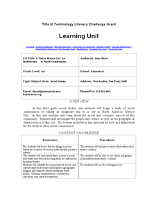
A Visit to Mexico City: An Introduction to World Communities
Third graders complete a variety of activities as they take an imaginary trip to Mexico City, complete with passports, maps, and Spanish dictionaries. They write postcards to send home and create items to sell at the market. The unit...
Curated OER
A Flip of Life in the 13 Colonies
Fourth graders create a flip book illustrating the 13 original colonies. They study the growth and development of each of the three groups of the original colonies. They use maps to observe and interpret geographic information and...
Curated OER
Community Treasures (Rivers and Trees): An Integrated Curriculum Unit
Third graders demonstrate an understanding of geography and its effects on lifestyles and culture. Then they apply basic economic terms and principles
and identify the United States government and history. Students also identify and...
Curated OER
Flight Paths of Orbiting Satellites
Students examine the path a satellite follows as it orbits the earth. For this space science lesson, students use a globe as they illustrate a satellite in its orbital plane, then plot points on the satellite's path on the globe to see...
Curated OER
Welcome to the Americas
Students research and map the North and South American continents. In this geography lesson on the Americas, students can locate North, Central and South American countries and states. Students choose a location to research and prepare a...
Curated OER
My Family Tree
Students create a family tree. For this ancestry lesson, students research a country that one of their ancestors is from. Students interview a grandparent and map out a family tree.
Curated OER
Watersheds: The San Francisco Bay Watershed
Sixth graders make a model of a watershed. In this geography lesson, 6th graders view a shaded relief map of California and locate landmarks. Students examine the San Francisco Bay Watershed by following the journey of water through...
Curated OER
Zimbabwe
In this Zimbabwe worksheet, students read an article and examine a map of Zimbabwe and then respond to 11 short answer questions regarding the economy and geography of the country.
Curated OER
Comparing Countries
Students compare facts about different countries. In this comparing lesson plan, students collect information about the US and another country and compare them. Students locate countries on the map and make a hypothesis about the lives...
Curated OER
Louisiana
Third graders study factual information about Louisiana including the state flag, bird, tree, and important geographical points using the Internet and maps. They explain the different groups that settled the state in this mini-unit.
Curated OER
The Conquest of the Aztec Civilization
Students use the classroom atlases, the Internet or textbooks to draw a freehand map. They work in groups using the maps in the book The Broken Spears (Portilla) and The Conquest of New Spain (Diaz) to draw a freehand map identifying...
Curated OER
Where In the World Am I?
Learners identify their location in the world after studying latitude, longitude, relative location, and absolute location. They use assigned web site to find information to make a flipbook that answers questions about their location in...
Curated OER
Characteristics of Africa
Students describe basic land features and characteristics that make up the continent of Africa, describe the people of Africa, where they live, and how they live and get a sense of what it is like to live in Africa.
Curated OER
Recent Volcanoes And Earthquakes:
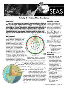
Students investigate the current model for the structure of the Earth. On a world map, they mark areas where they think earthquakes and volcanoes occur and compare those areas with earthquake and volcano location patterns.


