Curated OER
Zones of Conflict
Students read maps and identify specific countries involved in conflict. They classify countries in cultural realms. They relate maps to what they know about world conflict.
Curated OER
Geography: Analyzing the Local Environment
Students, in groups, explore the school grounds and organize their findings according to the five themes of geography. They take notes and sketch the grounds. Students divide the school and grounds into regions based on use.
Curated OER
Geography: African Floor Maps
Students explore the African continent and identify the various countries there. They examine the history, geography, environment, and inhabitants of the countries. Students create maps of Africa using a variety of materials.
Curated OER
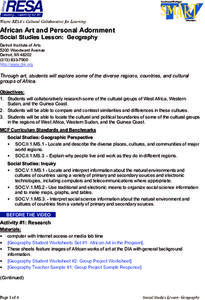
Geography
Pupils work together in groups to research the cultural groups of West Africa, Sudan and the Guinea Coast. They compare and contrast each culture and locate the political and cultural boundaries on a map.
Curated OER
Water and Land 207
Young scholars examine maps of different projections, mathematically calculate distortions, and note the advantages and disadvantages of each map. They study the different maps and transfer the map to graph paper.
Curated OER
Tracing Our Own Family Pilgrimages
Students observe a world map and are introduced to vocabulary like: cities, continents, rivers, lakes, and oceans. They discuss the names of the cities they live in and locate them on the map; then using a colored pushpin indicate: the...
Curated OER
A Place Called Fairfax
Students use maps to locate Virginia, its surrounding states and Fairfax County. Individually, they describe the absolute and relative location of the county and why it is important to know both. As a class, they brainstorm the...
Curated OER
Travel Brochure/ Itinerary
Students select and research a country of their choice and create a travel brochure and a 7-day itinerary.
Curated OER
A Place Called Fairfax
Students are introduced to the various types of maps of Fairfax County, Virginia. Using the maps, they explain the relative and absolute locations of the county and discuss the importance of both. They also discover how the county is...
Curated OER
Where's the Barbecue?
Students identify the major landforms, regions and rivers on a map of South Carolina. They compare the locations of the major Native American groups in the state as well. They chart where barbecue restaurants are located and write...
Curated OER
Exploring Explorers
Learners research a selected explorer and teach their small group about their explorer during a jigsaw activity. Independently they write a letter as if they were on a voyage with their explorer, and create a world map that includes the...
Curated OER
Breads Around the World
Pupils read about bread. For this lesson studying bread, students read about the history of bread and it's significance around the world. Pupils identify the three main crops used to make bread and ten common types of bread from...
Curated OER
Old World and New World - Why Contact Took So Long
Students use a globe to determine why contact between the old world and the new world took a long time. In this map skills lesson, students analyze routes between regions to determine why it took so long for the old world and the new...
Curated OER
Critical Literacy In The 21st Century
Pupils read the book Sitti's Secrets and complete prediction and comprehension activities. In this literacy lesson plan, students also write questions and comments they have on chart paper.
Curated OER
Where In the World Are You?
Fourth graders fill in blank copies of the United States Map and then the World Map.
Curated OER
SpellO': An Orienteering Lesson
Students participate in hands-on activities to practice orienting maps. Given activity cards, students accurately read maps and locate specific stations. Students collect information from the maps to spell a message when the activity...
Curated OER
Cities of the World
Students identify the symbol for cities on a political map. For this world map lesson, students identify specific cities on the World Political Map. Students should identify the country in which the city is located. Students discuss the...
Curated OER
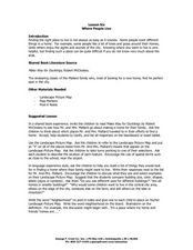
Lesson Six Where People Live
Young scholars investigate where people live. In this early geography lesson, students read Make Way for Ducklings! by Robert McCloskey and then discuss what neighborhoods are as they identify them on landscape picture maps.
Curated OER
Where Should We Put a Store?
Students analyze population data. They convert population data into simple density maps to help make decisions about their world. They select the best location for a school store based on population density. They present their maps...
Curated OER
World Climate Growing Zones
Students create a map showing where crops would be grown around the world. In this crops lesson plan, students show how the world climate would produce different parts of the world at different times. Students fill out worksheets.
Curated OER
Finding Your Spot in the World
Students practice locating places on a Thomas Brothers map. In this map skills lesson, students locate places on the map of where their ancestors are from and then practice finding various community places on a map. Students graph the...
Curated OER
Where in the World is Utah Wheat?
Students examine the role of climate and landforms in the use of Utah's land. For this geography lesson, students analyze the relationship between geography and agriculture in the state as they examine data regarding wheat production in...
Curated OER
Africa
Students complete various activities related to the continent of Africa. They label and color a map of Africa, sing the Continent Song, view pictures and discuss animals of Africa, listen to the book "Bill and Pete Go Down the Nile,"...
Curated OER
Countries of the World
Students in a ESL classroom examine a world map and study the various countries' names. The study the cultures of selected countries and create a vocabulary list. Finally they label an empty map with the countries' names and a short...


