Curated OER
Wales
Students investigate Wales. In this Wales lesson, students do Internet research for facts about Wales. Students are given a list sentences about Wales and decide if they are true or false. Students listen to an audio file and take...
Curated OER
Unraveling the Web
Students consider how a message might be traced along a complex network, then explore backbone maps as a basis for understanding the purpose and structure of the Internet.
Curated OER
Traveling Technology
Students create a dream vacation. For this traveling technology lesson, student use the internet, travel brochures and maps to research and create a dream vacation. They determine the complete itinerary and the total cost.
Curated OER
Oceanic Heat Budget Activities
Students map and research imaginary islands located in different parts of the world. They describe the weather and climate of their island and show how local currents, water temperatures and waves may influence the weather patterns.
Curated OER
Exploring Countries and Cultures
Fifth graders choose a country associated with a family member and research its location, government, language, economy, history, holidays, foods, sports, and famous people. They write to inform using this data and draw a map identifying...
Edgate
Discovering New Resources
What is a natural resource, and what resources did the Lewis and Clark expedition seek? After reading an article on the mapping of the west, learners get into small groups to discuss the important natural resources of the period. They...
Curated OER
Penguin Presentations
Students explore the attributes of penguins. In this penguins lesson plan, students participate in a penguin scavenger hunt and take notes on the information they encounter. Students prepare reports about their findings and share them...
Curated OER
U.S. Puzzle Map Bulletin Board
Students create cutouts of each state. They research different states noting their similarities and differences. They describe each state's location in relation to the state's surrounding them.
Curated OER
Mapping the Effects of War
Students examine how war can lead to environmental health crises. They read an article, conduct research on a region from the article, and create a poster to depict the geographic region and the environmental health effects of the conflict.
Curated OER
Group Research Project on Frog Habitats
Young scholars identify and research a frog habitat in small groups and compile a report to present to the class on the physical characteristics of their frog's environment. Students create a map illustrating areas in the world where...
Curated OER
It's All in the Making: Our Local Organizations
Young scholars study African American nonprofit organizations. In this nonprofit organizations lesson, students discuss African American organizations. Young scholars research the NAACP and NUL website. Students design posters for both...
Curated OER
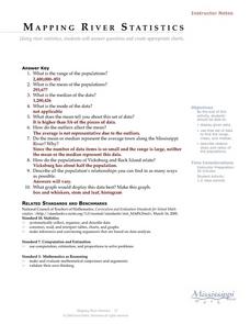
Mapping River Statistics
Students research different statistics to do with the Mississippi River. They answer questions about finding data and collect it by conducting research. The research is used to construct a data table. Then students use the table to...
Curated OER
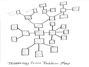
Wayne County Public Schools: Motto - Opening Minds...
Students use research, planning, and organizational skills to devise a technology crisis solution for the given school's problem. In this mapping and planning instructional activity, students read through the letter about the technology...
Curated OER
Civil War Research
Eighth graders research different aspects of the Civil War using various multi-media techniques. Students create a report based on their research that includes views of the war from the point of view of the North, South and slaves.
Curated OER
All About Me-I'm My Own Research Project
Third graders see how to do a research project. They understnad how to categorize information about themselves and relate it to information on sea animals for a future research project. This lesson fits in nicely with any unit on animals.
Curated OER
Making Democracy Work for Everyone, 1877-1904
Students investigate the culture of the post Reconstruction South. They participate in a jigsaw research activity, conduct Internet research on an assigned topic, and write a report to present to the class.
Alabama Learning Exchange
Researching Hurricanes with Technology
Learners explain the components that make up a hurricane.
Curated OER
Studies of the Eastern Worlds: Cultural Maps
Seventh graders look for similarities and differences in the culture of Eastern World countries by looking at the art from each country. They test their hypothesis and assumptions through further research in the media center. Finally...
Curated OER
Creating a Thematic Map Using S'COOL Data
Students observe weather patterns, collect data, and make a weather predictions for various locations on a map.
Curated OER
Mapping Your Local Community
First graders take a walking tour of their community to discover the names of numbered locations on a premade map. They then, create their own map of the community on the computer using Kidspiration software.
Curated OER
Reference Materials
After a class discussion where kids share how they find answers to their questions, learners explore the world of reference materials such as, an atlas, an almanac, and an encyclopedia. The Internet is also discussed as a way to access...
Curated OER
Park Brochures
Sixth graders investigate natural environments by researching national parks. In this brochure making lesson, 6th graders explore a specific national park and research it's information by utilizing the web. Students create travel...
Curated OER
Then and Now
Young scholars conduct research and use census data to compare different times and places. In this census instructional activity, students interpret data from charts and graphs, comparing census information from two time periods as well...
Curated OER
Tracing the Route of Bracero
Students make a map showing the work of a Bracero Worker. In this Bracero lesson plan, students listen to a worker in an online oral history as he explains his work locations and crops. They use a map to plot the areas he worked and the...


