Curated OER
MAKE YOUR OWN BOOK OF THE DEAD
Young scholars study the Book of the Dead and its importance to Ancient Egyptian culture, identify with ancient Egyptians through reading about their culture and religion, and use scroll-shaped paper and colored pencils to create their...
Curated OER
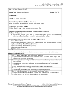
Mapping My Pathway
Eighth graders create career portfolios, speak with the school counselor, and develop and educational plan. Individually, 8th graders discuss career options and how an educational plan can assist them in future goals. They explore...
Curated OER
Making Your Own Master Calendar
Ninth graders discuss time demands such as homework, family, and chores that occupy their free time. They discuss how to effectively manage their time. They write important information and activities on a calendar. They develop and...
Curated OER
Using Maps To Make Public Health Decisions Case Study: Wildfires in Mexico 2000
Learners study environmental health. Using actual NOAA satellite imagery, students investigate the basic concepts of mapping. They explore the relationship between monitoring satellite images and public health decision making.
Curated OER
Edible Resource Maps
Third graders work in groups to create an edible resource map showing locations of at least five resources in the United States. Students research on the internet different regions and the resources that are found in those areas. They...
Curated OER
Weather Predictions
Fourth graders explore meteorologists. They explore symbols on a weather map and make five day forecasts.
Curated OER
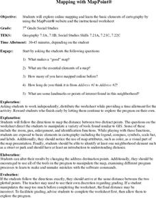
Mapping With MapPoint
The class is engaged through a discussion of mapping. They determine what they believe makes a good map and what the essential elements of a map are. Students work independently to complete a worksheet on mapping. They follow clear...
Curated OER
Making a Globe
Students examine the mercator projection or nautical chart and observe how global maps do not have the same distance as flat maps. They design handmade globes using the meridians and equator as guides to draw in the land. They paint and...
Curated OER
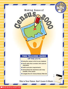
Making Sense of the Census
In this unit of lessons, young scholars make sense of the census. They examine why a census is taken and participate in activities.
Curated OER
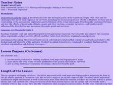
Making A New Nation
Eighth graders read standard road maps and topographical maps, and examine the lives of pathfinders who opened the trails to the West. They develop Living History presentations, role-playing a character from the past.
Curated OER
GIS: Mapping Watersheds of the Edwards Aquifer in Travis County
High schoolers manipulate existing GIS data to create and map a new layer of information that shows that watersheds in Travis County that are on top of Edwards Aquifer. They create and map that shows the watersheds in Travis County that...
Curated OER
1668 Map of Newark Activity
Eleventh graders read a map for historical information, decipher a map legend and symbols, and expand their knowledge of a historic time.
Curated OER
Sand Island Story Mapping
After reading Under the Blood-Red Sun, by Graham Salisbury, students use story mapping to create a visual representation of Hawaii. They include Pearl Harbor, Sand Island, and the Japanese relocation camp, where Tomikazu swims to visit...
Curated OER
Geography: Mapping Neighborhoods
Learners examine their neighborhoods and draw maps reflecting land use. In addition, they make predictions about their community's future. Students also consider the impact of business and industry on their communities and predict ...
Curated OER
Maps
First graders look at their classroom or school setting. They use positional word to describe where things are located in the school. Students discuss a map and why they are important. They read the story "Taylor's New School" and...
Curated OER
The Lincoln-Douglas Debates of 1858: Interactive Map Activity
Students utilize an interactive map to explore the 1858 Senate campaign in Illinois. They examine how factors such as population, transportation, and party strongholds can affect campaign strategies. Students write an essay discussing...
Curated OER
The Lincoln-Douglas Debates of 1858: Interactive Map Activity
Eleventh graders utilize an interactive map to explore the 1858 Senate campaign in Illinois and how factors such as population, transportation, and party strongholds can affect campaign strategies.
Curated OER
Making Sense of the Census
In this unit of lessons, students make sense of the Census. They examine why a census is taken and participate in activities.
Curated OER
Making Sense of the Census
In this unit of lessons, students make sense of the census. They examine why a census is taken and partipate in activities.
Curated OER
Mental Map Postcard
Learners visit an outdoor setting and make a mental map of what they observe. They return to the classroom and create a postcard with specified elements such as a description of the land and the ecosystem. Students illustrate the...
Curated OER
Make Your Own "Weather" Map
Learners create their own "weather" map using data from x-ray sources. They analyze and discuss why it is important to organize data in a fashion in which is easy to read. They compare and contrast different x-ray sources using a stellar...
Curated OER
Maps of Indian Territory, the Dawes Act, and Will Rogers' Enrollment Case File
Students, in groups, analyze one map at a time, first the 1885 map, then the 1891 map. After they have completed the analysis sheets, they compare the two maps and answer questions imbedded in the plan.
Curated OER
Mapping Geographical Skills
Eighth graders use technology to make a map of Canada in 1867 and 1873.
Curated OER
International Relations: Concept Mapping With Inspiration
Students create concept maps comparing and contrasting Neo-realism vs. Realism and Neo-liberalism vs. Liberalism using the Inspiration educational software. This lesson is intended for a high school level social studies class and...
Other popular searches
- Making Maps Geography
- Making Maps and Research
- Making Maps Using Technology
- Making Maps of History
- China, Making Maps
- Making Maps of Community
- Reading Making Maps
- Neigborhoods and Making Maps
- Making Maps Lesson Plans
- Making Maps Usign Technology
- China Making Maps
- Neighborhoods and Making Maps

