Curated OER
The Power of Words in Charlotte's Web
"How can a few good words save a pig's life?" Posed with this question, your ELD students explore E.B. White's Charlotte's Web in a meaningful, valuable way. By analyzing specific word choice from the book, especially the excerpts...
Curated OER
Fossils and Lithologic Units
Practicing paleontologists map the geologic time scale, simulate the formation of sedimentary rock, and analyze fossil data. Instructions for four activities and five assessment choices are provided for the teacher. This comprehensive...
Curated OER
Matthew Henson
Discuss the work of Matthew Henson, an African American who traveled to the North Pole with Robert Peary. After reading the story "Matthew Henson" by Maryann N. Weidt, learners answer questions by drawing inferences and conclusions,...
Curated OER
An Introduction to the Night Sky and Movement Astronomy
Basically, this is an interactive exploration of educational astronomy software and an app. Young astronomers discover how the apparent motion of the sky relates to Earth's movements and the position of the observer. It is out of this...
Curated OER
Water - Our Future
How is it that water that falls as rain ends up coming out of the tap on our sinks? Learners trace water's journey and examine how along the way pollutants make their way into the water supply. They conduct experiments, use the Internet...
Curated OER
Crude Conversation
Students analyze text and maps in determining the effect the world's energy resources have on human society, and make charts illustrating at least three ways each resource makes life easier for human society.
Curated OER
Ancient Greece and Ancient Rome Unit Plan
Students make two T charts, one for Sparta and one for Athens, showing pros and cons for living in either city-state. They use the physical information from the map and the cultural captions given for Athens and Sparts to come to their...
Curated OER
Sound Walk: Discovering Data and Applying Range, Mode, and Mean
Elementary schoolers sharpen their listening skills as they use sound maps, tallies, and line plots to organize and interpret data. Everyone takes a "sound walk," and focuses on the sounds around them. They chart and tabulate the sounds...
Curated OER
Our States, My State
Here is a very nice lesson on the shape of the United States, and the shapes of the individual states for your young geographers. They utilize worksheets embedded in the plan to color in a variety of states and to become familiar with...
Curated OER
Gingerbread Baby Unit
Learners participate in a variety of activities surrounding the book, Gingerbread Baby, by Jan Brett. They can create a house, a map, ornaments, and their own books. Additionally, they can draw, paint, or write out attributes for each...
Curated OER
Follow the Light
Here is another in the interesting series of lessons that use the special State Quarters as a learning tool. During this lesson plan, pupils learn about lighthouses, maps, the cardinal directions on a compass, and U.S. geography. There...
California Academy of Science
Discovering Rainforest Locations
How many rainforests are there, where are they, and do global factors effect their locations? These are great questions that have great answers. Children in grades four through eight use several different maps to determine why...
Civil War Trust
Civil War Soldier: Experiencing the Battle of Franklin
Fighting a war over home soil makes a living nightmare even more real. Class members describe the experience of a Civil War soldier during the Battle of Franklin, poised right at a major turning point of the war, after researching the...
Curated OER
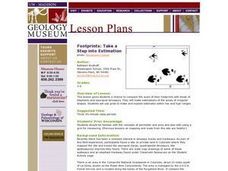
Footprints: Take a Step into Estimation
Compare sizes of student footprints with those of elephants and sauropod dinosaurs! Upper graders make estimations of the areas of irregular shapes; students use grids to make and explain estimates within low and high ranges.
BBC
EU, UN, and Commonwealth
Find out how international government organizations work to face global issues. Learners examine if major organizations like the EU, UN, and Commonwealth are effective at tackling big issues like animal protection. They think about...
Curated OER
What They Left Behind: Early Multi-National Influences in the United States
Students examine how the European voyages of discovery influence American culture even today. They map eighteenth century Europe's impact on the United States.
Curated OER
"The Drum"
Second graders read and discuss the folktale "The Drum" from India. They also answer story comprehension questions, complete an adjectives and verb worksheet, and label a map of India. Students sequence events from the story and make...
Curated OER
How Does Your Garden Grow? Discovering How Weather Patterns Affect Natural Cycles
For the warm-up in this cool climate lesson, you will need to click on "Mapping" and then "US Mapping" once you arrive at NOAA's "US Climate at a Glance" page. Earth science explorers realize that 2012 was a warm winter for us. They read...
Shakespeare in American Life
Tom Hanks and Caliban: Survivor Superstars
Here’s a clever way to combine language arts and social studies. Shakespeare’s The Tempest is believed to have been inspired by the wreck of the Sea Venture on Bermuda in 1609. The class views a brief scene from Castaway in which Tom...
Curated OER
Water Quality and Watersheds: A GIS Investigation
Requiring more than one class period, this resource takes earth science learners on a journey through a watershed. Using ArcGIS Explorer, an online geographic information system, they view maps of watersheds and surrounding landscapes....
Polar Trec
The Amazing Antarctic Trek
This resource provides two ways to engage learners in using latitude, longitude, and research skills. In pairs, or on their own, learners will locate several Antarctic regions on a map. They will write the name of the place and a few key...
Curated OER
Creating a PowerPoint Displaying Respectful Behavior
Respect is vital to every relationship and every classroom. Here you will find a resource which will help your pupils to create a multimedia presentation on the topic of respect. They relate their personal behavior and experiences with...
Curated OER
Run/Walk Across America
Walk, jog, or run across America. Maps of individual states, visual progress, competition, and rewards, seem to be great motivational ideas. Make sure that the distances that each class has to walk or run are the same, because getting...
Science Matters
Slip Sliding Along
The San Andreas Fault is the largest earthquake-producing fault in California. In the seventh lesson in the 20 part series, pupils create maps of California, focusing on the San Andreas Fault system. The comparison of where...
Other popular searches
- Making Maps Geography
- Making Maps and Research
- Making Maps Using Technology
- Making Maps of History
- China, Making Maps
- Making Maps of Community
- Reading Making Maps
- Neigborhoods and Making Maps
- Making Maps Lesson Plans
- Making Maps Usign Technology
- China Making Maps
- Neighborhoods and Making Maps
