Center for Learning in Action
Density
Explore the concept of density within states of matter—gases, liquids, and solids—through a group experiment in which young scientists test objects' texture, color, weight, size, and ability to sink or float.
Curated OER
Schoolyard Geology
Discover that maps show information about an area and that they have common features like scales and legends. View an aerial map of your school and find features on the map such as the playground, roads, and trees. Trace the outline of...
Curated OER
Your Galactic Address
Young scholars discover their place in the universe. For this astronomy lesson, students identify their location on various maps that have increasingly larger scales. In the end, the young scholars write their address in...
Curated OER
Metrics And Measurements
Middle schoolers engage in a study of measuring distances between geographical locations on a map. They are able to define and use the map scale in conjunction with the metric system. For this lesson they make their own maps and measure...
Curated OER
Goldilocks and the Three Bears
Students analyze classic children's stories by creating story maps. In this children's literature lesson, students read Goldilocks and the Three Bears, and practice retelling the story with picture cards that need to be put into...
Curated OER
Creating Station Models
Learners review weather conditions at various cities and create station models on a weather map.
Curated OER
Putting the World in Perspective
Students work in small groups to: make a mental map of the world by tearing paper shapes of the seven continents and locating them on a flat surface in their relative positions, compare their finished mental map to a reference world map,...
Curated OER
Sea Ice: Unscrambling the Egg Code
Students determine sea ice thickness, concentration, and floe size by reading egg codes. In this sea ice conditions lesson, students color code a map based on prescribed criteria and use the maps to identify changes in sea ice...
Curated OER
Design an Island
Students explore islands. They create a two- or three-dimensional map of an island. They explain how the topography of an area influences the location of water sources, ecosystems, and human settlements. Lesson includes adaptations for...
Curated OER
Mush! Tracking Travelers on the Trail
Students get to know Alaska and the Iditarod route that is run by dogs as they track the mushers' progress on a map that they create specifically for the race. They learn about latitude, longitude, plotting on a map, checkpoints, and...
Curated OER
How Far Did They Go?
Students create a map. In this direction and distance lesson, students come up with familiar places in the community and calculate the distances from these places to the school. Students create a map that displays these places and their...
Curated OER
Park Brochures
Sixth graders investigate natural environments by researching national parks. In this brochure making lesson, 6th graders explore a specific national park and research it's information by utilizing the web. Students create travel...
Curated OER
Arkansas History Lesson Plant One: Play-Do Soto
Fifth graders complete a variety of projects to learn about Arkansas history. In this Arkansas lesson plan, 5th graders go on a field trip to a state park, explore an Arkansas map, put play-dough on the trail of De Soto, color regions of...
Curated OER
Analyzing Hurricanes Using Web and Desktop GIS
Young scholars analyze hurricanes. In hurricanes lesson, students use the Internet and GIS to analyze hurricanes. Young scholars view the National Atlas of Maps to discuss the direction hurricanes move. Students study the wind and...
Curated OER
FINDING A RESOLUTION
Students examine detailed Moon and Earth views provided by the NASA-sponsored "World Wind" computer program. They work in groups to create maps of different scales using landmarks of their choice, and challenge their classmates to...
Curated OER
Trailblazers- Now and Then
Students examine and study the routes of trailblazers. In this American history lesson, students find a route on a map and compare that to the route of trailblazers. Students will then compare that map with a topographical map to...
Curated OER
Elements of Civilization
High schoolers create their own ancient civilizations based off of topographical maps of Egypt, Mesopotamia, the Indus Valley, and the Yellow River. In this social studies lesson, students are assigned one topographical map to use to...
Curated OER
Weather Versus Climate
Young scholars research on the internet to understand the difference between weather and climate. In this weather versus climate lesson plan, students research the internet, read a climate zone map, look into the climate zones, and...
Curated OER
Tracing the Route of Bracero
Students make a map showing the work of a Bracero Worker. In this Bracero lesson plan, students listen to a worker in an online oral history as he explains his work locations and crops. They use a map to plot the areas he worked and the...
Curated OER
We Found It!
First graders identify and describe landforms. They demonstrate an understanding of the compass rose and a map key using the trail of Lewis and Clark and the Corps of Discovery. They generate a map key.
Curated OER
Community Building
Seventh graders discover the similarities and differences between cities, towns, and rural communities. Using a Neighborhood map Machine, they create a Venn diagram and map of their own community. Students build a 3-D representation of...
Curated OER
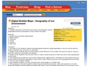
Geography of Our Environment
Students explore geographical elements. In this geographical elements lesson, students create a map showing the geographical elements in their area. Students take pictures of these elements to glue to their map and present it to the class.
Curated OER
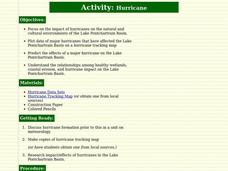
Hurricane
Students learn about and track hurricanes. For this natural disasters lesson, students discuss hurricane formation and research the impact/effects of hurricanes in the Lake Pontchartrain Basin. Students use a hurricane tracking map to...
Curated OER
The Desert Alphabet Book
Students explore world geography by researching a science book with their classmates. In this desert identification lesson, students utilize a U.S. map to locate the geographical locations of deserts. Students create an oral report based...
Other popular searches
- Making Maps Geography
- Making Maps and Research
- Making Maps Using Technology
- Making Maps of History
- China, Making Maps
- Making Maps of Community
- Reading Making Maps
- Neigborhoods and Making Maps
- Making Maps Lesson Plans
- Making Maps Usign Technology
- China Making Maps
- Neighborhoods and Making Maps


