Curated OER
Map Maker Map Maker
Students create their own maps. In this map making lesson, students go to Microsoft Word and create a chart. They label directions, buildings, streets, and distance.
Curated OER
Landscape Picture Map
Students design a landscape picture map. In this landscape picture mapping lesson, students understand when and why to use a landscape picture map. Students discuss landscape picture maps.
Curated OER
Understanding Topographic Maps
Underclassmen create a cone-shaped landform and then draw a contour map for it. Then they examine a quadrangle (which was easily located with an online search), and relate it to what they experienced. The accompanying worksheet is...
Curated OER
Lesson 4 Activity 1: Mapping the Third Dimension
Young scholars work in pairs to construct a simple stereoscope.
Curated OER
Making the Invisible Visible
Students evaluate the various ways in which cyberspace is beginning to be mapped by geographers, cartographers, artists, and scientists and use their understanding of the information these new maps can convey to create their own maps of...
Curated OER
Ecozones Project
Learners examine, detail and produce a display about a particular ecozone in Canada. They produce a detailed wall map, written report and a summary sheet.
Curated OER
Road Map Relief - Mixed Media painting
High schoolers use road maps to create non-objective artwork.
Curated OER
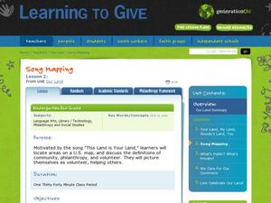
Song Mapping
Young scholars explore locations on the United States map. In this map skills lesson, students recite the song This Land Is Your Land and locate various places listed in the song on the map.
Curated OER
Inspirational Mapping for the Corps of Discovery
Third graders use a computer software entitled, Inspiration, in order to create a map or web of what Lewis and Clark should have packed for their journey west. They are given the expectations of the teacher and a scoring guide is...
Curated OER
Weather Lesson Five
Learners define a weather forecast, make a forecast using a weather map, identify three prediction guidelines, and explain how computers help to make forecasts. Students make a 24-hour forecast for each of the thirteen states targeted.
Curated OER
Geography of Canada
All about Canada! Learners explore the geography and providences of Canada by watching videos, studying maps and conducting internet research. By the end of this lesson, your class should be able to locate major areas and compare and...
Curated OER
Changing Planet: Sea Levels Rising
Begin by showing a six-minute video, Changing Planet: Rising Sea Level as an anticipatory set. Pupils draw a topographic map of a potato continent. Finally, they will visit NOAA's sea levels online map and NASA's carbon dioxide...
Curated OER
Where in the World Is Mexico?
Learners practice map-reading skills as they locate Mexico and its cities on a world map. By creating a puzzle out of a map of Mexico, students engage in a meaningful hands-on activity to help them explore that country's geography.
Curated OER
Geography of Mesopotamia
Students write a letter. In this irrigation instructional activity, students review how humans and the environment can interact with each other, learn new vocabulary words having to do with Mesopotamia, learn about irrigation and...
Curated OER
Ehhh...What'd you say?
Practice pronouncing and spelling words with the /e/ sound with spellers. They blend phonemes with spelling maps to master important representation and letter symbol of the short vowel /e/. They also make sock puppets and study the...
Curated OER
Summer Shorts
Want to use sequence maps in your narrative writing unit? Young writers work to create personal narratives about their summer vacation. They write a narrative of their vacation and create a display using summer clothing shapes made from...
Curated OER
Draw an Inch, Walk a Mile
Students work in small groups to solve the problems presented. The main project, mapping the classroom, use these discussions to collaborate in creating a tangible demonstration of their understanding.
Curated OER
Aaaa! It's A!
Exercise phonemic awareness of the vowel /a/ to help children become successful readers. They connect spoken phonemes to written grapheme's and create a relationship between the vocal gesture of /a/ and its grapheme map in text and words.
Center Science Education
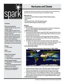
Hurricanes and Climate
Feeling under the weather? This instructional activity on hurricanes can whip things up! With professionally designed maps and handouts, teach your future weathermen (or women) where, when, and how hurricanes occur. They identify...
Curated OER
China Quest
Read and research information on China. Young researchers complete a knowledge hunt about China then locate and describe each location using directional words. They recognize the word meaning through context clues and application practice.
SeaWorld
Animal Migrations
Here is a fabulous set of activities for your young scientists. Each lesson contains map, hands-on, and game activities that will help the class understand why and how animals migrate from one place to another. First they'll examine the...
Curated OER
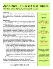
Agriculture: It Doesn't Just Happen
After reading an informational text on the Agricultural Research Service, learners research the role of the ARS in Oklahoma. Using reputable online sources, they label a map of the state with relevant areas. Researchers focus on one of...
TED-Ed
A Digital Reimagining of Gettysburg
Why would Robert E. Lee order Pickett's Charge, an action that changed the course of the Civil War? Geographer and historian Anne Knowles uses digital technology to explain what she thinks is the missing piece in trying to understand...
Smithsonian Institution
A Ticket to Philly—In 1769: Thinking about Cities, Then and Now
While cities had only a small fraction of the population in colonial America, they played a significant role in pre-revolutionary years, and this was certainly true for the largest city in the North American colonies: Philadelphia. Your...
Other popular searches
- Making Maps Geography
- Making Maps and Research
- Making Maps Using Technology
- Making Maps of History
- China, Making Maps
- Making Maps of Community
- Reading Making Maps
- Neigborhoods and Making Maps
- Making Maps Lesson Plans
- Making Maps Usign Technology
- China Making Maps
- Neighborhoods and Making Maps


