abcteach
Street Mapping
What's around the block? Or down the street? Ask your pupils to tap into their map skills by drafting the area around their home and school.
Corbett Maths
Enlargements with Fractional Scale Factors
Enlargements make it bigger, right? A video shows viewers how to perform a basic dilation with a fractional scale factor. They learn how to use the scale factor to find the location of the transformed vertex by multiplying the horizontal...
Curated OER
Maps Reinforcement
In this map worksheet, middle schoolers complete 6 multiple choice questions and 5 short answer questions about 3 different map figures.
Journey Through the Universe
A Scale Model Solar System
Between the time scientists discovered Pluto and reclassified it as a dwarf planet, it did not even make one full revolution around the sun. In two activities, scholars investigate scale models and their properties. Pupils find that it...
University of Nottingham
Drawing to Scale: A Garden
See how design and geometry go hand in hand. The activity asks learners to use geometry to design a backyard garden given dimensions of each feature. Scholars work with ratios and scale to develop an accurate scale drawing that includes...
Owl Teacher
Introduction to World of Geography Test
Assess your learners on the five themes of geography and the most important key terms and concepts from an introductory geography unit. Here you'll find an assessment with 15 fill-in-the-blank and 14 multiple-choice questions, sections...
Curated OER
Three Scale Drawing Activities
In this scale drawing activity, students complete three different scale drawing activities. One activity is making a scale drawing, one involves answering questions from a given scale drawing, and one is a cross-number...
Laboratory for Atmospheric and Space Physics
Planetary Distances on the Playground
There's no need to stay inside; get out of the classroom and create a scaled map of the solar system on your playground field! In collaborative groups, scholars identify the distance between the sun and other planets, place planet...
Curated OER
Problem-Solving Decisions: Reasonable Answers
In this problem solving learning exercise, students answer 6 questions pertaining to a story problem about a tabletop scale model of the Nile River.
Curated OER
Make a Map
In this mapping activity worksheet, students finish the map by following the 5 directions and using the map key. Students the map key, scale, and an inch ruler for help.
Mathed Up!
Enlargements
Make enlargements with and without centers. Pupils work through seven problems dealing with dilations or enlargements. The first couple items are strict enlargements without centers, while the others have centers. Class members also...
Kentucky Educational Television
The Road to Proportional Reasoning
Just how big would it really be? Young mathematicians determine if different toys are proportional and if their scale is accurate. They solve problems relating scale along with volume and surface area using manipulatives. The...
Curated OER
Scale Drawing
In this scale drawing worksheet, 10th graders solve 10 different word problems that include various types of scale drawings in each. First, they determine the length of a highway on a map. Then, students determine the dimensions of a...
Curated OER
Worksheet for Analysis of a Map
For this primary source analysis worksheet, students respond to 6 short answer questions that require them to analyze the maps of their choice.
Curated OER
Formulas Multiple Choice
In this formulas learning exercise, students determine the distance between two points. They read story problems, identify needed information, write equations and solve them. Students find the midpoint of a line. This...
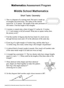
Mathematics Assessment Project
Geometry
Help learners find joy in facing mathematical challenges. The questions posed on this instructional activity encourage young mathematicians to utilize skills learned throughout a geometry unit, and to apply themselves and persevere...
Curated OER
Maps Not Drawn to Scale
In this maps activity, students redraw a map to make it more accurate and drawn to scale in the space given. Students draw 1 map and answer 2 questions.
Curated OER
Unit V: Worksheet 2 - Constant Force
Physics learners studying force and acceleration practice solving eight problems with this assignment. They calculate acceleration and deceleration, net force, and distances required for stopping a moving object. Kinematics equations and...
K-State Research and Extensions
Water
How are maps like fish? They both have scales. The chapter includes six different activities at three different levels. Scholars complete activities using natural resources, learn how to read a map, see how to make a compass rosette,...
Curated OER
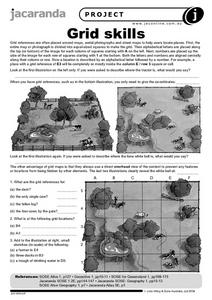
Grid Skills
In this geography worksheet, students use grid references on a map to locate places in the pictures given. They also identify another advantage of using a grid map, which they have an overhead view of the content to prevent any features...
Curated OER
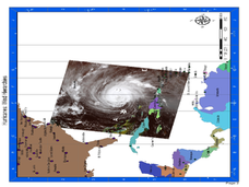
Hurricane Winds: A Spatial Hierarchy of Processes at Different Scales
In this earth science lesson, students study a satellite image of hurricane Isabel and write answers to 5 questions that follow. They match predictions to the map locations.
Curated OER
Unit 19 Scale Drawing
In these scale drawing worksheets, students read the distance problems and select the answer from the choices. Students complete 9 problems.
EngageNY
Getting a Handle on New Transformations 2
Use 2x2 matrices to move along a line. The second day of a two-day instructional activity is the 28th installment in a 32-part unit. Pupils work together to create and solve systems of equations that will map a transformation...
Curated OER
Lesson 3-5: Proportions and Similar Figures
In this similar figures worksheet, students use proportions to solve 6 short answer and multiple choice questions. Students use proportions to answer questions about map scales and height of trees given shadow lengths.


