Curated OER
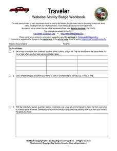
Traveler: Webelos Activity Workbook
This three-page worksheet is designed to be used by the Weblos of Boy Scouts of America. They are given 13 choices of academic activities that involve the use of maps, geography, math, and money. They must complete five of the activities...
Curated OER
Comparison of Snow Cover on Different Continents
Students use the Live Access Server (LAS) to form maps and a numerical text file of snow cover for each continent on a particular date and analyze the data for each map, corresponding text file to determine an estimate of snow cover for...
Curated OER
Any Small Goodness
Are you thinking of reading Any Small Goodness with your students? Engage them with these worksheets. Sharpen prediction and response skills, in addition to creating a character analysis map. Also included, are some thoughtfully-written...
Curated OER
Informational Text Features
How can you tell if the text you're reading is informational or narrative? Show your reading class this basic PowerPoint to illustrate the characteristics of an informational text. What makes this presentation especially effective is...
Curated OER
Names and Places
Students explore where jobs are done. In this careers and geography lesson, students locate places in Canada on a map and list jobs that are done in their area of Canada. Lesson includes extension and differentiation ideas.
Curated OER
Vocabulary Review and Map Skills
Students, when given the name of a community, identify a food, a craft, a custom, language and music, unique to that community 100% of the time. They find similarities and differences between this community and their own in four...
Curated OER
Where Has It Been? Tracking the Ivory-Billed Woodpecker
By studying the assumed extinction, and subsequent rediscovery of the Ivory-billed Woodpecker, learners use maps and come up with a scenario for the rediscovery of the bird. This incredibly thorough lesson plan is chock-full of...
Curated OER
Introduction Lesson to the Book Where the Red Fern Grows
An excellent lesson plan on the classic book, Where the Red Fern Grows. Learners view the W. Wilson Rawls website and engage in a series of activities generated by the website. They write in their reflective journals, watch a video, and...
Curated OER
Recreate the Race
Young scholars research and find the route of the Alaskan dog sled race.In this Iditarod race lesson students find the checkpoints for the Iditarod on a map. Young scholars research information in pairs about each one of the checkpoints....
Curated OER
Schoolyard Geology
Discover that maps show information about an area and that they have common features like scales and legends. View an aerial map of your school and find features on the map such as the playground, roads, and trees. Trace the outline of...
Physics Classroom
As the Crow Flies Lab
A simple, yet memorable, way of practicing with displacement vectors is described here. Divide your class into groups and assign each a different landmark on campus. They measure smaller legs of the path from the classroom to their...
National Wildlife Federation
Get Your Techno On
Desert regions are hotter for multiple reasons; the lack of vegetation causes the sun's heat to go straight into the surface and the lack of moisture means none of the heat is being transferred into evaporation. This concept, and other...
Curated OER
I Can Find that Where? - A Study of Landforms
First graders make landform maps of the United States. In this landform lessons, 1st graders participate in a discussion of local landforms and make a landform map of the United States. They follow the teacher's directions to add plains,...
Southern Nevada Regional Professional Development Program
Reading Literature - An Occurrence at Owl Creek Bridge
“An Occurrence at Owl Creek Bridge,” Ambrose Bierce’s short story, is used to model how structural moves, the decisions an author makes about setting, point of view, time order, etc., can be examined to reveal an author’s purpose. Groups...
NASA
Hurricanes and Hot Towers with TRMM
Take cover because a wild presentation on hurricanes is about to make landfall in your classroom! An outstanding PowerPoint presentation is the centerpiece of this lesson. Not only does it provide information and photographs, but several...
Curated OER
Giving Students a Little Latitude
Students use a world outline map to locate places using coordinates of latitude and longitude. They answer questions about places based on their knowledge of the map and on their research and make up more questions of this sort for each...
Curated OER
Lesson on GPS
Students investigate global positioning systems. In this technology and mapping lesson, students view a PowerPoint presentation in which they identify the features of a GPS, state its uses, and follow steps to find a waypoint.
Curated OER
Governance
Third graders participate in decision-making situations. In this social studies lesson students make connections between rules and laws and the purposes for those rules and laws. Students use critical and creative thinking skills to...
Curated OER
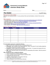
Literature Study Guide - The Hobbit
With several online resources for J.R.R. Tolkien's The Hobbit, as well as many reading and literary analysis activities, this novel study guide is a great way to keep your young readers organized during a book report. The guide...
Curated OER
Literature Study Guide - The Prince and the Pauper
Offering several reading comprehension activities, such as a character map and a plot flow chart, this book report form will help your class through Mark Twain's Prince and the Pauper. The activities in the lesson lend well to...
Curated OER
Baseball Challenge - Basic Geography Skills
A fabulous presentation/activity based on geography. The author has designed a "baseball game" where batters advance to the next base if they correctly answer a multiple choice question about geography. Geographic terms are used, along...
Curated OER
The Bear Facts
Students explore various kinds of bears and gather information about them. In this research and habitats lesson plan, students chart their bear information on large posters with illustrations of their bears. Students map the...
Curated OER
Using Your Senses
Here is a terrific lesson that uses a special State Quarter as a learning tool. This one uses the Alabama State Quarter. During this lesson, pupils learn about their five senses. They make observations about what is in paper bags using...
Scholastic
Reading Characters
Philip Pullman's The Golden Compass provides the text for a study of how writers bring characters to life. Using the provided character mapping worksheets, readers respond to questions and then write a short character sketch.
Other popular searches
- Making Maps Geography
- Making Maps and Research
- Making Maps Using Technology
- Making Maps of History
- China, Making Maps
- Making Maps of Community
- Reading Making Maps
- Neigborhoods and Making Maps
- Making Maps Lesson Plans
- Making Map Scales
- Making Maps Usign Technology
- Making a Map Project


