Curated OER
Map Directions and the United States
Third graders search TDC database for images of a compass rose, a miles marker, and a US map. They identify cardinal and intermediate directions to help identify their state and other states on a US map.
Curated OER
Salt Relief Map of Virginia
Fourth graders create a salt relief map of the four regions of Virginia. They indentify land forms and bodies of water, and summarize how they made their project.
Curated OER
Color Enhanced Maps
Students download or create maps with numerical weather data. They add isolines and color to create regions on their maps. They explore the visual properties of color palettes and create a visualization applying their knowledge.
Curated OER
Mufaro's Beautiful Daughters - Mapping the Story
Students listen to John Steptoe's story, "Mufaro's Beautiful Daughters" and create a story map.
Curated OER
Rockin' Map Summaries
Students summarize a piece of text. After reviewing the correct way to read and summarize, students work in groups to summarize a piece of text assigned by the instructor. They write a summary paragraph by creating a story map and the...
Curated OER
When a Map Isn't A Map...
In this maps activity, students read about the Earth, sky, rivers and lakes, and more, and then answer short answer questions about it. Students complete 3 questions.
Curated OER
First World War Maps
Tenth graders examine the First World War. In this Global History lesson, 10th graders analyze various maps of this time. Students construct maps of each front of the war by answering various questions.
Curated OER
Let's Sum It Up
Students read the book, 'Shiloh, and, as a group, complete a story map of the first chapter. They re-read the second chapter and individually make up a story map for it. In small groups, they complete story maps of the remaining chapters.
Curated OER
Mapping Potato Island
Students create their own topographical map using a potato. For this hands on lesson students construct a topographical map and explain what contour lines are using a potato.
Curated OER
Coordinate Grid: Mapping Archeological Sites
Fourth graders discover how to apply the Cartesian coordinate system by figuring out the length and width of their school playground. They determine that pacing is an important tool for the initial mapping of a site. Students conduct a...
Curated OER
Making Public Policy
Eighth graders examine a Legislative website to view the biography of a member and a map of the district that the member represents. They are then visited by the member who engages students in a discussion about how legislators make...
Curated OER
Technology Strategy Map
In this technology strategy mapping activity, students formulate a strategy for a technology leadership project for their organization.
Curated OER
Mapping Data Made Manageable
Students explore how to select unbiased random samples as they choose report data to include on maps. They propose methods for choosing random numbers and discuss their advantages and disadvantages. They consider bias in science.
Curated OER
Decision Making, Take a Seat or Get off the Bus
Fifth graders explore the positive and negative consequences of choosing to fight against discrimination. They read the story of Rosa Parks. Students discuss the movement against segregation. Students read other books about...
Curated OER
Mapping Out A Summary
Students summarize a selected piece of fiction text. After reviewing the correct way to read silently, students read a chapter in the novel they are currently reading. They write a chapter summary using a story map and the process...
Curated OER
Summarization Mapping
Students observe and demonstrate the strategy of summarizing the main idea. They discuss six rules of summarizing, and observe the teacher summarizing the first chapter of the novel "The Incredible Journey." Students then read chapter...
Curated OER
Reading Comprehension: The Very Hungry Caterpillar
In this reading comprehension worksheet, students draw a picture, make words, and respond to short answer questions about The Very Hungry Caterpillar.
Curated OER
It's All in the Making: Our Local Organizations
Young scholars study African American nonprofit organizations. In this nonprofit organizations lesson, students discuss African American organizations. Young scholars research the NAACP and NUL website. Students design posters for both...
Curated OER
Word Map-- The Latin Root "spect"
In this language arts learning exercise, students examine a colorful poster showing about 100 words which share the root "spect" from the Latin "spectare" which means to look. This very colorful poster has each word in a different color...
Curated OER
Mapping Tanzania
In this Tanzania worksheet, students label countries, cities, landmarks, rivers, and more that make up Tanzania. Students label 10 items.
Curated OER
Making Headlines
Learners identify acts of kindness in the news. In this random acts of kindness lesson, students discuss kindness, find a news article about an act of kindness that took place in another country, locate the country on a map, and write a...
Curated OER
Route Map Lesson Plan
Students read and make a route map by following step by step directions. They identify and make legends.
Curated OER
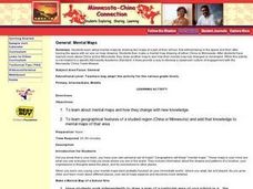
Minnesota-China Connections: Mental Maps
Students examine the concept of mental mapping. They draw a map of their school, before and after touring the space they draw. Then they draw mental maps of China and Minnesota, before and after seeing actual maps of the areas.
Curated OER
Lets Put Delaware On The Map
Students compare and contrast historical and modern maps of Delaware. Through class discussion and group activities, students analyze maps and make comparisons. Each group participates in a game to aid in discerning the similarities...
Other popular searches
- Making Maps Geography
- Making Maps and Research
- Making Maps Using Technology
- Making Maps of History
- China, Making Maps
- Making Maps of Community
- Reading Making Maps
- Neigborhoods and Making Maps
- Making Maps Lesson Plans
- Making Map Scales
- Making Maps Usign Technology
- Making a Map Project
