Curated OER
WORLD GEOGRAPHY
Students identify and analyze map symbols and map grids by completing various worksheets and creating their own map using these skills. Students identify and analyze what latitude and longitude are on a map to play a game of Bingo....
Curated OER
Going to the Zoo
Students choose a map and follow directions to get to the zoo. For this physical education and map skill lesson, students follow a color map to get to the zoo. Students walk, jump or use other movement skills to reach the zoo.
Curated OER
Project Jukebox
Students analyze an interview with the Climate Change Project Jukebox in order to help them undertand how to use a concept map. In this writing and climate change lesson, pairs of students log onto the Internet site for Climate...
Curated OER
Character, You Say? Prove It!
Young scholars discuss character traits, and complete a character map and a Venn diagram for selected characters in their assigned text.
Curated OER
MAP MAGNETIC FIELD OF A ROOM
Students map the magnetic field of a room (classroom or room at home -- recommend kitchen) at two or more heights. They create a coordinate grid within the room and make a relatively accurate map of the room to super impose the...
Curated OER
Compass Rose Directions
Second graders use cardinal and intermediate directions to locate places on maps and places in the classroom, school, and community. They draw a setting map of "Little Red Riding Hood." Students give five steps of cardinal or...
Curated OER
Map Making with Lewis and Clark
Students develop maps based on a virtual internet expedition of The Louisiana Purchase land area. They create the maps based on an actual outdoor expedition of their communities. Student create two maps, one based on the Louisiana...
Curated OER
Creating A Life Map
Learners investigate the concept of a life plan and how to write one with the help of a graphic organizer that encourages one to create a timeline for planning. They write journal prompts that are based upon personal knowledge of life...
Curated OER
Planning A Railroad Online Lesson
Students plan a route across Donner Summit using topographical maps in order to understand the challenges involved in constructing the railroad in the Sierra Nevada Mountains. In this history lesson plan, students first discover how to...
Curated OER
Where's the Sand?
Students identify the characteristics of deserts. In this geography lesson plan, students discuss the characteristics of a desert and label a map with the names of deserts.
Curated OER
Listen to the Land
Young scholars discover how we use land. They gain insight into the way we use the land, both for benefit and consequence. Students explore how to 'listen to the land' as they make decisions on how it should be used and the consequences...
Curated OER
Quarters from the Coast
Students discuss Fifty State Quarters Program, compare and contrast location of land and water on map of United States, while also becoming aware of physical shape of nation and home state, and explore coastal areas in United States.
Curated OER
Getting to the Core of World and State Geography
Students create topography relief maps. In this geography skills lesson, students review geography core knowledge skills, design and make a state relief map, and compile a student atlas.
Curated OER
Lesson Plan for a 5th Grade Science Class
Sixth graders use the SQ3R reading strategy to learn about the behavior of light. In this behavior of light lesson, 6th graders read a selection about the behavior of light and use the strategy to complete the reading. Students make a...
Curated OER
The Bee Tree
Students practice reading comprehension by reading a book in class. For this story map lesson, students read The Bee Tree by Patricia Polacco, and create a story map based on the problem and solution of the book. Students...
Curated OER
Using Graphic Organizers for Sensemaking
Pupils create concept maps in order to assess the information that they have gathered during research. They study the concept map to determine if the research is complete.
Curated OER
Follow the Light
Students investigate the role of lighthouses in navigation and practice the use of cardinal directions through reading activities, discussion, locating geographical features, and mapping lighthouses along the east coast of the United...
Curated OER
Defining Regions
Fifth graders will work in cooperative learning groups to research North American regions and create presentations to share with their classmates. To show what they have learned, 5th graders will create maps of North American regions.
Curated OER
The Amazing PE Race
Students utilize map reading skills, perform locomotor movements, and practice skills as they make their way through the Amazing PE Race. They use a map of school grounds to collect clues around the building.
Curated OER
Bow-Wow County
In this maps and reasoning skills learning exercise, students use the 8 clues provided to label the towns on the map. Students make sure the towns they have labeled on the map fit all the clues.
Curated OER
CHARTING THE COURSE
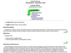
Students uses atlases, maps, and Web resources to determine the distance, driving time, and amount of money they need to make the trip (estimates should include hotel/motel stays, meals, and souvenirs).
Curated OER
Colonial Vacation Planner
Students plan a family vacation to states that were among the original 13 colonies. The groups determine which state they visit, map their route, calculate the mileage, and determine how much money they spend on gasoline.
Curated OER
Summarizing and Mapping for Comprehension
Students practice summarization in order to increase their comprehension of non-fiction text. They read and summarize passages by finding the main ideas in passages from a Social Studies textbook. After silently reading the passage they...
Curated OER
Claiming Land
Young scholars examine several European maps with conflicting representations of the same geographic region. They uncover why different European nations produced different maps. In addition, they determine the role maps played in helping...
Other popular searches
- Making Maps Geography
- Making Maps and Research
- Making Maps Using Technology
- Making Maps of History
- China, Making Maps
- Making Maps of Community
- Reading Making Maps
- Neigborhoods and Making Maps
- Making Maps Lesson Plans
- Making Map Scales
- Making Maps Usign Technology
- Making a Map Project


