Curated OER
South America: Physical Map
In this South American physical map worksheet, students make note of the major landforms and bodies of water located on the continent.
Curated OER
Asia Physical Map
In this Asia physical map instructional activity, students make note of the major landforms and bodies of water located on the continent.
Curated OER
Inspirational Mapping for the Corps of Discovery
Third graders use a computer software entitled, Inspiration, in order to create a map or web of what Lewis and Clark should have packed for their journey west. They are given the expectations of the teacher and a scoring guide is...
Curated OER
Weather Lesson Five
Learners define a weather forecast, make a forecast using a weather map, identify three prediction guidelines, and explain how computers help to make forecasts. Students make a 24-hour forecast for each of the thirteen states targeted.
Curated OER
Changing Planet: Sea Levels Rising
Begin by showing a six-minute video, Changing Planet: Rising Sea Level as an anticipatory set. Pupils draw a topographic map of a potato continent. Finally, they will visit NOAA's sea levels online map and NASA's carbon dioxide...
Curated OER
Where in the World Is Mexico?
Learners practice map-reading skills as they locate Mexico and its cities on a world map. By creating a puzzle out of a map of Mexico, students engage in a meaningful hands-on activity to help them explore that country's geography.
Curated OER
Geography of Mesopotamia
Students write a letter. In this irrigation instructional activity, students review how humans and the environment can interact with each other, learn new vocabulary words having to do with Mesopotamia, learn about irrigation and...
Curated OER
Ehhh...What'd you say?
Practice pronouncing and spelling words with the /e/ sound with spellers. They blend phonemes with spelling maps to master important representation and letter symbol of the short vowel /e/. They also make sock puppets and study the...
Curated OER
Summer Shorts
Want to use sequence maps in your narrative writing unit? Young writers work to create personal narratives about their summer vacation. They write a narrative of their vacation and create a display using summer clothing shapes made from...
Curated OER
Exercise Set 2.6: An Introduction to Functions
In this functions learning exercise, students solve 70 short answer questions. Students find domain of functions and evaluate them for a given value. Students determine if a mapping diagram represents a function.
Curated OER
Contour Map Worksheet #2
Following a contour map of a hill, a stream, and the ocean, are five multiple choice questions. Earth science enthusiasts determine elevation, direction of water flow, distance, and steepness. They also match the map to a selection of...
Curated OER
Draw an Inch, Walk a Mile
Students work in small groups to solve the problems presented. The main project, mapping the classroom, use these discussions to collaborate in creating a tangible demonstration of their understanding.
Howard Hughes Medical Institute
Building Ecological Pyramids
Looking for a fresh take on traditional food/energy pyramids? Conduct an innovative activity where pupils build their own! The lesson uses research data from Gorongosa National Park in Mozambique for a real-life safari touch. Scholars...
Curated OER
Aaaa! It's A!
Exercise phonemic awareness of the vowel /a/ to help children become successful readers. They connect spoken phonemes to written grapheme's and create a relationship between the vocal gesture of /a/ and its grapheme map in text and words.
Curated OER
Unit V: Worksheet 2 - Constant Force
Physics learners studying force and acceleration practice solving eight problems with this assignment. They calculate acceleration and deceleration, net force, and distances required for stopping a moving object. Kinematics equations and...
Curated OER
Length
Without using a ruler, learners estimate the relative length of various lines in these three scenarios. The first two are set up as maps, with learners determining the shortest and longest distances from one position to another. The last...
Weebly
Liberty Theme Park Project
Invite your young historians to demonstrate how the American Revolution truly was one crazy ride after another as they design a theme park! This unique and engaging project prompts learners to consider major events leading up to and...
Leadership Challenge
Inspire Students Today to Make a Difference in the Future
Your search for a year's worth of leadership lessons is over! A lesson in a character education series provides a full two semesters of inspiring leadership activities. The resource includes individual and group challenges to ensure a...
Center Science Education
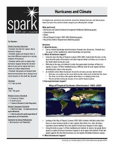
Hurricanes and Climate
Feeling under the weather? This instructional activity on hurricanes can whip things up! With professionally designed maps and handouts, teach your future weathermen (or women) where, when, and how hurricanes occur. They identify...
Curated OER
China Quest
Read and research information on China. Young researchers complete a knowledge hunt about China then locate and describe each location using directional words. They recognize the word meaning through context clues and application practice.
SeaWorld
Animal Migrations
Here is a fabulous set of activities for your young scientists. Each lesson contains map, hands-on, and game activities that will help the class understand why and how animals migrate from one place to another. First they'll examine the...
K-State Research and Extensions
Water
How are maps like fish? They both have scales. The chapter includes six different activities at three different levels. Scholars complete activities using natural resources, learn how to read a map, see how to make a compass rosette,...
Texas State Energy Conservation Office
Investigation: Tour de Texas
Teams of Texas tourists gather into groups to analyze what they can do with $50 worth of an alternative fuel. They write checks, keep a balance sheet, and map out their sight-seeing route taking into consideration the location of...
Curated OER
Agriculture: It Doesn't Just Happen
After reading an informational text on the Agricultural Research Service, learners research the role of the ARS in Oklahoma. Using reputable online sources, they label a map of the state with relevant areas. Researchers focus on one of...
Other popular searches
- Making Maps Geography
- Making Maps and Research
- Making Maps Using Technology
- Making Maps of History
- China, Making Maps
- Making Maps of Community
- Reading Making Maps
- Neigborhoods and Making Maps
- Making Maps Lesson Plans
- Making Map Scales
- Making Maps Usign Technology
- Making a Map Project


