Curated OER
Understanding Topographic Maps
Underclassmen create a cone-shaped landform and then draw a contour map for it. Then they examine a quadrangle (which was easily located with an online search), and relate it to what they experienced. The accompanying worksheet is...
Curated OER
Let's Make a Map
Second graders draw maps of their playground, noting objects such as trees and play equipment. Working in groups, they make maps of different parts of the school and assemble them into a schoolwide map. They make maps on a field trip to...
Curated OER
Making a Map of the Classroom
Students create a map of the classroom using the computer programs AppleWorks and iChat in this math-based technology lesson. Lesson extension ideas include a scavenger hunt and maps of other school buildings.
Curated OER
Finding Your Way on the Farm
Third graders make a grid map. In this directionality lesson plan, 3rd graders review how to use a grid to locate objects or places on a map. Students draw a grid map of the classroom and locate seating assignments. Students create a...
Curated OER
Making the Invisible Visible
Students evaluate the various ways in which cyberspace is beginning to be mapped by geographers, cartographers, artists, and scientists and use their understanding of the information these new maps can convey to create their own maps of...
Curated OER
Road Map Relief - Mixed Media painting
High schoolers use road maps to create non-objective artwork.
Curated OER
Understanding Geography
Students create a map of their own neighborhood to show the relationships between the geography of the neighborhood and its economy and culture. They view and discuss an introductory video on how geographers study an area then go out...
Curated OER
Rock Around the Map
Students research the geographical histories of various musical genres and make maps that note important places in music history. They Write geographical biographies about one of their favorite musical artists.
Curated OER
New York Cities Map Quiz
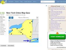
In this online interactive geography worksheet, students examine a map of New York and identify the 11 noted cities on the map using a pull down menu within 3 minutes.
Curated OER
Florida Cities Map Quiz
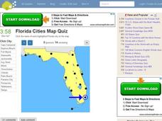
In this online interactive geography instructional activity, students examine a map of Florida and identify the 12 noted cities on the map using a pull down menu within 3 minutes.
Curated OER
Texas Cities Map Quiz
In this online interactive geography worksheet, students examine a map of Texas and identify the 15 noted cities on the map using a pull down menu within 3 minutes.
Curated OER
South America Map Quiz
In this online interactive geography quiz worksheet, students examine the map that includes all of South America's countries. Students identify the 13 countries in 2 minutes.
Curated OER
Middle East Map Quiz
In this online interactive geography quiz worksheet, students examine the map that includes 26 Middle Eastern countries. Students identify the names of the countries in 4 minutes.
Curated OER
Central America Map Quiz
In this online interactive geography quiz worksheet, students examine the map that includes 22 Central American countries. Students identify the names of the countries in 3 minutes.
Curated OER
California Cities Map Quiz
In this online interactive geography quiz activity, students examine the map that includes 12 California cities. Students identify the names of the cities in 3 minutes.
Curated OER
Michigan Cities Map Quiz
In this online interactive geography worksheet, students examine a map of Michigan and identify the 14 noted cities on the map using a pull down menu within 3 minutes.
Curated OER
Canada Map Quiz
In this online interactive geography quiz activity, students examine the map that includes 13 Canadian provinces and territories. Students identify the names of the provinces and territories in 2...
Curated OER
Making a Life Map
Middle schoolers create a life map of their life. They start the activity with a question from the teacher and expand on it. They can share their life maps with the class if they so choose.
Curated OER
Maps Not Drawn to Scale
In this maps activity, students redraw a map to make it more accurate and drawn to scale in the space given. Students draw 1 map and answer 2 questions.
Curated OER
Song Mapping
Young scholars explore locations on the United States map. In this map skills lesson, students recite the song This Land Is Your Land and locate various places listed in the song on the map.
Curated OER
USA: Average Precipitation and Temperature Map
In this United States map worksheet, students make note of the average precipitation and temperature in regions of the country.
Curated OER
Eurasia Physical Map
In this Eurasia physical map worksheet, students make note of the major landforms and bodies of water located in this world region.
Curated OER
Australia and Oceania: Physical Map
In this Australia and Oceania physical map worksheet, students make note of the major landforms and bodies of water located within this region.
Curated OER
Australia Outline Map
In this Australia and Oceania outline map instructional activity, students make note of the major landforms and bodies of water located within this region.
Other popular searches
- Making Maps Geography
- Making Maps and Research
- Making Maps Using Technology
- Making Maps of History
- China, Making Maps
- Making Maps of Community
- Reading Making Maps
- Neigborhoods and Making Maps
- Making Maps Lesson Plans
- Making Map Scales
- Making Maps Usign Technology
- Making a Map Project

