Hi, what do you want to do?
Curated OER
Etc: Maps Etc: Physical Map of South America, 1910
A physical map from 1910 of South America showing color-contoured land elevations and water depths. Elevations range from sea level to over 6,500 feet, and water depths range from sea level to below 13,000 feet. This map shows the...
Curated OER
Etc: Maps Etc: Orographical Map of South America, 1911
An orographic map of South America from 1911 showing the primary mountain systems and general elevations, and major river systems. The map is color-coded to show elevations from sea level to over 12000 feet, with highlands in buff tints...
Curated OER
Etc: Maps Etc: Vegetation Distribution of South America, 1911
A map from 1911 of South America showing the distribution of vegetation types. The map is color-coded to show regions of forests, regions of woodlands, grass, and cultivation, regions of steppes and prairies, desert regions, and regions...
Curated OER
Etc: Maps Etc: England, Scotland, and Ireland, 18th Century
Map of England, Scotland, and Ireland during the 18th Century, showing important cities of the time and major rivers.
Curated OER
Unesco: United States of America: Olympic National Park
Located in the north-west of Washington State, Olympic National Park is renowned for the diversity of its ecosystems. Glacier-clad peaks interspersed with extensive alpine meadows are surrounded by an extensive old growth forest, among...
Curated OER
Ganges Map
NPR provides a detailed map of the Ganges River. Identifies major countries and cities on the river and surrounding areas. Highlights the river on the map in yellow. Displays other important geographic features.
TeachEngineering
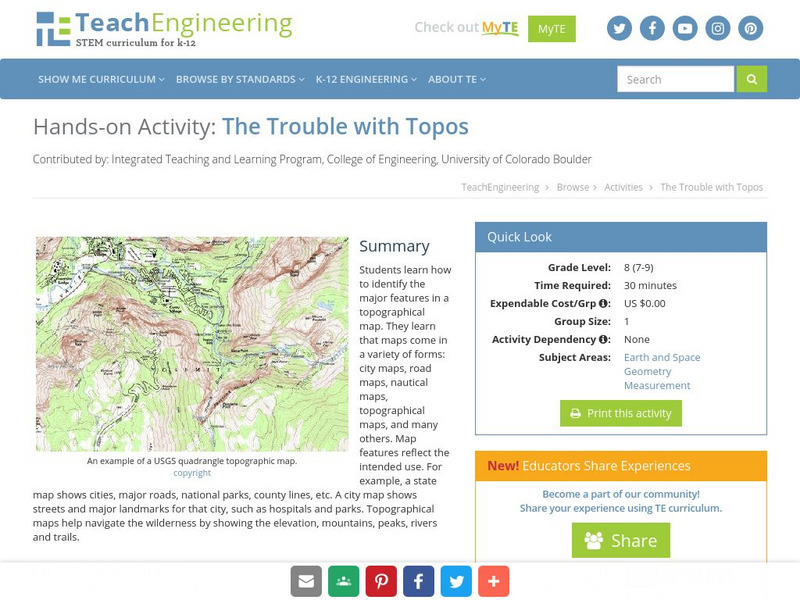
Teach Engineering: The Trouble With Topos
Students learn how to identify the major features in a topographical map. They learn that maps come in a variety of forms: city maps, road maps, nautical maps, topographical maps, and many others. Map features reflect the intended use....
Countries and Their Cultures
Countries and Their Cultures: Palestinians
Palestinians inhabit an area east of the Mediterranean Sea and south of Lebanon. The Jordan River, Lakes Huleh and Tiberias, and the Dead Sea separate Palestine from Jordan. Christians refer to Palestine as "the Holy Land." Today...
Houghton Mifflin Harcourt
Holt, Rinehart and Winston: World Atlas: Myanmar (Burma)
Check out this map of Burma showing the major cities and the Irrawaddy River running the length of the country. There are also some quick facts listed about the country.
Latimer Clarke Corporation
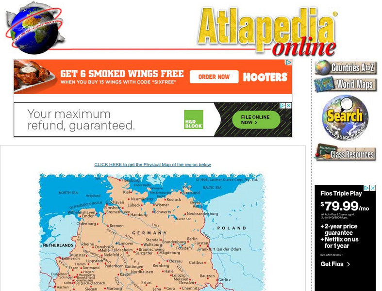
Political Map of German Speaking Countries
Map of Germany, Austria, Liechtenstein and Switzerland showing major cities and rivers, as well as neighboring countries.
Other
Cabrillo College: Cahokia
A concise, bulleted description of Cahokia, the major trade and population center of the Mississippian Mound Builders on the banks of the Mississippi River.
Annenberg Foundation
Annenberg Learner: A Biography of America: The u.s. Rail Network Around 1880
Annenberg Learner's series on Industrial Supremacy in America includes this map showing the major rail lines east of the Mississippi River in about 1880.
TeachEngineering
Teach Engineering: Sea to Sky
In this lesson, students learn about major landforms (e.g., mountains, rivers, plains, valleys, canyons and plateaus) and how they occur on the Earth's surface. They learn about the civil and geotechnical engineering applications of...
Curated OER
University of Texas: Rwanda: Political Map
A small political map of Rwanda showing the major cities, rivers, and neighboring countries. Map is from the Perry Castaneda Collection.
Khan Academy
Khan Academy: Uruk
Nestled between the Tigris and Euphrates rivers, the world's first major city sprang up in a fertile region of land called Mesopotamia. This article discusses the kings, writing, monumental temples and palaces, specialized occupations,...
Countries and Their Cultures
Countries and Their Cultures: Sara
"Sara" is the term employed by outsiders to refer to a group of non-Muslim tribes in southern Chad, all of whom speak mutually intelligible dialects. Each tribe is a distinct geographic, political, and endogamous entity. Major tribes are...
Geographic
Map of Canada
Basic map of Canada. Includes major cities, coastlines, major lakes and rivers, and bays.
Other
Andorra
This is a map of Andorra that includes all of the major cities and rivers. Also provides a history of Andorra's government.
Curated OER
Educational Technology Clearinghouse: Maps Etc: South China, 1971
"South China comprises the drainage basins of the middle and lower Yangtze River, the basin of the His Chiang (West River) in Kwangtung and Kwangsi; and the mountainous coastal provinces of Fukien and Chekiang. The division between the...
Curated OER
Educational Technology Clearinghouse: Maps Etc: Northeast China, 1971
"Northeast China - the provinces of Heilungkiang, Kirin, and Liaoning - is the most important region of the country and a nationally significant and still-developing center of agricultural production. Most of the Northeast remained...
Curated OER
Etc: Maps Etc: The Dominion of Canada and Newfoundland, 1902
A map from 1902 of the Dominion of Canada, showing provinces, province capitals and major cities, railroads, canals, mountain systems, lakes, rivers, and coastal features. Symbols on the map indicate the head of navigable rivers (anchor...
Curated OER
Educational Technology Clearinghouse: Maps Etc: British India, 1744 1774
A map of British India during the reign of King George II (1727-1760) and British Major-General Robert Clive's campaigns in India (1744-1774). The map shows Calcutta as the capital at the time, and shows the territory of Bengal extending...
Curated OER
Educational Technology Clearinghouse: Maps Etc: North America, 1858
A map from 1858 of North America showing the boundaries at the time for Russian America (Alaska), Greenland, British America or New Britain, Canada East and Canada West, the United States, Mexico, Central America, and the West Indies...
Other popular searches
- Geography Major Rivers
- Major Rivers in Tennessee
- World Major Rivers
- Major Rivers in Arkansas
- Major Rivers in Us
- Major Rivers u.s.
- Major Rivers in World
- Major Rivers United States
- Major Rivers United Statea
- Major Rivers Us
- Major Rivers United Stat Ea
- Major Rivers Texas Map


