Curated OER
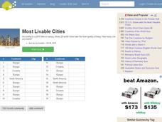
Most Livable Cities Quiz
In this online interactive geography quiz learning exercise, students respond to 20 identification questions about the most livable cities in the world. Students have 4 minutes to complete the quiz.
Curated OER
Baseball--Where the Parks Are
In this social studies instructional activity, students utilize a map to label the location of each city with a Major League team and then with colored pencils label the homes of the All-American Girls League teams.
Curated OER
Ohio Map
In this Ohio worksheet, 4th graders explore the state of Ohio. Students look at the map of Ohio and fill in the state capital, major cities, and any other important landmark or site on the map.
Curated OER
Ohio Outline Map
In this Ohio outline map worksheet, students examine political boundaries of the state and the placement its capital city as well as its major cities. This map is not labeled.
Curated OER
Early 19c Industrialization in America: The Market Revolution
Posing a question about the effects of American Industrialization, this presentation provides viewers with a comprehensive look at the 19th century. From the "Lowell Girls" to the Iron Horse, these slides would be an excellent supplement...
Curated OER
China - the Geography of European Imperialism - Spheres of Influence in China
Ninth graders create a map of China. They identify the various spheres of influence carved out by the Imperialist powers of Europe as well as locating geographical features of china and major cities. They explain the global impact of...
Curated OER
Finding River Cities
Using a wall map, students will find major rivers in the four regions of the United States. Then they answer questions about how people use natural resources, such as rivers.
Scholastic
Perfect Postcards: Illinois
Connect the geography and history of Illinois using an art-centered activity on the railroads. The railroad connected once-distant places, particularly in the Midwest. Using research, class members create postcards of fictional...
Curated OER
Need for Reconstruction: Devasation and Liberation in the South
Eighth graders examine the amount of destruction in the South following the Civil War. They explore the reasons why Reconstruction was needed.
Curated OER
The Early 19c: The Creation of an American Culture
Full of good information and photos from the 1700's to the 2004 election, this powerpoint could be a great resource in a lecture about American nationalism. While the slides require commentary and smooth transitions (as well as a little...
Curated OER
An Era of Innovation
Research milestones from the past century. Transportation milestones have changed society, the economy, communication, and travel. Pupils research these changes in order to create a transportation exhibit showing the enhancements in...
Curated OER
Character Worksheet Three
In this character activity, students answer questions about themselves in relation to their family, relationships, and day to day life. Students complete 29 questions.
Curated OER
Map Memory
Fifth graders, working in a whole class setting, label a United States map with the names of all the states that they know. They transfer the names of the states to an individual map and color it. Next, they receive directions on how to...
Curated OER
Globe Skills Lesson 5
In this map skills worksheet, learners read a text selection about locations during the American Revolution and then respond to 8 fill in the blank questions.
Curated OER
Applied Science- Built environment Lab (Trains)
Students examine transportation. In this train design lesson, students study how trains work and how to efficiently design a track by working with an electric train set. As a class they compare various types of trains and work...
Curated OER
States Quizzes
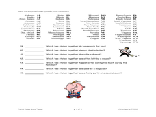
In this state postal code activity, students respond to 45 fill in the blank questions that require them to use the listed state postal codes as answers.
Curated OER
Come One, Come All
Students analyze information from core map and other sources and construct routes from New York and Boston to Cincinnati as they might have existed in 1835.
Curated OER
Geografia de Espana
Students play a board game called "Geografia de Espana. The object of the game is to reach the desired destination or region according to the color chosen by each play or group. Each player takes a turn to spin the spinner to find out...
Curated OER
Telemarketers Rights and Yours
Students research the controversy of whether or not the National Do Not Call Registry is constitutional, and then hold a class debate. Students research the National Do Not Call Registry, the FTC, the FCC, and the most current status of...
Curated OER
Reading a Local and National Weather Map
Students practice reading a national and local weather map. Using this information, they work together to make predictions about the weather for the next few days. They discuss the use of symbols and maps as a class and discuss how...
Curated OER
Interpreting Aerial Photographs
Students interpret aerial photographs. They view aerial photographs or satellite-produced images to locate and identify physical and human features. They study satellite images and label their images for bodies of water, clouds,...


