Curated OER
Magellan
Students identify the route of Magellan's voyage. In this map skills lesson, students use a globe to identify various coordinates where Magellan traveled.
Curated OER
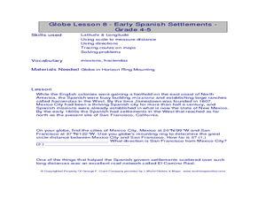
Globe Lesson- Early Spanish Settlements
Students use a globe. In this geography and early settlements lesson, students learn about the settlement of missions and haciendas in New Mexico. Students locate Mexico City and San Francisco on the globe and determine the distance...
Curated OER
Globe Lesson- The Revolutionary War
Students discover using globes. In this geography lesson, students use a globe to outline the original 13 colonies. Students also use a globe to measure the distance from London to New York City and determine how many days it would have...
Curated OER
The Gold Rush
Learners identify the routes involved in the Gold Rush on a map. In this map skills lesson, students use a United States map to locate the routes used to travel to California during the Gold Rush. Learners demonstrate how to use the map...
Curated OER
Cattle Trails
Students identify and locate cattle trails on a globe. In this map skill lesson, students use a marker to locate Texas and Montana and use the map scale to calculate the distance of the cattle trail.
Curated OER
Chinese Folktales
High schoolers examine Chinese folktales. In this literature and philanthropy lesson, students read Chinese folktales and analyze their literary elements. High schoolers consider the effects of generosity in the tales and in their own...
Curated OER
Learning to Give: Generosity of Spirit Folktales
Young scholars read two Inuit folktales about life and death. In this language arts lesson, students study the models of giving found in these Inuit tales about life, death, grief, sacrifice, and generosity. As the class reads these...
Curated OER
Weather Forecasts
In this weather worksheet, students view a weekly forecast for Bradford, United Kingdom and answer short answer questions about it. Students complete 7 questions.
Curated OER
Geotagging in school
Middle schoolers create a digital photo map of the world. In this digital photo map lesson plan, students pick topics such as the Olympics, natural disasters, or trip planning and create a photo map on the computer.
Curated OER
I Know Where You Are!
Students study what a GPS is and use it to challenge themselves and find positions on a map. In this investigative lesson students find various points on a map using a GPS system and answer questions on a worksheet.
Curated OER
Mystery of the Alaskan Seamounts
Students study seamounts and the processes that form them. In this Gulf of Alaska lesson students interpret data and investigate a hypothesis.
Curated OER
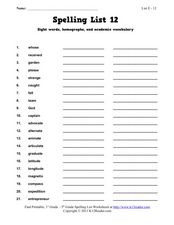
Spelling List 12: Sight Words, Homographs, and Academic Vocabulary
In this spelling list worksheet, students practice spelling words that are sight words, homographs, and vocabulary. Students practice spelling 21 words total.
Curated OER
Spelling List 1: Sight Words, Suffix "-ant," and Academic Vocabulary
For this spelling list worksheet, students practice spelling words that are sight words, schwa n, and vocabulary. Students practice spelling 21 words total.
Curated OER
Geography and Its Five Themes
Geography is not limited to just learning about the Earth and its physical features.
Curated OER
Give Me a B: North Dakota Quarter Reverse
Students examine the North Dakota quarter reverse and note the bison. and Badlands displayed on it. After practicing as a group making the B sound, they explore the classrom for more words beginning with that letter. Working in pairs,...
Curated OER
Chart Interpretation
Learners study the use of a nautical chart and how to obtain information from it. They describe and differentiate the basic topographic characteristics of a chart and demonstrate the use of nautical tools used to plot fixed points on a...
Curated OER
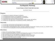
Earthquake Plotting
Students become familiar with map coordinates. They establish the frequency of earthquake occurrences and study the location and magnitude of earthquakes. To establish the location of plate boundaries.
Curated OER
Creating and Analyzing Graphs of Tropospheric Ozone
Students create and analyze graphs using archived atmospheric data to compare the ozone levels of selected regions around the world.
Curated OER
Three D Constellations
Students are introduced to both celestial coordinates and to the first rung on the distance determination ladder. They convert spherical coordinates to Cartesian coordinates to construct a three dimensional model of a constellation...
Curated OER
The Librarian Who Measured the Circumference of the Earth
Sixth graders explore angles, triangles, and investigate the circumference of the earth. They participate in a Webquest, access data bases, and communicate with other students through an on-line project site involving the circumference...
Curated OER
A Geopoem About Alaska
Sixth graders conduct Internet research on the physical and human characteristics of Alaska. They compose and write geopoems about the state of Alaska, using a template.
Curated OER
Hurricanes
Eighth graders gather information on hurricanes that are affecting the world at the time of the lesson. They work together in groups to collect the data and record their information in a table. They are asked questions to finish the lesson.
Curated OER
Make Your Own "Weather" Map
Learners create their own "weather" map using data from x-ray sources. They analyze and discuss why it is important to organize data in a fashion in which is easy to read. They compare and contrast different x-ray sources using a stellar...
Curated OER
Climate & Atmosphere: A Global & Local Perspective
Young scholars complete a series of activities in which they study atoms, molecules, and the presence of atmosphere. They study the water cycle and the Greenhouse Effect by investigating and completing handouts.
Other popular searches
- Latitude and Longitude
- Latitude Longitude
- Latitude and Longitude Games
- Latitude & Longitude
- Latitude and Longitude Maps
- Longitude and Latitude Game
- Longitude and Latitude Math
- Geography Latitude Longitude
- Whaling Latitude Longitude
- Longitude Latitude Minutes
- Longitude and Latitude Lines
- Volcano Latitude Longitude


