Curated OER
If I Can't See It, How Do I Know It's There?
High schoolers build a model ocean using a variety of materials representing the various levels of the ocean. They collect data about the ocean floor in a partner activity. They practice working with topographical mapping grids.
Curated OER
Warm up to the Gulf Stream
Students find out the temperature difference between the Gulf Stream and the surrounding water. They locate the Gulf Stream on the infrared image of the eastern seaboard of the US.
Curated OER
Interpreting Satellite Images
Students identify differences between photography and satellite imagery space.
Curated OER
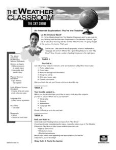
The Sky Show
Pupils use lecture and research to answer the question: Why is the sky blue? students research a variety of other sky phenomena, chart their observations and participate in experiments.
Curated OER
Fossils and Migration Patterns in Early Hominids
Students plot the locations where major fossils of hominids have been found to extrapolate possible migratory patterns.
Curated OER
Naval Warfare in the American Revolution
Students determine speed and bearing, calculate a position by dead reckoning, and modify this position using vectors for wind and current drift.
Curated OER
Alaska's Physical Systems and History
Students read about Alaska's physical systems and determine how Alaska's physical makeup has impacted its history. They create timelines of their particular physical system.
Curated OER
Circle the Earth - Explore Surface Types on a Journey around Earth
Students use CERES percent coverage surface data with a world map in locating landmasses and bodies of water at Earth's Equator.
Curated OER
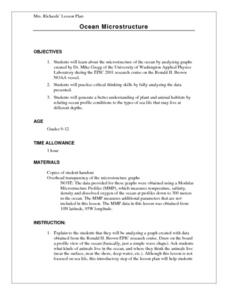
Ocean Microstructure Lesson Plan
Pupils explore the microstructure of the ocean by analyzing graphs created by Dr. Mike Gregg of the University of Washington Applied Physics Laboratory during the EPIC 2001 research cruise on the Ronald H. Brown NOAA vessel.
Curated OER
Correlating Atmospheric Data Lesson Plan
Students make and test hypotheses about atmospheric data collected aboard the NOAA ship Ronald H. Brown research cruise.
Curated OER
The Angle of the Sun's Rays
Students study elevation of the Sun above the horizon and the angle of the rays and their heating power.
Curated OER
How Does Climate Affect Your Environment?
Students access the Global Sun Temperature Project website and research the relationship between the location and climate of a participating school to its building structure. They consider how climate affects the type of structures...
Curated OER
Roller Coaster Mania
Fifth graders extend their knowledge of developing maps. They work in cooperative groups to develop an amusement park display and a brochure.
Curated OER
Astronomy With a Stick
Young scholars find the altitude of the Sun at 10 A.M., at solar noon, and at 2 P.M. by measuring the height of the gnomon and the length of the shadow at each time. They record the measurements in their notebooks for later conversion.
Curated OER
Learning About the Shape of the Earth
Seventh graders investigate ways of telling the shape of the Earth and its position in the Universe both historically and today.
Curated OER
Location, Location, Location
Students use maps to locate their community in order to create a flip book.
Curated OER
The Commission of Inquiry
Students explore the role and functions of a commission of inquiry and participate in a democratic debate.
Curated OER
Timing the Transit of Venus
Middle schoolers calculate elapsed time and look for patterns.
Curated OER
Lichens as Air Quality Indicators: A beginning lichen identification study (2003
Students use GPS and trees to explore lichens and air quality.
Curated OER
Testing Soils for Garden Planting
Sixth graders collect soil samples and record the location of the samples by using GPS.
Curated OER
Ocean Microstructure
Students assess the ocean's microstructure by analyzing graphs created during tne Ronald H.Brown research cruise. they discuss at what depths various sea animals live and write paragraphs on data analysis from the graphs.
Curated OER
Relative Humidity of Your School
Pupils predict the location where the relative humidity the highest and lowest in and around their school. They use a sling psychrometer to measure the relative humidity of the various locations.
Curated OER
Class Letter of Introduction
Students follow guidelines to collectively draft a class letter that introduces their school to the rest of the participants in an online science experiment about water quality. They post the letter online as part of the larger unit.
Curated OER
Where in the Usa is Radon?
Students determine the areas of New Jersey and the US that are likely to have high radon concentrations. Students draw a map of their own neighborhood that show soil associations in their neighborhood.
Other popular searches
- Latitude and Longitude
- Latitude Longitude
- Latitude and Longitude Games
- Latitude & Longitude
- Latitude and Longitude Maps
- Longitude and Latitude Game
- Lines of Latitude
- Longitude and Latitude Math
- Geography Latitude Longitude
- Latitude and Gps
- Measuring Latitude


