Curated OER
Educational Technology Clearinghouse: Maps Etc: Scranton and Wilkes Barre, 1920
A map from 1920 of the vicinity of Scranton and Wilkes-Barre district showing county lines, principal cities and towns, railroads, lakes, and rivers.
Curated OER
Etc: Maps Etc: Scranton and Wilkes Barre District, 1919
A map from 1919 of the vicinity of Scranton and Wilkes-Barre district showing county lines, principal cities and towns, railroads, lakes, and rivers.
Curated OER
Educational Technology Clearinghouse: Maps Etc: Alberta and Saskatchewan, 1909
A map from 1909 of the central and southern parts of Alberta and Saskatchewan showing the provincial capitals of Edmonton and Regina, major cities and towns, existing and proposed railways, lakes, and rivers of this portion of the...
Curated OER
Educational Technology Clearinghouse: Maps Etc: Alberta and Saskatchewan, 1912
A map from 1912 of the central and southern parts of Alberta and Saskatchewan showing the provincial capitals of Edmonton and Regina, major cities and towns, existing and proposed railways, lakes, and rivers of this portion of the...
Curated OER
Educational Technology Clearinghouse: Maps Etc: Manitoba and Saskatchewan, 1906
A map from 1906 of the provinces of Manitoba and Saskatchewan showing the province capitals of Winnipeg and Regina, major cities and towns, existing and proposed railways, lakes and rivers, Hudson Bay Company posts, and Indian...
Curated OER
Etc: Maps Etc: British Columbia and Alberta, 1920
A map from 1920 of the provinces of Alberta and British Columbia showing the province capitals of Edmonton and Victoria, major cities and towns, railways, the Inland Passage from Vancouver, lakes and rivers, coastal features, and islands...
Curated OER
Etc: Maps Etc: Alberta and British Columbia, 1906
A map from 1906 of the provinces of Alberta and British Columbia showing the province capitals of Edmonton and Victoria, major cities and towns, railways, lakes and rivers, mountains, coastal features, forts, Hudson Bay Company posts,...
Curated OER
Etc: Maps Etc: Nova Scotia and Prince Edward Island, 1911
A map from 1911 of Nova Scotia and Prince Edward Island, showing the provincial capitals of Halifax and Charlottetown, major cities and towns, railways, lakes and rivers, coastal features, and smaller neighboring islands.
University of California
Ucmp: The World's Biomes
This is an introduction to the major biomes on Earth. This page groups biomes into five major types: aquatic, deserts, forests, grasslands, and tundra. Information on climate, animal/plant life, and much more is given for each of type...
Other
Corporation of the County of Haliburton: The County of Haliburton
Haliburton is an Ontario county that is renowned for it tourism due to the regions many lakes and rivers. Information is provided on the areas government, economy and tourism activities.
US Geological Survey
Usgs: Water Science for Schools Water Science Storytime!
This U.S. Geological Survey website features a fictious town, Dryville, and uses it to illustrate every aspect of water management that you might encounter. Click Home to access the site in Spanish.
Other
Freshwater Ecology
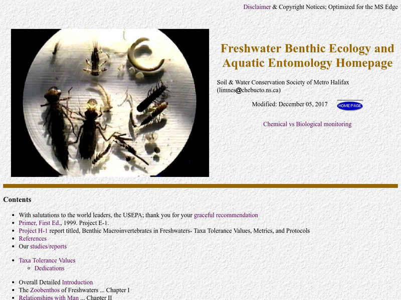
This is a comprehensive and detailed site providing information on aquatic macroinvertebrates. The emphasis is on biomonitoring of water quality through quantitative assessment of numbers and types of small aquatic organisms.
University of Utah
University of Utah: Genetic Science Learning Center: Meet the Microenvironments
Investigate the Great Salt Lake's islands, rivers, and man-made structures that define several diverse microenvironments.
CK-12 Foundation
Ck 12: Life Science: Aquatic Biomes
[Free Registration/Login may be required to access all resource tools.] Aquatic biomes can be generally classified based on the amount of salt in the water. Freshwater biomes have less than 1% salt and are typical of ponds and lakes,...
Biology Pages
Kimball's Biology Pages: Freshwater Ecosystems
A reference page describing freshwater ecosystems, lakes, ponds, and rivers.
Walled Lake Consolidated Schools
Loon Lake Elementary School: Jacques Marquette
A biography of Jacques Marquette (1637-1675), a French explorer and Roman Catholic missionary who was one of the earliest European explorers in North America. He joined the French explorer Louis Jolliet on a trip down the Mississippi...
Walled Lake Consolidated Schools
Loon Lake Elementary School: Henry Hudson
A biography of Henry Hudson (1565-1611), an English explorer and sea captain. He made four voyages in an attempt to discover a northern route between Europe and Asia. Hudson never found such a passage, but he sailed farther north than...
ClassFlow
Class Flow: Map Skills Germany
[Free Registration/Login Required] In this lesson map skills are reinforced by identifying physical features in Germany. Mountains, rivers, lakes, and land elevation are discussed. Political maps identify population and cities.
World Wildlife Fund for Nature
Wwf: Our Earth: Ecoregions: Habitats: Freshwater Wetlands
An introduction and overview of freshwater wetland habitats.
Curated OER
Etc: Maps Etc: Canada, Railways and Economic Regions, 1911
A map from 1911 of Canada showing the principal economic regions, railway network, and shipping routes in the Great Lakes and Hudson Bay. The map is color-coded to show the industrial districts, agricultural lands, grazing lands, and...
Other
International Lake Environment Committee Foundation: Lake Biwa (Japan)
See a map of Lake Biwa, and a brief description of the biggest lake in Japan.
Ducksters
Ducksters: Science for Kids: Freshwater Biome
Kids learn about the freshwater aquatic biome. Ecosystems such as rivers, streams, ponds, lakes, wetlands, swamps, and bogs.
Curated OER
Etc: Maps Etc: Lake District and Isle of Man, 1908
A detailed travel map of western England around the Lake District and the Isle of Man from 1908, showing portions Westmoreland and Lancashire counties. The map shows first class and secondary roads, railways, cities, towns, coastal and...
Curated OER
Educational Technology Clearinghouse: Maps Etc: Strathspey and Inverness, 1908
A detailed travel map of central Scotland from 1908, showing Nairn, Elgin, and portions of Banff and Inverness counties. The map shows first class and secondary roads, railways, cities, towns, ports, ferry routes, rivers, lakes, terrain...


