Curated OER
How To Read A Map
For this map skills worksheet, students view a map and answer five short answer questions by using the map key as a...
Curated OER
"Label Me" Texas Map
In this Texas map worksheet, students research, label and discuss the top ten major cities in Texas on a map, label the physical attributes and identify the surrounding states around Texas.
Curated OER
Unit VI: Worksheet 2 - Force, Velocity, Displacement
Future physics majors look at a diagram of a marble rolling across a railing. They sketch motion maps and force diagrams. They determine the horizontal range of the marble as it falls to the floor. Then they double the height and repeat...
Curated OER
Creating a Map of France
In this crating a map of France learning exercise, students find and label important parts of France, bodies of water, mountains and surrounding countries.
Curated OER
Describing A Place - Part I The British Isles
In this describing place worksheet, students label the cardinal and ordinal directions on a compass rose using the drop-down menus. They complete a matching activity by matching an item from column C with one in A and B. They read an...
Curated OER
Labeling a Map of the British Isles and Elapsed Time
In this map work and elapsed time activity, students label England, Scotland, Wales, and Ireland on a map. They calculate the elapsed time of a delivery that is described in a word problem that is broken down into four parts.
Curated OER
Former Soviet Map Quiz
In this outline map quiz worksheet, students examine the provided map and label the noted countries that used to be part of the former Soviet Union.
Curated OER
Freeform Texas Map
In this Texas map learning exercise, students research, label and discuss the most important cities in Texas, its physical attributes and the states that surround Texas.
Curated OER
Freeform Pennsylvania Map
In this Pennsylvania map worksheet, students research, study and label twenty important cities, physical attributes and the neighbors that surround Pennsylvania on a Pennsylvania map.
Curated OER
Third Grade Social Studies Quiz
In this social studies activity, 3rd graders complete multiple choice questions about communities, maps, distances, and more. Students complete 11 questions.
Curated OER
U.S. Geography: California
In this map skills about the state of California instructional activity, students locate and label specific places and areas and create a map key and symbolize the economy and areas of personal interest. Students answer 5 questions.
Curated OER
U.S. Geography for Children: Michigan
In this Michigan map activities worksheet, students observe an outline map of the state of Michigan, locate and label specific places and areas, and create a map key. Students complete 5 activities.
Curated OER
U.S. Geography for Children: The Northeast
In this map skills of the northeastern United States activity, students observe an outline map, locate and label the states, and designated landforms and bodies of water; and create symbols and a map key for sources of economy and other...
Curated OER
Freeform Rhode Island Map
In this free form Rhode Island map worksheet, students study, locate and memorize key cities, physical attributes and surrounding states for a quiz. Students fill out the major cities on a blank map of Rhode Island.
Curated OER
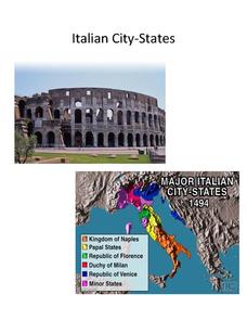
Italian City-States
Check out this packet of worksheets involving mapping activities, vocabulary logging, reading and comprehending informational texts, etc., which focuses on Italian city-states during the fourteenth and fifteenth centuries. There are also...
Inside Mathematics
Vencent's Graphs
I like algebra, but graphing is where I draw the line! Worksheet includes three multiple-part questions on interpreting and drawing line graphs. It focuses on the abstract where neither axis has numbers written in, though both are...
Curated OER
Rivers Run Through It
In this mapping practice worksheet, 5th graders read an informational paragraph and answer 7 questions about the parts of a map along with places shown on a given map.
Curated OER
U.S. Commonwealths and Territories
For this Puerto Rico worksheet, students follow directions to create icons and label cities on a map of Puerto Rico. Students follow 5 sets of directions.
Curated OER
Texas: U. S. Geography for Children
In this Texas map worksheet, students locate and label key features of Texas on the map and create icons to symbolize the economy and culture of Texas.
Curated OER
Florida: U.S. Geography for Kids
In this Florida geography worksheet, students locate and label the important features of Florida and create icons for the economy and culture of Florida.
Port Jefferson School District
Climate Patterns
Young climatologists explore the factors that contribute to a region's climate in this two-part earth science activity. To begin, learners are provided with a map of an imaginary planet and are asked to label global wind and...
Curated OER
Sub-Saharan Africa: Physical Geography
In this geography skills worksheet, students respond to 22 short answer and map skills questions about the location and geographic features of sub-Saharan Africa.
Curated OER
Forester
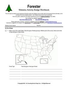
In this forester worksheet, students illustrate a map that shows the types of forests growing in various parts of the country. They also identify six forest trees common to the area where they live and explain how both wildlife and...
Curated OER
Family Life in a Village in Bangladesh
In this Bangladesh learning exercise, students read about the lives of men and women and the weather in Bangladesh. They then take that information to create a poster. Maps are also provided.

