Port Jefferson School District
Climate Patterns
Young climatologists explore the factors that contribute to a region's climate in this two-part earth science activity. To begin, learners are provided with a map of an imaginary planet and are asked to label global wind and...
Curated OER
Corn Exports Visually
Learners study imports and exports and the countries that import the most corn from the U.S. They construct mini paper corn plants and label a map with these plants to represent the amount of corn the U.S. exports to countries around the...
Curated OER
Sub-Saharan Africa: Physical Geography
In this geography skills worksheet, students respond to 22 short answer and map skills questions about the location and geographic features of sub-Saharan Africa.
Curated OER
Basic Guide to Writing an Essay
Introducing your class to essay writing? The gentle tone, concise explanations, and clear examples provided by a 17-slide presentation introduces young writers to the expository essay format. All that's missing is a complete essay with...
Curated OER
Hatchet
Students write about a time when they were in a situation where nature frightened them. They write about how Brian solved the problem of how to start a fire in the story. Students complete a short research paper on one of the plants or...
Curated OER
Earth on the Earth
Fourth graders plot points on a graph and transfer those coordinates onto a large scale model resulting in an outline of the Western Hemisphere. They identify the major geographical landforms of the Western Hemisphere.
Curated OER
Tongue Map
Students explore human anatomy by conducting a human senses experiment. In this taste lesson, students identify the main purpose of a tongue and how it enhances our eating habits. Students utilize baking coca, lemon juice, salt and honey...
Curated OER
Color-Coded Sentence Diagrams
Students read Ruth Heller's books and learn to identify various parts of speech. They label words according to the parts of speech and use the words to form simple and then more complex sentences. Afterward, they analyze sentences and...
Channel Islands Film
Island Rotation: Lesson Plan 3
How far have California's Channel islands moved? What was the rate of this movement? Class members first examine data that shows the age of the Hawaiian island chain and the average speed of the Pacific Plate. They then watch West...
Curated OER
Rescue!
Students explore movement and position concepts. They follow directions using left , right, up, down, North, South, East and West. Students draw and follow a path on a grid to show a route followed. They label and follow legends on a map.
Curated OER
North America Knowledge
Second graders move around a large map of the North America drawn on the playground. They follow the directions called out by the teacher. They may also develop their own tasks for other students to follow.
Curated OER
TORNADOES!
Third graders compare the parts of a real tornado with the parts of a tornado created in a demonstration, label "Tornado Alley" on their maps, and label the locations of famous tornado disasters on their maps.
Curated OER
Early Explorers
Fifth graders investigate the routes taken by the early explorers. In this explorers instructional activity, 5th graders use interactive notebooks, discussion and maps to discover the routes taken. Students get into pairs and label maps,...
Curated OER
Name That Taste
Students analyze taste buds. In this taste lesson, students complete an experiment in groups of four people. Students have four cups with a different substance in each cup. One student dips a Q-tip into each cup and tests on another...
Curated OER
Discovering Your Heritage
Learners interview a family member about their heritage. They listen to and record part of their family's oral history. Students also create and label a family tree going back a minimum of two generations and compare and contrast...
Curated OER
Kids Need Natural Resources
Third graders define renewable and non-renewable resources and give multiple examples of each type of resource. In this environmental science lesson, 3rd graders sort picture cards into two categories, renewable and non-renewable...
Curated OER
The 400-acre wood
In this forest planning lesson plan, students visit the 400-acre wood website and work in groups to learn about the specific aspects of forest development. Students create, label and color a forest planning map and present their map...
Curated OER
Social Studies:
Learners identify various types of breads fromother countries and locate them on maps. In small groups, they make story maps of books that mention bread and make books resembling sandwiches. Students have a bread tasting party and...
Curated OER
Watersheds: The San Francisco Bay Watershed
Sixth graders make a model of a watershed. In this geography lesson, 6th graders view a shaded relief map of California and locate landmarks. Students examine the San Francisco Bay Watershed by following the journey of water through...
Curated OER
Letters from Rifka
Fourth graders read Letters from Rifka and discuss the feelings of people forced to leave their homes and countries. For this migration lesson, 4th graders relate their feelings about moving from their home forever. Students trace...
Curated OER
Going to the Promised Land
Students analyze primary resources and map in order to draw conclusions regarding the migrant-worker experience during the Great Depression. They explain and explain the impact of economic and ecological events on individuals.
Curated OER
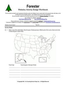
Forester
In this forester activity, students illustrate a map that shows the types of forests growing in various parts of the country. They also identify six forest trees common to the area where they live and explain how both wildlife and humans...
Curated OER
The Korean War - A Time Line Activity
Students create a Korean War time line. They identify, describe, and label nine of the key events and turning points of the Korean Conflict. They include all nine events listed on the direction sheet, contain a title, and have at...
Curated OER
Filling in the Picture
Students study archaeological sites. They discover some of the problems inherent in choosing sites and what parts are chosen for excavation. They evaluate and explain their choices for study and articulate the process of archaeological...


