Annenberg Foundation
A Growing Global Power
How does a nation turn into a global superpower? The 16th installment of the 22-part series on American history investigates the rise of the United States to global importance in the late nineteenth and early twentieth centuries. Groups...
Curated OER
Former Soviet Map Quiz
In this outline map quiz worksheet, students examine the provided map and label the noted countries that used to be part of the former Soviet Union.
Curated OER
Freeform Texas Map
In this Texas map learning exercise, students research, label and discuss the most important cities in Texas, its physical attributes and the states that surround Texas.
Curated OER
Freeform Pennsylvania Map
In this Pennsylvania map worksheet, students research, study and label twenty important cities, physical attributes and the neighbors that surround Pennsylvania on a Pennsylvania map.
Curated OER
United States Map
Students compare the United States on a globe and on a map. In this map instructional activity, students relate the sizes of the continents and locate the United States. Students identify the location of the continental US as well as...
Rainer Goebel
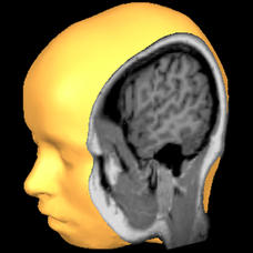
Brain Tutor 3D
The human brain is staggeringly complex, and its structure can seem impossible to grasp. This user-friendly app allows for exploration of the brain's anatomy, providing nomenclature, 3-D mapping, and functions.
Curated OER
Third Grade Social Studies Quiz
In this social studies activity, 3rd graders complete multiple choice questions about communities, maps, distances, and more. Students complete 11 questions.
Curated OER
Facts, Fictions and Perceptions of Regions
Students examine the different characteristics of the regions of the United States. They discuss places they have visited in the U.S., and in small groups conduct research on a selected region of the U.S. Each group labels a map of...
Curated OER
Maize to Maquiladoras: Movement from Mexico to Arizona
Fourth graders label maps of Arizona and Mexico to show the people, goods, and ideas that have moved between the two places. In this Arizona and Mexico lesson plan, 4th graders summarize the effects of the movement on Arizona life.
Curated OER
African Safari Adventure
Students conduct Internet research on the different safaris available. They locate and label safari sites on the continent of Africa. They create a PowerPoint presentation for the class to persuade the class why they should vote for...
Curated OER
Technology Lesson Activity: Fractions
Fifth graders practice using the English measuring system by creating fractions. In this parts of a whole instructional activity, 5th graders combine math key bars to simulate small parts of a bigger item. Students combine...
Curated OER
Jamestown Journey Part 1
Fourth graders work to solve one of the major problems facing the Jamestown settlers, the best location to settle upon arrival in Jamestown. Students discuss and review the past European and American events that lead to the...
Curated OER
Arrange the Classroom (Part 1 of 3)
Fifth graders arrange the classroom using all the moveable objects and through the exploration of area and perimeter. They determine the area of the classroom, create and label model pieces of furniture using graph paper, and create a...
Curated OER
U.S. Geography: California
In this map skills about the state of California instructional activity, students locate and label specific places and areas and create a map key and symbolize the economy and areas of personal interest. Students answer 5 questions.
Curated OER
U.S. Geography for Children: Michigan
In this Michigan map activities worksheet, students observe an outline map of the state of Michigan, locate and label specific places and areas, and create a map key. Students complete 5 activities.
Curated OER
U.S. Geography for Children: The Northeast
In this map skills of the northeastern United States activity, students observe an outline map, locate and label the states, and designated landforms and bodies of water; and create symbols and a map key for sources of economy and other...
Curated OER
Metrics And Measurements
Students engage in a study of measuring distances between geographical locations on a map. They are able to define and use the map scale in conjunction with the metric system. For this activity they make their own maps and measure the...
Curated OER
Cell Parts
Students identify parts of a cell. In this biology instructional activity, students create a simulated cell by using Jell-o, fruit roll ups, raisins, gum drops, and M&M's. Students construct the simulated cell and identify each part.
Curated OER
Let's Make a Map
Second graders draw maps of their playground, noting objects such as trees and play equipment. Working in groups, they make maps of different parts of the school and assemble them into a schoolwide map. They make maps on a field trip to...
Curated OER
What is Cacao?
Students use the Internet to learn about the cacao plant. For this plants lesson, students complete a KWL chart on chocolate, learn about cocoa plants and discuss the parts of a plant. Students use the Internet to learn how...
Curated OER
Freeform Rhode Island Map
In this free form Rhode Island map worksheet, students study, locate and memorize key cities, physical attributes and surrounding states for a quiz. Students fill out the major cities on a blank map of Rhode Island.
Curated OER
Apple: Seed to Tree
Students grow seeds of an apple and learn about Johnny Appleseed. In this apples lesson plan, students map Johnny Appleseed's travels, learn how he got his name, compare different Johnny Appleseed books, and grow apple seeds themselves.
Curated OER
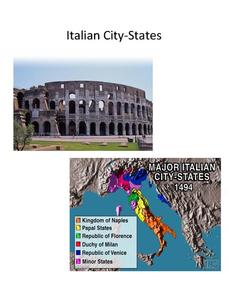
Italian City-States
Check out this packet of worksheets involving mapping activities, vocabulary logging, reading and comprehending informational texts, etc., which focuses on Italian city-states during the fourteenth and fifteenth centuries. There are also...
Curated OER
Geography/Current Events Project
Using the Balkan region as an example, fourth graders review the five themes of geography as a class. They identify the physical and human characteristics of a region before labeling the countries and landforms on a map. They then...


