Science Matters
Ring of Fire
Over a period of 35 years, earthquakes and volcanoes combined only accounted for 1.5 percent of the deaths from natural disasters in the United States. The 15th lesson in a 20-part series connects the locations of earthquakes and...
Curated OER
Design a Soda Bottle Label
Students make a mind web to describe their favorite soda. They then make thumbnail sketches of their labels. Tehy create a unique font with which to write the mane of their soda.
Curated OER
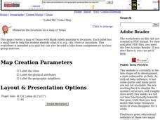
"Label Me" Texas Map
In this Texas map worksheet, students research, label and discuss the top ten major cities in Texas on a map, label the physical attributes and identify the surrounding states around Texas.
Curated OER
Map Studies
Middle schoolers analyze maps of Europe, and research and discuss current wars in Europe, and compare them to World War I and World War II.
Curated OER
Mapping South America
Students explore South America. In this South American instructional activity, students use their geography skills to create population, terrain, biomes/vegetation, and major exports maps. Students present their finished maps to their...
Curated OER
Unit VI: Worksheet 2 - Force, Velocity, Displacement
Future physics majors look at a diagram of a marble rolling across a railing. They sketch motion maps and force diagrams. They determine the horizontal range of the marble as it falls to the floor. Then they double the height and repeat...
Centers for Ocean Sciences
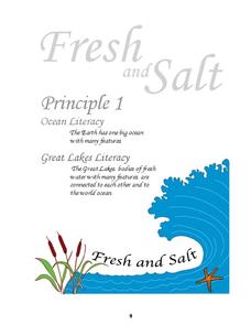
Ocean and Great Lakes Literacy: Principle 1
Is your current lesson plan for salt and freshwater literacy leaving you high and dry? If so, dive into part one of a seven-part series that explores the physical features of Earth's salt and freshwater sources. Junior hydrologists...
Curated OER
Creating a Map of France
In this crating a map of France learning exercise, students find and label important parts of France, bodies of water, mountains and surrounding countries.
Curated OER
Parts of the Body
Fifth graders create a quiz. In this parts of the body lesson, 5th graders identify and illustrate body parts. With a partner, students create a quiz on the terms used during the lesson.
Curated OER
Summer Trip
Fourth graders search for information and directions to specific cities from their homes, figure cost of trip when given miles per gallon, distance, and cost per gallon of gas, develop outline budget for summer trip, and draw and label...
Curated OER
Desert Cinquains
Learners use the cinquain structure and correct parts of speech to write a poem with a desert theme.
Curated OER
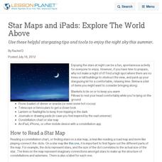
Star Maps and iPads: Explore The World Above
Use these helpful stargazing tips and tools to enjoy the night sky this summer.
Curated OER
"The Drum"
Second graders read and discuss the folktale "The Drum" from India. They also answer story comprehension questions, complete an adjectives and verb worksheet, and label a map of India. Students sequence events from the story and make...
NOAA
Into the Deep
Take young scientists into the depths of the world's ocean with the second lesson of this three-part earth science series. After first drawing pictures representing how they imagine the bottom of the ocean to appear, young scholars...
Curated OER
What a Relief Map
Students create a map using cookie dough. In this geography lesson, students research the physical features of a country, draw a diagram and design and create a map out of cookie dough.
Curated OER
Describing A Place - Part I The British Isles
In this describing place worksheet, students label the cardinal and ordinal directions on a compass rose using the drop-down menus. They complete a matching activity by matching an item from column C with one in A and B. They read an...
Curated OER
Labeling a Map of the British Isles and Elapsed Time
In this map work and elapsed time activity, students label England, Scotland, Wales, and Ireland on a map. They calculate the elapsed time of a delivery that is described in a word problem that is broken down into four parts.
Curated OER
Latin American Relief Map
Students, in groups, research, design and construct a relief map of a section of Latin America using papier-mache. They show major landforms, elevations and notable bodies of water. They present their maps to the class.
Curated OER
Reading a Map
Third graders become familiar with the vocabulary and skills related to mapping. In this guided reading lesson, 3rd graders find proper nouns on from the map. Students read Goldilocks. Students make a map...
Chicago Botanic Garden
Recent Weather Patterns
Decide whether weather is changing! A two-part activity first challenges classes to review the differences between weather and climate. Once finished, individuals then analyze historical data to determine if climate change is happening...
Illustrative Mathematics
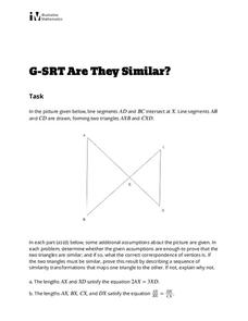
Are They Similar?
Learners separate things that just appear similar from those that are actually similar. A diagram of triangles is given, and then a variety of geometric characteristics changed and the similarity of the triangles analyzed. Because the...
PBS
Inspector Detector
How do spacecraft detect magnetic fields? The fourth installment of a five-part unit has learners develop a device with magnets that allows for the detection of magnetic fields. They use a map of an imaginary planet to try out their...
National Wildlife Federation
Massive Migrations
Turn your students into flocks of migratory birds for this fun activity on animal migration. Prior to the activity, the teacher creates four different migration routes in the classroom or any available open space, labeling nesting...


