Curated OER
Map Skills
Young scholars explore geography by creating a poster presentation in class. In this mapping lesson, students identify the different components featured on a modern day map and how to utilize them in order to navigate. Young scholars...
Curated OER
North Carolina Salt Dough Map Social Studies Project
In this lesson, North Carolina Salt Dough Map, 4th graders create a salt dough map of North Carolina, Students use dough to form the shape of the state of North Carolina. Students label the three regions of North Carolina and all of...
Curated OER
Summer Trip
Fourth graders search for information and directions to specific cities from their homes, figure cost of trip when given miles per gallon, distance, and cost per gallon of gas, develop outline budget for summer trip, and draw and label...
Curated OER
STORY MAPPING: THE HUNDRED DRESSES
Young scholars illustrate and paraphrase each chapter of The Hundred Dresses, creating a graphic organizer through the use of story mapping. After students have completed their story maps, ask for a few volunteers to present theirs to...
Curated OER
Reading a Local and National Weather Map
Students investigate weather maps. In this weather lesson, students discover the meaning of different weather icons and symbols. Working independently, students use the local forecast to correctly label a state map.
Curated OER
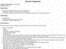
Desert Cinquains
Learners use the cinquain structure and correct parts of speech to write a poem with a desert theme.
Curated OER
Unit VI: Worksheet 2 - Force, Velocity, Displacement
Future physics majors look at a diagram of a marble rolling across a railing. They sketch motion maps and force diagrams. They determine the horizontal range of the marble as it falls to the floor. Then they double the height and repeat...
Curated OER
Parts of the Body
Fifth graders create a quiz. In this parts of the body lesson, 5th graders identify and illustrate body parts. With a partner, students create a quiz on the terms used during the lesson.
Curated OER
"The Drum"
Second graders read and discuss the folktale "The Drum" from India. They also answer story comprehension questions, complete an adjectives and verb worksheet, and label a map of India. Students sequence events from the story and make...
Curated OER
Describing A Place - Part I The British Isles
In this describing place worksheet, students label the cardinal and ordinal directions on a compass rose using the drop-down menus. They complete a matching activity by matching an item from column C with one in A and B. They read an...
Curated OER
Reading a Map
Third graders become familiar with the vocabulary and skills related to mapping. In this guided reading lesson, 3rd graders find proper nouns on from the map. Students read Goldilocks. Students make a map...
Curated OER
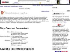
Freeform Texas Map
In this Texas map learning exercise, students research, label and discuss the most important cities in Texas, its physical attributes and the states that surround Texas.
Curated OER
Freeform Pennsylvania Map
In this Pennsylvania map worksheet, students research, study and label twenty important cities, physical attributes and the neighbors that surround Pennsylvania on a Pennsylvania map.
Curated OER
Technology Lesson Activity: Fractions
Fifth graders practice using the English measuring system by creating fractions. In this parts of a whole instructional activity, 5th graders combine math key bars to simulate small parts of a bigger item. Students combine...
Curated OER
Jamestown Journey Part 1
Fourth graders work to solve one of the major problems facing the Jamestown settlers, the best location to settle upon arrival in Jamestown. Students discuss and review the past European and American events that lead to the...
Curated OER
U.S. Geography: California
In this map skills about the state of California instructional activity, students locate and label specific places and areas and create a map key and symbolize the economy and areas of personal interest. Students answer 5 questions.
Curated OER
U.S. Geography for Children: Michigan
In this Michigan map activities worksheet, students observe an outline map of the state of Michigan, locate and label specific places and areas, and create a map key. Students complete 5 activities.
Curated OER
U.S. Geography for Children: The Northeast
In this map skills of the northeastern United States activity, students observe an outline map, locate and label the states, and designated landforms and bodies of water; and create symbols and a map key for sources of economy and other...
Curated OER
New Perspectives
Students examine maps that are designed to give different perspectives. They create mental maps that illustrate their own perspectives and those of people from other parts of the world.
Curated OER
Knowing Where You Are
Learners work together to research the names of places in their state. They divide up their state so that each group can research a different section and complete a chart of the different names. They create a key for the map to explain...
Curated OER
Texas: U. S. Geography for Children
In this Texas map worksheet, students locate and label key features of Texas on the map and create icons to symbolize the economy and culture of Texas.
Curated OER
Florida: U.S. Geography for Kids
In this Florida geography worksheet, students locate and label the important features of Florida and create icons for the economy and culture of Florida.
Curated OER
Basic Guide to Writing an Essay
Introducing your class to essay writing? The gentle tone, concise explanations, and clear examples provided by a 17-slide presentation introduces young writers to the expository essay format. All that's missing is a complete essay with...
Curated OER
Hatchet
Students write about a time when they were in a situation where nature frightened them. They write about how Brian solved the problem of how to start a fire in the story. Students complete a short research paper on one of the plants or...


