Curated OER
Family Life in a Village in Bangladesh
In this Bangladesh learning exercise, students read about the lives of men and women and the weather in Bangladesh. They then take that information to create a poster. Maps are also provided.
Curated OER
Making Globes
Fifth graders construct and design paper mache globes. They paint and draw the continents and oceans, and label each continent and ocean.
Curated OER
The 50 States and its Holidays
Though the format of this ELL lesson is confusing (the standards listed are for plate tectonics, yet the objectives are for American geography and holidays), a teacher could glean some ideas from the main idea. Here, pupils complete a...
Curated OER
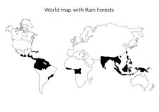
World Map With Rain Forests
In this geography worksheet, students study a map of the world which shows shaded areas indicating where the rain forests are located. There are no labels for countries or continents.
California Polytechnic State University
Australian Geography Unit
At the heart of this resource is a beautifully detailed PowerPoint presentation (provided in PDF form) on the overall physical geography of Australia, basic facts about the country, Aboriginal history, and Australia culture and lifestyle.
Curated OER
The Dynamic Earth
Students participate in assessments related to the layers of the Earth. They read chapters of text, answer questions, watch videos, and identify and label continents and oceans on a map. They design posters, create vocabulary cards,...
Curated OER
African Safari
Sixth graders gain an appreciation for the different cultures that inhabit the Earth by focusing on the people of Africa
Curated OER
Displaying the Data
Students gather facts about their parent's families through the completion of parent interview forms. Using tally marks, the data gathered is counted, transferred to graphs and used to create family timelines.
Curated OER
PLATE MOVEMENTS AND CLIMATE CHANGE
Students label three geological maps with continents provided to analyze the relationships between the movement of tectonic plates and the changes in the climate. In small groups, they discuss their findings and form hypotheses about the...
Curated OER
Country Capitals
Students define the meaning of country capital. In this country capital instructional activity, students identify the symbol and find country capitals. Students locate and label capital cities on a map and insert the capital symbol.
Curated OER
Learning About Our World
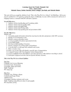
Young scholars explore their world using the book "This is the Way We Go to School." They predict information about the story based on the title and pictures. Students label a world map with the names of continents and oceans. They write...
Curated OER
Three Young Pilgrims
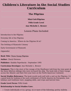
Fifth graders study the story of the voyage of the Mayflower told from the view point of the three Allerton siblings who were on board the ship. The book tells of their voyage across the Atlantic and their first year here on the North...
Curated OER
Africa
Students complete various activities related to the continent of Africa. They label and color a map of Africa, sing the Continent Song, view pictures and discuss animals of Africa, listen to the book "Bill and Pete Go Down the Nile,"...
Curated OER
Northwest Ordinance
Pupils examine the area where the Northwest Territory was located. They discover the steps territories need to follow to become states. They create a map of the Northwest Territory and label the states that came out of that region.
Curated OER
China: How to Put Some "Tang" in Your Medieval Dynasties
Fourth graders label the countries that border China and the physical features of Asia. They discuss the physical features of Asia and label them on the other map.
Curated OER
Gray Whales on the Move
Students study whale migration and their natural history. In this migration lesson plan students plot whale migration on a map and describe their ecosystems.
Curated OER
The World At Your Fingertips
In this the world at your fingertips worksheet, students bring in 5 items from home that are not made in the U.S., then complete a chart, indicate on a map and answer 6 questions about imported items.
Curated OER
Sand, Sand, Everywhere Sand
Learners study the physical characteristics of four types of desert regions. In this desert regions lesson, students watch a video about deserts and discuss the deserts. Learners compare the deserts and research the ways humans have...
Curated OER
Longitude
In this globe worksheet, students learn how longitude is measured on a globe. Students read the information before answering 5 questions. A globe will be required.
Curated OER
Cool Coral Reefs
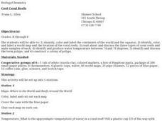
Young scholars identify, color and label the continents of the world and the equator. They identify and produce water temperature between 74 and 78 degrees. They identify and discuss the term polyps and construct a colony of polyps.
Curated OER
Where in the World Am I?
Students are introduced to geography skills. They answer questions on a worksheet using the internet and maps. They examine the area of Japan as well.
Curated OER
Pangaea Puzzle
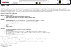
Learners test evidence for the existence of Pangaea in the Earth's past. They create a current map of the Earth's continents and put them together like a puzzle. They compare this result to a a picture of the shape of Pangaea.
Curated OER
The Big Blue
Third graders create paper mache globes with balloons. They label the 4 oceans on their balloons with reference to large wall map, classroom globe, and Encarta Virtual Globe CD-ROM projected on large screen TV with Tvator or other...
Curated OER
May We Present Planet Earth?
Learners draw a map to scale. They illustrate knowledge of how to use DOGS TAILS on a map. Students identify the main parts of a map. They identify and illustrate the major features necessary for sustaining a quality of life for a society.

