Curated OER
Rivers, Maps, and Math
Middle schoolers use maps to locate and label the major rivers of North and South America. Using the internet, they identify forests, grasslands, mountain ranges and other landforms on the continents as well. They compare and contrast...
Curated OER
Ecosystems Lesson Plan
Students research ecosystems (rainforest, desert, grassland, woodland, and arctic tundra). Students compare the seven continents and the importance of proximaty to the equator.
Cornell University
Too Much of a Good Thing?
Continuing their study of beneficial insects, young entomologists discover where in the world some of these bugs are. By labeling, coloring, and using the scale on a map, pupils explore the territories and arrival of the Asian lady...
Curated OER
Map of Asia
In this map worksheet, 3rd graders will study a map of Asia. Students will use this map to label and/or familiarize themselves with various aspects of the continent.
Curated OER
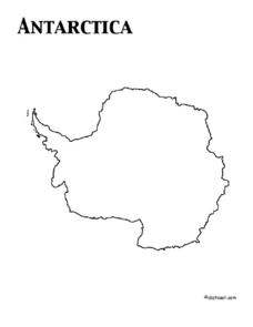
Map of Antarctica
In this map worksheet, 3rd graders will study a map of Antarctica. Students will use this map to label and/or familiarize themselves with various aspects of the continent.
Curated OER
Africa Political Map
In this blank outline map worksheet, students explore the political boundaries of the continent of Africa, the countries located there, and label other geographic features.
Curated OER
Europe Map Quiz
In this Europe map quiz instructional activity, students examine an outline map of the continent and label the names of each of the countries.
Curated OER
Where's the Sand?
Middle schoolers identify the characteristics of deserts. In this geography lesson plan, students discuss the characteristics of a desert and label a map with the names of deserts.
Curated OER
Mapping China
Students identify cities in China on a map. In this map skills instructional activity, students locate the continent of Asia and the country of China. Students use a blank map to label China and bordering countries.
Curated OER
Continents
Students investigate World Geography by researching the different continents. In this Asian Geography lesson, students discuss the continent of Pangaea and color a worksheet of the continents. Students locate China on the map worksheet...
Curated OER
Mapping South America
Students explore South America. In this South American instructional activity, students use their geography skills to create population, terrain, biomes/vegetation, and major exports maps. Students present their finished maps to their...
Curated OER
Learning European Geography
Sixth graders discover locations and countries in Europe by identifying them on a map. In this European geography lesson, 6th graders read the book The Lost Little Elephant, with their class and discuss the geography referenced in...
Curated OER
World: Continents Map
In this outline map worksheet, learners note the political boundaries of the continents of the world. The map is labeled with the names of the 7 continents.
Curated OER
Southern Hemisphere Map
In this Southern Hemisphere polar projection map worksheet, students examine this region of the world. The continents shown are labeled.
Curated OER
Where in the World? Oceans & Continents
In this geography worksheet, young scholars answer 6 questions using a coded map as a reference, then students identify labeled geographic features.
Curated OER
Antarctica Map
In this Antarctica worksheet, students study a very detailed map of this continent. Important features on this map are labeled.
World Maps Online
Introduction to the World Map
Students identify the differences between maps and globes. In this map skills instructional activity, students are shown a globe and a map and recognize the differences. Students use post-it notes to locate several locations on the world...
Curated OER
Exploring the World's Geography
Students discuss the seven continents of Earth and the diverse geography. After discussion, they create their own paper-mache globes which properly display all seven continents, the equator, and the prime meridian. They conduct research...
Curated OER
Modeling Earthquake Data
Students evalute evolutionary theories and processe of Geology. They examine evidence that the movement of continents has had signicicant global impact, major geological events. Students evaluate the forces which shape the lithosphere...
Curated OER
Africa, A Look Through the Eyes of A Child
Second graders read literature about Africa, examine physical characteristics of the continent, explore animals native to Africa, and discuss distance between Africa and locations in the United States.
Curated OER
North American Biomes
In this Science worksheet, learners color a biome map of North America. Students color the map by solving the clues listed on a separate sheet of paper.
Curated OER
Antarctica
In this map worksheet, 3rd graders explore a map of the continent of Antarctica. Students will color and label the map of the continent.
Curated OER
The Physical World: Continents and Oceans
In this world map instructional activity, study the map of the continents and oceans. Students label each of the 12 sections of the world map.
Curriculum Corner
Earth Day Book
This Earth Day, celebrate our beautiful planet with an activity book that challenges scholars to show off their map skills, complete a crossword puzzle, write acrostic poems, alphabetize, and reflect on their personal Earth-friendly habits.


