Curated OER
Map Skills
Young scholars explore geography by creating a poster presentation in class. In this mapping lesson, students identify the different components featured on a modern day map and how to utilize them in order to navigate. Young scholars...
Curated OER
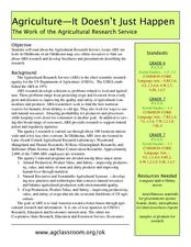
Agriculture: It Doesn't Just Happen
After reading an informational text on the Agricultural Research Service, learners research the role of the ARS in Oklahoma. Using reputable online sources, they label a map of the state with relevant areas. Researchers focus on one of...
Curated OER
Literature Study Guide: Siddhartha
Though this book report form is labeled Siddhartha, the multiple-page format would work for any novel you are reading in class. Complete with a reading schedule, a summary page, a list of generic literature response questions, and a list...
Curated OER
North Carolina Salt Dough Map Social Studies Project
In this lesson, North Carolina Salt Dough Map, 4th graders create a salt dough map of North Carolina, Students use dough to form the shape of the state of North Carolina. Students label the three regions of North Carolina and all of...
Curated OER
Play Doh Map of Your State
Learners create a state map using Playdoh. In this hands-on state geography lesson, students work in groups to form a three-dimensional map of their state using Playdoh made at home following a (given) recipe. Learners use four...
Curated OER
Arkansas Map
In this Arkansas worksheet, students analyze an outline map of the state of Arkansas and label the capital city. Students label other important cities and important attractions and color the map.
Curated OER
Map of Norway
In this geography of Norway worksheet, students color and label a map with major cities and physical features. Students need to do their own research.
Curated OER
Draw a Map
Students draw a map. In this map drawing lesson students draw a map to show where a character is from and where they are going in the story. Students are writing an odyssey.
Curated OER
The Roman Empire-Map Activity
In this Roman Empire worksheet, students complete a map activity in which they label and color civilizations, countries and physical features as instructed. There are no maps included.
Curated OER
California Outline Map
In this California outline map worksheet, students examine political boundaries of the state and the placement its capital city as well as its major cities. This map is not labeled.
Curated OER
Pennsylvania State Map
In this geography of Pennsylvania worksheet, learners color and label a map of the state. Students also study the location of Pennsylvania on a grey background map of the entire 50 states.
Curated OER
Utah State Map
For this geography of Utah worksheet, students color and label a map of the state of Utah. Students also study a second map that shows the location of this state in the U.S.
Curated OER
Oregon State Map
In this history worksheet, students view and label a map or Oregon its main regions, major cities, important landmarks, compass rose and a legend.
Curated OER
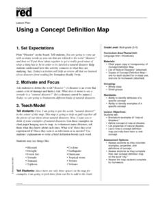
Using a Concept Definition Map
Students define "natural disaster" by offering examples and charting them to discover what a concept definition map is. Then students create their own maps using the word "city".
Curated OER
Maps Can Help Us
First graders explore the geography of Montana by analyzing geographic maps of the area. In this Native American reservation lesson, 1st graders discuss the similarities and differences between reservations in the state of Montana....
Curated OER
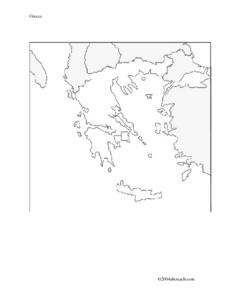
Map And Flag of Greece
In this Greece worksheet, students color and study a Greek flag. Students also color and label a map of Greece. This could be used in writing a report.
Curated OER
Exploring the Map of Morocco
In this exploring the map of Morocco worksheet, students find and label cities, islands, bodies of water, mountains, deserts and other countries around Morocco.
Curated OER
The Country of Chile - Map Work
In this map worksheet, students label a map of Chile by following 11 directions given at the bottom of the page. They label landforms and water bodies associated with the country.
Curated OER
Map of Kellyburi
In this map worksheet, 6th graders use a map to label 12 locations, answer 6 directional questions, write the answer for 17 general information questions, select the word for 10 sentences and read 25 English words for Thai animal names.
Curated OER
Blank Map of Canada
In this Canadian geography activity, students use a blank map of Canada to color and label important geographical features and cities. Students will need to do their own research before labeling this map.
Curated OER
Map of Egypt
In this map of Egypt activity, students label the cities, bodies of water, surrounding countries and color the map according to the directions.
Curated OER
Map of Italy
In this map of Italy worksheet, students find, color and label cities, surrounding countries, bodies of water and landforms in the country of Italy.
Curated OER
Map of Argentina
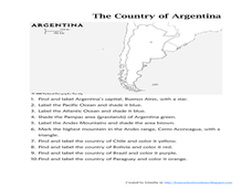
In this map of Argentina worksheet, students label key areas, cities, bodies of water and surrounding countries, then color the map according to directions.
Curated OER
Map of India
In this map of India worksheet, students label the capital city, the bodies of water and the compass points, then color the surrounding colors according to directions.
Other popular searches
- Map Labeling
- Africa Map Labeling
- Midwest Map Labeling
- Geography Map Labeling
- Labeling a Map Continents
- Blank Labeling Maps
- Labeling Maps Pangaea
- Labeling Map Parts

