Curated OER
Voyage to the New World
Young scholars examine the exploration of the New World. They write a descriptive account of the first encounter between Europeans and Native Americans, analyze and label maps, plot Columbus's journey on a map, and write a chapter summary.
Curated OER
Geographic Features of the East Coast
Fourth graders view a map of the thirteen colonies and discuss why the people who came from England built towns along the Atlantic coast. They read the directions on the worksheet and underline words in the question that ask them to do...
Curated OER
El Tiempo en Chile
Students analyze what information would one expect to find in a weather report. They list in Spanish weather conditions for today in their community. Students visit Chile and locate it on a map.
Curated OER
Where in the World? Oceans & Continents
In this geography worksheet, students answer 6 questions using a coded map as a reference, then students identify labeled geographic features.
Curated OER
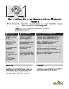
Maize to Maquiladoras: Movement from Mexico to Arizona
Students label maps of Arizona and Mexico of the products that moved from one place to another. In this Arizona and Mexico lesson plan, students also summarize the effects of the movement on life in Arizona.
Curated OER
Texas
Young scholars draw the outline of the Lone Star State, label the state signs (bird, flower, tree), and sing the state song.
Curated OER
Oceanography
Fourth graders define new vocabulary associated with oceanography. They locate and label the four oceans. They also identify features of the ocean floor.
Curated OER
Constellation Lab
For this constellation worksheet, students plot given constellations and stars on a map and color code each. They answer questions about the constellations they plot.
Curated OER
If These Walls Could Talk: Seeing a Culture Through Human Features
Students read Talking Walls and discuss the walls presented and their importance to the culture. In this geography lesson, students locate and label each country/continent discussed in the book on a world map. Students take a walk and...
Curated OER
Quiz: Translations and Vectors
In this translation and vector worksheet, students graph and label translations of polygons and points. Translation instructions are given as ordered pairs, as well as in written words. This one-page worksheet contains ten problems.
Curated OER
Gray Whales on the Move
Middle schoolers study whale migration and their natural history. In this migration instructional activity students plot whale migration on a map and describe their ecosystems.
Curated OER
Where Oh Where
Students read a current event article orally and make connections regarding the geographic themes of the newspaper location. In this current event article lesson, students use a map to locate where the event from their...
Curated OER
Atom and Eve
Students research and define an atom using a concept map. They design and create a model of an atom, labelling all the parts, and write a journal entry.
Curated OER
Dynastic Explorations
Students complete a unit of lessons on medieval Chinese dynasties. They examine the impact the Chinese culture has had on their own lives, label maps, conduct research, read stories, create bamboo stick sentences, write poems, and make...
Curated OER
Our Native Americans
Students complete a unit of lessons on Native Americans. They label maps, list resources the Native Americans used in their daily lives, create an original short story, define key vocabulary, and develop a model of something that...
Curated OER
GPS Art
Students design their own logo or picture and use a handheld GPS receiver to map it out. They write out a word or graphic on a field or playground, walk the path, and log GPS data. The results display their "art" on their GPS receiver...
Curated OER
Africa
Students complete various activities related to the continent of Africa. They label and color a map of Africa, sing the Continent Song, view pictures and discuss animals of Africa, listen to the book "Bill and Pete Go Down the Nile,"...
Curated OER
Virtual Fetal Pig Dissection
Learners use the internet to introduce themselves to the anatomy of a fetal pig. In pairs or individually, they work their way through a virtual dissection of a fetal pig while completing questions on a study guide. They also develop...
Curated OER
Traveling the Silk Road
Students take a virtual trip down the Silk Road. Using a map, they trace the location of the trade route and others that were developed later. They use different spices and goods to trace how they came to the Americas. They answer...
Curated OER
Community Cartography
Learners use an inflatable globe which they wrap in plastic wrap. They use a permanent marker and outline the continents, and label major oceans and trace the equator. Students bring heir globes and use their projection for a discussion...
Curated OER
Region Reality
Eighth graders compare and contrast world regions and explore the theme of world regions. In this world geography lesson, 8th graders name regions in the U.S. and mark them on a map. Students discuss the cultural and physical...
Curated OER
Water Features of Virginia
Students locate and identify water features important to the early history of Virginia. Thye recognize where most cities developed and locate and label the rivers on a Virginia wall map.
Curated OER
Constant Net Force
In this forces activity, students calculate life force, acceleration, and displacement for 8 word problems. Students must label force diagram and a summation force model.
Curated OER
Fossil Evidence for Plate Tectonics
Learners draw maps of counties that were important to the discovery of plate tectonic theory. In this plate tectonics lesson plan students excavate constructed fossil sites from matching coastlines and discuss the possible...
Other popular searches
- Map Labeling
- Africa Map Labeling
- Midwest Map Labeling
- Geography Map Labeling
- Labeling a Map Continents
- Blank Labeling Maps
- Labeling Maps Pangaea
- Labeling Map Parts


