Curated OER
Vacation Matrix-Integrated Core
Students read aloud, "The Best Vacation Ever," by Stuart Murphy locate vacation spots on a map and describe their own vacations. Students illustrate their summer vacation spot and describe the vacation, placing it on a "vacation matrix"...
Curated OER
Physical World Map
In this world map worksheet, students practice their geography skills as they label the 7 continents and 5 oceans. Teachers may use this physical map for various classroom activities
Curated OER
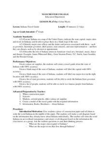
Indiana Travel Guide
Fourth graders, after exploring and researching the state of Indiana, create a travel guide about the state of Indiana including its capital, major rivers, governors and two famous people from the state. They utilize a variety of art...
Curated OER
Identifying Continents and Oceans
Students locate and identify the four major oceans and the seven continents on a world map. They use an unlabeled world map and compass rose to describe relative locations of the continents and oceans.
Curated OER
World Oceans
Learners locate the world's oceans. In this geography skills lesson, students chart the locations of the Indian, Arctic, Pacific, and Atlantic Oceans on world maps.
Curated OER
Displaying the Data
Students gather facts about their parent's families through the completion of parent interview forms. Using tally marks, the data gathered is counted, transferred to graphs and used to create family timelines.
Curated OER
Everything Grows
First graders read about the growth of living things. In this similiarities and differences activity, 1st graders list things that are similiar and different about growing plants. Students then use a graphic organizer to list the...
Curated OER
Ancient Civilizations
Sixth graders complete map-work in order to understand the progression of hunter-gatherer societies. In this hunter-gatherer lesson plan, 6th graders label maps with the Equator, the Tropics, and the vegetation. They complete associated...
Curated OER
Navigating by the Numbers
Students observe how math is important in navigation and engineering. They study how surveyors use math and science to calcute, count, measure, label, and indicate distances on a map. They estimate specific distances.
Curated OER
Digging For Dinosaurs
In this dinosaur themed activity, students work together as a team of paleontologists to draw the dinosaur bones they discovered at a dig site. They must label their drawing on a grid map and then provide data about the length and...
Curated OER
Early Explorers
Fifth graders study early explorers. In this World history lesson, 5th graders draw an outline of a map labeling each part, build geographical features out of dough, and paint each of the land and water features.
Constitutional Rights Foundation
Refugees From Vietnam and Cambodia
The United States may have pulled its troops from the Vietnam War in 1973, but the conflict was far from over for the citizens living in Asia at the time. An informative resource lets learners know about the wave of over 220,000...
Curated OER
Mapping the 'Utah War'
Eleventh graders examine the contributions of Native American Indians, explorers, and Utah's pioneers.
Curated OER
Assessing the Labour Behind the Label
Twelfth graders examine the labor conditions in different companies and corporations. In groups, they use the internet to locate the conditions of the companies of the clothes they are wearing. They share their information with the...
Curated OER
Mapping Dinosaurs in Place and Time
Third graders study the continents that specific dinosaurs lived on. They compare the continent's location and climate when dinosaurs live there with its current location.
Curated OER
Literature: Mapping the Mockingbird
Students read Harper Lee's To Kill a Mockingbird, focusing on setting. They list items that create mental images of the novel's setting along with location references to characters and events. Using posterboard, they construct physical...
Curated OER
Path Map for the Lake Bonneville Flood
Students use a digital atlas of Idaho to explore the effects of the Lake Bonneville Flood. They become familiar with how floods shape our earth and change landscapes. Students graph a a timeline of the rise and fall of Lake Bonneville.
Curated OER
Virginia's Five Geographic Regions
Tenth graders study the products and industries of five major geographic regions in Virginia. They use web based resources to examine maps of Virginia and to make a large classroom map which they label with the products and industries....
Curated OER
The Yangtze River: Lifeline of China
Students locate the Yangtze river on a map, and label major cities and landmarks. Students identify and interpret the diversity of the people living along the Yangtze. Students explain the pros and cons of the
Three Gorges Dam project.
Curated OER
The Landscape
Students recognize and recreate the political boundaries and physical features of the nation of Slovakia. They create topographic maps of Slovakia. The maps should include labeled line drawings of bordering countries. Slovakia should be...
Curated OER
Book: Latinos Today: Facts and Figures
Students, after reading Chapter 1 in the book, "Latinos Today: Facts and Figures," identify and characterize the four main ethnic/racial groups in America. They calculate and design a bar graph showing their populations by their...
Curated OER
U.S. geography for Children: New York
In this geography activity, 5th graders study the state of New York. Students follow the given directions to complete 5 tasks on the state map that is given.
Curated OER
Country Capitals
Students define the meaning of country capital. In this country capital instructional activity, students identify the symbol and find country capitals. Students locate and label capital cities on a map and insert the capital symbol.
Curated OER
The Dynamic Earth
Students participate in assessments related to the layers of the Earth. They read chapters of text, answer questions, watch videos, and identify and label continents and oceans on a map. They design posters, create vocabulary cards,...
Other popular searches
- Map Labeling
- Africa Map Labeling
- Midwest Map Labeling
- Geography Map Labeling
- Labeling a Map Continents
- Blank Labeling Maps
- Labeling Maps Pangaea
- Labeling Map Parts


