Curated OER
TORNADOES!
Third graders compare the parts of a real tornado with the parts of a tornado created in a demonstration, label "Tornado Alley" on their maps, and label the locations of famous tornado disasters on their maps.
Curated OER
Early Explorers
Fifth graders investigate the routes taken by the early explorers. In this explorers instructional activity, 5th graders use interactive notebooks, discussion and maps to discover the routes taken. Students get into pairs and label maps,...
Curated OER
Holy Mole
Third graders explore the Mexican sauce Mole and the culture of Mexico. In this Mexican culture lesson, 3rd graders find Mexico on the map and access prior knowledge about the country. Students discuss Mexican foods....
Curated OER
4: In With the Imports
Students research imports of American Samoa and Hawaii and create a map showing the major imports for both. In this economics lesson, students identify where American Samoa and Hawaii are on a map, discover what the imports for the...
Curated OER
Volcano Hazards
Students research volcano hazards in VolcanoWorld, make a paper volcano, produce and watch the effects of ashfall, produce and watch the effects of a mudflow and create a hazard map by plotting historical ashfall/mudflow data from Mount...
Curated OER
River to the Sea
Students investigate the function of wathersheds and weather while they follow Lewis and Clark on their jouney west. They also create a map using acurate measurements and build a model watershed.
Curated OER
Discovering Your Heritage
Learners interview a family member about their heritage. They listen to and record part of their family's oral history. Students also create and label a family tree going back a minimum of two generations and compare and contrast...
Curated OER
Magnetic Fields and Bermuda Triangles
Students map magnetic fields of a magnet using a compass and predict where fields cancel each other to create 'Bermuda Triangles'. In this magnetism lesson, students use a compass to map the magnetic field of a magnet. They explain how...
Curated OER
The 400-acre wood
In this forest planning lesson plan, students visit the 400-acre wood website and work in groups to learn about the specific aspects of forest development. Students create, label and color a forest planning map and present their map...
Curated OER
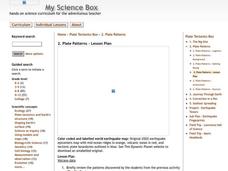
Plate Patterns
Students read about a volcano and use the latitude and longitude information to plot and describe the volcano on the map. They discuss patterns seen on the map. In addition, they color code a map according to zones, plates, etc.
Curated OER
Human Impact on the Everglades Environment
Third graders research changes the Army Corps made in Everglades, focus on the human impact on the environment, design graphic organizers, summary statements, develop a Florida map of the Everglades region and give a presentation about...
Curated OER
Nutrition and Health and School Gardening
Students examine how healthy eating contributes to a healthy body and life style. They read nutritional labels on food items. They use the Five Foods Pyramid to evaluate their own eating habits. They plan, design, and create a school...
Curated OER
Australia
Students research Australia using the Internet. They draw a flag, identify and label Australia's major cities. They discover facts about Australia's tourists attractions and culture. They design a travel brochure using the facts.
Silos & Smokestacks National Heritage Area
Life as a Pioneer
Students examine historical documents and research why early pioneers settled on the Iowa prairie. They review maps, describe the impact of railroading, describe life in pioneer times, and identify the effects of drought, prairie fire,...
Curated OER
Social Studies:
Learners identify various types of breads fromother countries and locate them on maps. In small groups, they make story maps of books that mention bread and make books resembling sandwiches. Students have a bread tasting party and...
Curated OER
Book: Spain
Students, after reading Chapter One in the book, "Spain," design and re-create the political boundaries as well as the physical features of nation of Spain. They utilize play-doh or salt dough to illustrate and create their three...
Curated OER
Describe My City
Students explore the functions of cities by creating a visual image of their own neighborhood. Students diagram, list, and label the major businesses and cultural areas of the neighborhood where they grew up, then write a letter to a...
Curated OER
What Makes a Tropical Rainforest Special?
Learners examine the characteristics of the tropical rainforest. Using a map, they locate the rainforests found around the world, continents and the equator. Using the internet, they research the various layers of the rainforest and...
Curated OER
Kids Need Natural Resources
Third graders define renewable and non-renewable resources and give multiple examples of each type of resource. In this environmental science lesson, 3rd graders sort picture cards into two categories, renewable and non-renewable...
Curated OER
Tourism in Northern Ireland
In this tourism worksheet, students label pictures of tourist destinations with the name of the country they are located in, write sentences about pictures showing damage caused by tourists, identify locations on a map, and fill in...
Curated OER
Graphing
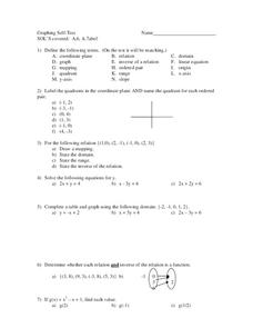
For this graphing worksheet, 9th graders solve and graph 8 different problems that include defining various terms related to graphing. First, they label the quadrants in a coordinate plane and name the quadrant for each listed ordered...
Curated OER
Donde en el mundo estas?
Learners give & follow directions given in Spanish, using oral, written and graphics. They use maps, globes, atlases, and remote sensing, GIS, and GPS to acquire and process information about places.
Curated OER
Physical Geography of Africa
Fifth graders investigate the topography of Africa. In this physical geography instructional activity, 5th graders research the six regions of Africa and complete a physical map. Students locate various landforms in...
Curated OER
Watersheds: The San Francisco Bay Watershed
Sixth graders make a model of a watershed. In this geography lesson, 6th graders view a shaded relief map of California and locate landmarks. Students examine the San Francisco Bay Watershed by following the journey of water through...
Other popular searches
- Map Labeling
- Africa Map Labeling
- Midwest Map Labeling
- Geography Map Labeling
- Labeling a Map Continents
- Blank Labeling Maps
- Labeling Maps Pangaea
- Labeling Map Parts


