Curated OER
Yo Ho, Yo Ho, A Pirate's Map for Me: An Original Story
Students read Blackbeard and brainstorm their knowledge of maps. In this language arts and geography instructional activity, students use landmarks on their playground to review north, south, east and west and discuss the compass rose....
Curated OER
Antarctica
In this map worksheet, 3rd graders explore a map of the continent of Antarctica. Students will color and label the map of the continent.
Curated OER
France
In this map of France worksheet, students view and label a map of France with its regions, major cities and important landmarks. Students include a compass and legend to accompany their map.
Curated OER
India
In this map of India learning exercise, students label a map of India with its regions, major cities, important landmarks and include a rose compass and legend.
Curated OER
Thailand
In this map of Thailand activity, students view and label a map of Thailand with its regions, major cities, important landmarks, compass rose and a legend.
Curated OER
Map of Africa
For this Africa worksheet, students analyze a labeled map of Africa. The map shows all the countries and regions as well as the bodies of water. There are no questions to answer.
Curated OER
North Africa & Southwest Asia Map Quiz
In this geography skills instructional activity, students examine the blank outline map of North Africa and Southwest Asia. Students label the countries located in the region.
Curriculum Corner
Earth Day Book
This Earth Day, celebrate our beautiful planet with an activity book that challenges scholars to show off their map skills, complete a crossword puzzle, write acrostic poems, alphabetize, and reflect on their personal Earth-friendly habits.
Curated OER
Seasons and Day Time
Learners label a diagram of the Earth rotating about the sun and indicate the direction of the rotation and the seasons at each location. They indicate the seasons, the poles, the hours of daylight at each pole, the direction of rotation...
Curated OER
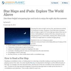
Star Maps and iPads: Explore The World Above
Use these helpful stargazing tips and tools to enjoy the night sky this summer.
NOAA
Into the Deep
Take young scientists into the depths of the world's ocean with the second lesson of this three-part earth science series. After first drawing pictures representing how they imagine the bottom of the ocean to appear, students...
Curated OER
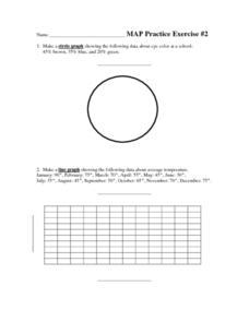
MAP Practice
In this geometry activity, students create circle, line and bar graphs using different comparisons of events. There are 24 questions with an answer key.
Curated OER
Terrabagga Activity Using a Magnetometer
Clever! Earth science learners construct a model of a planet containing a magnetic core. The planet, Terrabagga, is made out of a paper grocery bag, magnets, a dead D battery, and rubber bands. Pictures of each step of the construction...
Curated OER
Mapping Spain
In this map labeling worksheet, students follow directions to label 10 items on a map of Spain. They label the capital city of Madrid, the Pyrenees Mountains, surrounding water bodies and countries. They trace the flow of the Duero River.
Curated OER
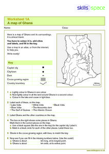
A Map of Ghana
In this Map of Ghana worksheet, students are given a blank map and key. They are told to label major features and color according to directions.
Curated OER
Map of Pennsylvania's Waters
In this labeling bodies of water in Pennsylvania worksheet, learners observe a map outline of the state with water sources and use the word bank of names of creeks, lakes, reservoirs, and rivers to identify them. Students label 21 bodies...
Starfall
Short A Label the Picture
In this labeling activity, learners will use six short /a/ words from a word bank to label the proper object on a picture of Appleland.
Curated OER
Northridge, California Earthquake Map
In this earthquake intensity learning exercise, students are given a map labeled with the intensity of shaking for the Northridge area and its surroundings for the earthquake that occurred in 1994. Students color an intensity scale and...
Curated OER
Corn Exports Visually
Learners study imports and exports and the countries that import the most corn from the U.S. They construct mini paper corn plants and label a map with these plants to represent the amount of corn the U.S. exports to countries around the...
Curated OER
Compass Rose Activity
Which direction is which? Use this compass rose labeling learning exercise to practice with basic directions as learners fill in the compass themselves. They use cardinal and intermediate direction abbreviations. Consider using their...
Curated OER
Compass Rose
Keep it simple and visual when practicing directions using this compass rose labeling worksheet. Learners fill in the compass themselves, using cardinal and intermediate direction abbreviations. North is done for them. Consider using...
Curated OER
MAP GRIDS, CLIMATES AND HEMISPHERES
Students compare/contrast the grid and latitude/longitude system used on a globe. They describe the areas which are considered to be a tropical, temperate, and polar, based on knowledge of climates.
Curated OER
Outline Map of Japan
In this geography worksheet, students examine a black line outline map of Japan. There is a compass rose on the page. There are no labeled cities.
Other popular searches
- Map Labeling
- Africa Map Labeling
- Midwest Map Labeling
- Geography Map Labeling
- Labeling a Map Continents
- Blank Labeling Maps
- Labeling Maps Pangaea
- Labeling Map Parts


