eSchool Today
E School Today: Landforms
Understand the formation and geology of different landforms around the Earth.
Khan Academy
Khan Academy: Mesoamerica
Civilization in Mesoamerica flourished and crashed repeatedly, giving rise to a distinctive worldview and some remaining mysteries. This article discusses the rise of early civilizations in this region.
CZBrats
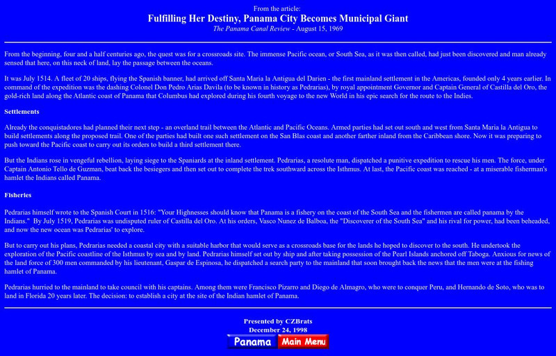
Fulfilling Her Destiny, Panama City Becomes Municipal Giant
This page is a excerpt of an old (1969) newspaper article about the early history of Panama - when Spanish explorers first crossed the Isthmus and decided to call it by the name of a fishing village.
Scholastic
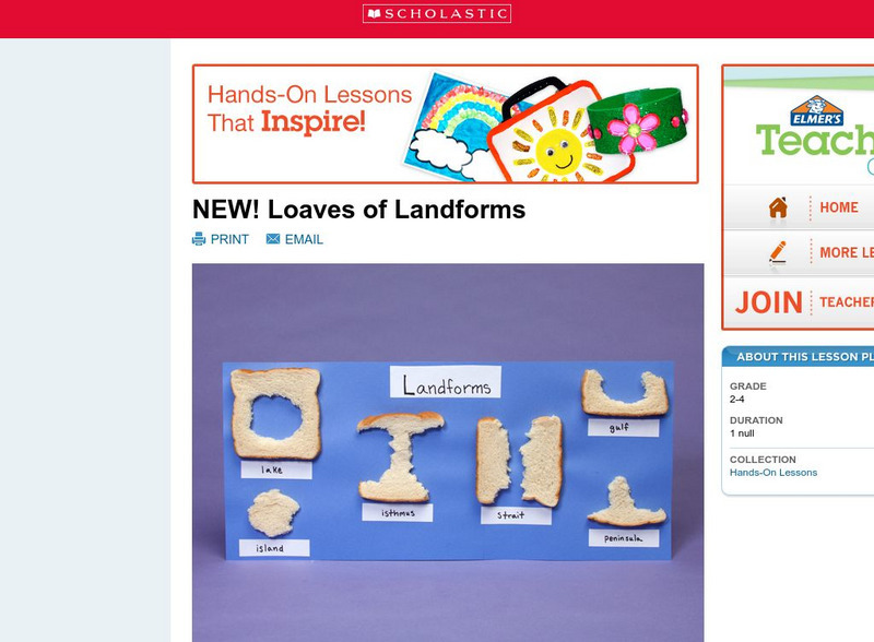
Scholastic: Loaves of Landforms
This is a comprehensive lesson plan to teach primary students about landforms. A foundation in geography begins with an understanding of the terms geographers use to describe the features of Earth. Help students grow their vocabulary and...
A&E Television
History.com: Vasco Nunez De Balboa
A short biography of Vasco Nunez de Balboa, a Spanish explorer, who is credited with sighting the Pacific Ocean while crossing the isthmus of Panama.
PBS
Pbs Teachers: Expedition Panama: Bridge That Changed the World
Investigate the Coriolis effect on the directional flow of currents by measuring linear speeds at different places on the globe. Create a timeline demonstrating geologic time.
Mariners' Museum and Park
The Mariner's Museum: Vasco Nunez De Balboa
A biography of the life of explorer Vasco Nunez de Balboa.
Curated OER
Educational Technology Clearinghouse: Maps Etc: The Barbary States, 1802 1805
A map of the Mediterranean Sea region showing the Barbary States and southern Europe at the time of the Tripolitan War (First Barbary War - 1801-1804) between the United States and the North African Ottoman Empire regencies. The map...
Curated OER
Educational Technology Clearinghouse: Maps Etc: Newfoundland, 1903
A map from 1903 of the Canadian province of Newfoundland, showing cities, towns and ports, railways, lakes, rivers, and coastal features, as well as the coastal districts of White Bay, Bonne Bay, Bay of Exploits, Bonavista Bay, St....
Curated OER
Nova Scotia, New Brunswick, Prince Edward Island, and Newfoundland, 1903
A map from 1903 of the Canadian Maritime Provinces of New Brunswick, Nova Scotia, Prince Edward Island, and an inset of Newfoundland. The map shows province and county borders, rivers, cities, and railroads. "New Brunswick, a province of...
Curated OER
Educational Technology Clearinghouse: Maps Etc: Mexico, 1872
A map from 1872 of Mexico, showing states and state capitals, major cities, towns, and ports, railroads, lakes and rivers, mountain systems, terrain, and coastal features. Steamship routes to major ports are shown, with distances marked...
Curated OER
Educational Technology Clearinghouse: Maps Etc: Nicaragua Canal, 1919
A map from 1919 of the Isthmus of Nicaragua, showing the proposed route of the Atlantic-Pacific canal from Greytown on the Caribbean coast to Lake Nicaragua, then across to Brito on the Pacific coast. The map shows the locations of the...
Curated OER
Educational Technology Clearinghouse: Maps Etc: West Indies, 1910
A relief map from 1910 of the West Indies and Central America showing the land relief of the islands and isthmus, the extent of the submerged Florida, Bahamian, and Yucatan platforms, the basins of the Gulf of Mexico and Caribbean Sea,...
Curated OER
Educational Technology Clearinghouse: Maps Etc: North America, 1885
A map from 1885 of North America, Central America, Greenland, and the Caribbean showing political boundaries at the time, major cities, mountain systems, lakes, rivers, and coastal features of the region. Ship routes from San Francisco...
Curated OER
Educational Technology Clearinghouse: Maps Etc: North America, 1899
A study map from 1899 using North America to illustrate various geographic terms commonly found on maps. The map shows examples of continent, river valley, peninsula, strait, bay, political boundary, lakes, island, ocean, cape, sound,...
Curated OER
Educational Technology Clearinghouse: Maps Etc: North America, 1901
A map from 1901 of North America, Central America, the Caribbean, and Greenland showing general land elevations, mountain systems, rivers, coastal features, and ocean currents. The map is color-coded to show land elevations ranging from...
Curated OER
Educational Technology Clearinghouse: Maps Etc: North America, 1783
A map of North America, Central America, and northern South America at the end of the American Revolutionary War (1783). The map is color-coded to show the territory of the United States at the time, British possessions in Canada,...
Curated OER
Educational Technology Clearinghouse: Maps Etc: North America, 1858
A map from 1858 of North America showing the boundaries at the time for Russian America (Alaska), Greenland, British America or New Britain, Canada East and Canada West, the United States, Mexico, Central America, and the West Indies...
Curated OER
Educational Technology Clearinghouse: Maps Etc: North America, 1800
A map of North America and Central America showing territorial claims and possessions in 1800. The map is color-coded to show the territories of the United States, British, Spanish, French, and Russians, and indicates areas of disputed...
Curated OER
Educational Technology Clearinghouse: Maps Etc: Drawing North America, 1872
A map exercise from 1872 for drawing North America. The map shows the general outline of the coasts, major waters and rivers, and a vertical profile cross-section of the continent from the San Francisco Bay area to Cape Hatteras....
Curated OER
Etc: West Indies and Mexico, 1898 1906
A map of the West Indies and Mexico between 1898 and 1906, showing political boundaries at the time, capitals, major cities and ports, railroads and canals, rivers, terrain, islands, and coastal features of the region. Inset maps detail...
Curated OER
Etc: The West Indies and Mexico, 1898 1906
A map from 1907 of Mexico, Central America, and the West Indies (Greater Antilles to Puerto Rico) between the Spanish-American War in 1898 and the Third Pan-American Conference in 1906. The map shows the political boundaries in 1906,...
Curated OER
Etc: Proposed Isthmian Canal Routes, 1848 1884
Proposed routes for canals on the Central American isthmus.
Curated OER
Etc: Proposed Isthmian Canal Routes, 1848 1884
A map of the proposed isthmian canal routes in Nicaragua and Panama between 1848-1884. The map shows the two chief proposals, the Nicaraguan from Greytown on the Caribbean to Lake Nicaragua and Brito on the Pacific, and the Panama...
Other popular searches
- Land Forms Lakes Isthmus
- Isthmus of Panama
- Isthmus Geography
- Isthmus Panama
- Isthmus of Suez
- The Isthmus of Panama


