Curated OER
Give Me Some Latitude
For this latitude worksheet, students use an atlas or other reference to respond to 4 multiple choice questions about the equator and the poles.
Curated OER
Riding With Alice
Student listen to Don Brown's, Alice's Grand Adventure before discussing cross country travel. They trace Alice's travels on an outline map of the US and focus on the state of Indiana. They color and label the counties that Alice...
Curated OER
Hidin' Out
Fourth graders draw three major Underground Railroad routes crossing Indiana on an outline map and include habitats and towns. They produce an oral history involving at least three natural habitats and one human habitat.
Curated OER
Eat Your State
Fourth graders identify the three major crops, some of the specialty crops, a natural resource from Indiana. They identify where they are located with 90% accuracy. Students map the physical regions of Indiana and identify the major...
Curated OER
Where Are We?
Second graders identify the correct location of their city and state on a map. Through a matching activity, 2nd graders correctly identify their state on a shaped cookie map of the Unites States. They identify their city on a shaped...
Curated OER
How We Get From Here to There
Students recognize various types of movement people rely on to get from one place to another, locate the forms of movement on a map and choose one form of movement and research its path.
Curated OER
State Quarter Game
Investigate the 50 State Quarter's Program. Learners view and discuss the images on the Indiana state quarter, develop a list of questions about the states, conduct research to answer the questions, and play a game using the questions...
Curated OER
Life and Times, Developing a Chronology
Students review the career and life of Ernie Pyle as an example of a biography in context. They consider how a chronology maps out the events in the life of an individual in the context of other events that were occurring at the same time.
Curated OER
What Is That Bubblin' In My Back Yard?
Students are introduced to the GIS system. They create a map plotting local sites the Environmental Protection Agency has on its EPA Regulated Sites list. They identify a list of schools that are near potentially hazard sites.
Curated OER
States of Fitness
Learners participate in physical activities coordinating to divisions on a map.
Curated OER
Can You Give Me Directions To the Game?
Learners become familiar with the use and capabilities of GIS and use it for research and mapping purposes. They heighten their ability to estimate travel times by incorporating distance, mode of travel and urban congestion into the...
Curated OER
Discovering the Past Using the Future: Remote Sensing and the Lost City of Ubar
High schoolers use a video, maps, worksheets and Internet research to explore the role that sensing played in locating Ubar - the lost city of Arabia.
Curated OER
Getting Comfortable with the Internet & Geography
Students are introduced to the basic characteristics of Geography. Using maps, they practice identifying locations and other landmarks. They use the internet to explore websites with are geographically oriented.
Curated OER
Eagle Creek Park (A Hike)
Learners plot a hiking course using aerial photos and a topographic overlay and find the latitude and longitude of absolute locations. They measure the total distance of a hiked area and figure the area of the ground walked using Heron's...
Curated OER
Mesoamerican Carving Project
Third graders are introduced to the use of glyphs and relief carving by Mesoamerican cultures. They complete worksheets, view PowerPoint presentations, participate in a Webquest and create an original glyph carving in sandstone.
Curated OER
Geography of Japan
Students complete a worksheet that guides them through an overview of Japanese geography. Students research the topography, climate, population and size of Japan and consider how these factors work together to produce Japanese culture.
Curated OER
Japanese Fans
Fourth graders, understanding that fans are part of the cultural tradition of Japan, create fans that incorporate design techniques and ornamentation similar to that used in Japan. They also use the fan as an aid to expressive action.
Curated OER
Social Studies: Cameroon
Students discover the history of Cameroon and compile a list of foreign foods found in their local grocery. After taking notes on a lecture, they brainstorm a list of foods they might find on a trip to the country and compare it to what...
Curated OER
Cyber Vacation
Students will look up information concerning their destination. The information should include their destination; the monetary system of the country; cost of hotels; airplane fares, etc. They look at ways to improve o searches as a...
Curated OER
What's In a Name?
Students examine the origins of the names of U.S. states, focusing on names that were derived from Native American words. They are provided with lists of the names of the 50 states, and then research online or in library resources the...
Scholastic
Perfect Postcards: Illinois
Connect the geography and history of Illinois using an art-centered lesson on the railroads. The railroad connected once-distant places, particularly in the Midwest. Using research, class members create postcards of fictional cross-state...
Curated OER
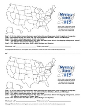
Mystery State #15
Do you know the name of the Badger State? Using five fantastic clues, your super sleuths will determine the name of mystery state number 15. A wonderful way to warm up the class!
Curated OER
Community
Second graders draw a picture. In this communities lesson, 2nd graders read the book Communities, and review as they read. Students use construction paper to create a picture of their houses in three different communities including...
Curated OER
Characteristics of Africa
Learners describe basic land features and characteristics that make up the continent of Africa, describe the people of Africa, where they live, and how they live and get a sense of what it is like to live in Africa.


