Curated OER
Landforms and Bodies of Water
A simple worksheet helps your learners with geographic terms. This could be used as a template for future worksheets which have learners identify some geographic terms, then complete an essay about one of the terms.
Curated OER
I Am A Rock, I Am An Island: Describing Landforms and Bodies of Water
Students identify common landforms and bodies of water from descriptions of distinguishing features. For this landforms and bodies of water lesson plan, students describe the features they see in the pictures given to them.
Curated OER
Map of Pennsylvania's Waters
In this labeling bodies of water in Pennsylvania worksheet, learners observe a map outline of the state with water sources and use the word bank of names of creeks, lakes, reservoirs, and rivers to identify them. Students label 21 bodies...
Curated OER
Bodies of Water
Learners investigate the geography of the Earth by identifying bodies of water. In this global geography lesson, young scholars read a list of bodies of water which they must identify in a word scramble.
Curated OER
Wet Water, Dry Land
Pupils observe and examine relationship between landforms and bodies of water, recognizing differences between them. Students then define island, peninsula, isthmus, archipelago, lake, bay, straight, system of lakes, and identify land...
Curated OER
Major American Water Routes
Sixth graders locate and identify the major bodies of water and waterways in the United States. Through a simulation activity, they describe how early explorers would have described their surroundings. Working in groups, they create...
Curated OER
Water: Where in the Watershed?
Students become connected to their watershed by exploring a local water body and mapping its features. They focus on how the local watershed fits into the larger scheme of the watershed.
Curated OER
Kids Conserve? Water Preserved
Sixth graders review the steps of the water cycle. Individually, they calculate the amount of water they use in a day and identify ways they can conserve. As a class, they discuss how conserving water today helps future generations and...
Curated OER
Investigating Our Place in the World
Students study the concept of geography in a year long unit. In this geography unit, students participate in different activities that explain the spatial sense of the world, the physical landmasses and bodies of water, geographic...
Curated OER
Rivers Run Through It
Using a relief map of New York State, learners answer questions about the distance between different cities, identify bodies of water, and more. First, they discuss vocabulary related to the Hudson River area. Then, they complete a...
Curated OER
Is the Hudson River Too Salty to Drink?
Students explore reasons for varied salinity in bodies of water. In this geographical inquiry lesson plan, students use a variety of visual and written information including maps, data tables, and graphs, to form a hypothesis as to why...
Curated OER
Transportation
Engage in an 8-day study of different modes of transportation. Your students explore the concept of location and define the physical characteristics of places, such as, land forms, bodies of water, natural resources, and weather.
Curated OER
United States Identifier
Fifth graders examine and research a major region of the Unites States in groups of four. In addition, they locate the states, capitals, mammals and two bodies of water or mountain ranges found within their region. After the research,...
Curated OER
Rivers... for Kids
Pupils investigate U.S. geography by exploring it's bodies of water. For this river formation lesson, students identify the reasons rivers are needed in our country by reading assigned text. Pupils examine a diagram which explains how...
Curated OER
Growth of a River
Students evaluate geography by drawing an image in class. In this river lesson, students identify a list of vocabulary terms associated with bodies of water. Students identify how a river is formed and draw a picture of one including the...
Curated OER
Water Features - Lesson 2 - U.S. Political Map Grade 4-5
Students locate water features on maps. In this geography lesson, students complete worksheets that require them to identify water features on a U. S. political map.
Curated OER
The Water Around Us
Students discuss importance of reading maps and knowing about the geography of the United States, and locate bodies of water on different types of maps and examine how they are used in the state or local community.
Curated OER
Water Tank Mural
Students evaluate visual arts by creating a mural on campus. In this symbolism instructional activity, students research famous artists on the Internet and examine the impact their work has had on society. Students create murals around...
Curated OER
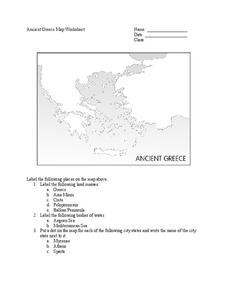
Ancient Greece Map Worksheet
Since the beginning of time, geography has shaped the development of human civilization, and ancient Greece is no exception. This activity supports young historians with exploring this relationship as they first identify key land masses,...
Ms. Catsos
Ancient Rome Map Worksheet
It wasn't just the great leaders of ancient Rome that shaped their civilization—the geography of the region played a major role as well. After first identifying major land masses, bodies of water, and city states on a map of Europe,...
Curated OER
Microsoft Publisher Country Brochure
Students explore geographic information. In this geography and technology lesson, students choose a county and answer related questions on a Webquest. Students create a word web and design a country brochure.
Curated OER
Identifying Island Countries
Students discover the definition of an island and identify island countries around the world. In this geography lesson, students determine the characteristics of an island. Finally the students will identify specific island countries,...
Curated OER
Land or Sea?
Sixth graders access a database to search for desired information, using "and" or "or" connectors where necessary. They choose a connector and search a prepared database of European countries to locate which countries border certain...
Curated OER
Salt Relief Map of Virginia
Fourth graders create a salt relief map of the four regions of Virginia. They indentify land forms and bodies of water, and summarize how they made their project.


