Curated OER
Carbondale: The Biography of a Coal Town
Students use a brief history of the growth and decline of the anthracite region in the state to create a photograph and map "peak shaped" time line. They practice map and photo analysis strategies to "read" photographs and maps.
Curated OER
Driving Forces Forestry In Canada
Learners discuss the natural and economic impact of forests and forestry. Using given statistics they construct different types of graphs in which they make observations and draw conclusions.
Curated OER
Jelly Bean's Galore
Learners investigate the origins of the Jelly Bean. They complete a Scavenger Hunt using the jellybean website. Pupils create a bar graph using information collected about jelly beans. Students discuss the time of year that Jelly Beans...
Curated OER
Wolves: Friend or Foe?
High schoolers study wolves and their habitat in Yellowstone. In this environment and behavior lesson students create an interactive map of wolves in Yellowstone.
Curated OER
A Class Census
Students recognize that data represents specific pieces of information about real-world activities, such as the census. In this census lesson, students take a class and school-wide census and construct tally charts and bar graphs to...
Curated OER
Is the Hudson River Too Salty to Drink?
In this estuary worksheet, students examine data about the salinity of the Hudson River, create a graph from given data and complete 12 short answer questions about the data and graph.
Curated OER
How Has Math Evolved?
Eighth graders pick a topic or person to research related to the history of mathematics. They brainstorm and create a concept map, using the multimedia software inspiration, about what they are researching and want to examine. They then...
Curated OER
Ocean Currents and Sea Surface Temperature
Students use satellite data to explore sea surface temperature. They explore the relationship between the rotation of the Earth, the path of ocean current and air pressure centers. After studying maps of sea surface temperature and ocean...
Curated OER
Thanksgiving Acrostic Poems
Students watch streaming video, Holiday Facts and Fun: Thanksgiving, define and discuss acrostic poetry, complete circle map using words associated with Thanksgiving, and create acrostic Thanksgiving poems to be typed in Microsoft Word...
Curated OER
The Path of the Black Death
Students are able to show on a map how the Black Death moved through Europe. They summarize the direct effects of the Black Death in Europe. Students cite evidence from firsthand accounts in developing an argument that connections can,...
Curated OER
Oceanic Heat Budget Activities
Young scholars map and research imaginary islands located in different parts of the world. They describe the weather and climate of their island and show how local currents, water temperatures and waves may influence the weather patterns.
Curated OER
A Visit to Mexico City: An Introduction to World Communities
Third graders complete a variety of activities as they take an imaginary trip to Mexico City, complete with passports, maps, and Spanish dictionaries. They write postcards to send home and create items to sell at the market. The unit...
Curated OER
The Built Environment-An Integrating Theme
Students observe, record, and present knowledge of their local built environment while conducting a walking tour of their community. They develop written and photo journals, drawings, time lines, graphs, and charts to engage in...
Curated OER
Charlotte's Web Trading Card
Students read Charlotte's Web, view variety of trading cards, discuss what they know about trading cards and their purpose, choose character from story, complete bubble map about character, and create character trading card using...
Curated OER
Groups Coming to America
Fifth graders use text or other references to locate different types of information about the Mayflower and pilgrims. They create a presentation for lower elementary classes about the Pilgrims.
Curated OER
Asian Civilizations
Seventh graders complete computer based research to complete a travel brochure that highlights an Asian civilization.
Delegation of the European Union to the United States
The Geography of Europe
What is the European Union? Where is it? Why is it? To begin a study of the EU, class members examine the physical geography of Europe and the size and population density of 28-member countries in comparison to non-member countries...
Curated OER
Discovering Your Community
Students focus on the origins of the families that make up their community by exploring their family's origins through themselves, parents, and grandparents. Students create a map marked with family origins for the class.
Curated OER
"A Costly Prosperity", South Carolina during World War II
Eleventh graders study the history of South Carolina during World War II. In this American History lesson, 11th graders analyze the economic growth of this state through primary sources. Students interpret many different...
Curated OER
Natural Resources
Fifth graders begin the lesson plan by identifying the different types of natural resources. As a class, they discuss how environments are destructed and how the loss of one natural resource can affect the economy. Using a map, they...
Curated OER
de Soto's Expedition: An Alternate Route
Eighth graders interpret historical evidence presented in primary and secondary resources. In this Exploration Age lesson, 8th graders compare historical maps with new maps focusing on the route of Hernado de Soto.
Curated OER
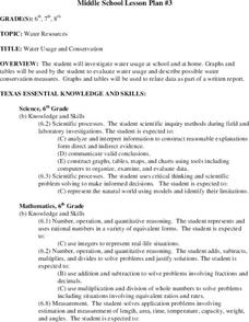
Water Usage and Conservation
Young scholars investigate water usage at school and at home. They use graphs and tables to evaluate water usage. Students describe possible water conservation measures. They use graphs and tables to relate data as part of a written report.
Curated OER
Rosie's Walk
Students use maps and globes to locate and describe locations, directions and scale. Using the maps, they identify man made or natural features of different environments. They practice using geographical terms to describe a specific...
Curated OER
A Bird's Eye View of our 50 States
Third graders focus on state birds as they learned absolute location (latitude/longitude) of each state, as well as their relative location (bordering states).
Other popular searches
- Maps Graphs and Charts
- Charts, Graphs, Maps
- Maps, Charts, Graphs, Tables
- Charts, Maps, Graphs
- Charts, Maps and Graphs


