A Mighty Girl
Gladys West
Teens might find it hard to imagine life before GPS. Using global positioning systems, they can quickly locate the nearest gas station, fast food establishment, or the home of a new friend. Introduce them to Gladys West, the lady who...
CK-12 Foundation
Operations with Vectors: GPS Device
Determine the distance between two hikers using vectors. Pupils use an interactive to develop the formula to find the distance between two points knowing their relationship to a third point. Learners use the formula to calculate the...
Curated OER
Meet Geodesy-The Science Behind GPS
Students discover how a datum of reference points are used to to describe a location. In this Earth Science activity, students will simulate how a GPS accurately determines the location of reference points within a datum.
Captain Planet Foundation
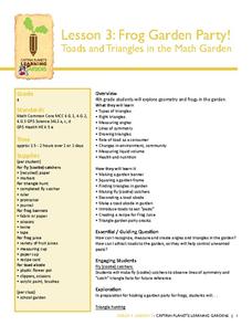
Frog Garden Party! Toads and Triangles in the Math Garden
It's frog party time! With frog banners, frog juice, and a triangle hunt, your garden party is sure to be both entertaining and educational. The lesson connects geometry, earth science, and delicious snacks to teach kids about ecosystems...
Curated OER
GPS Art
Students design their own logo or picture and use a handheld GPS receiver to map it out. They write out a word or graphic on a field or playground, walk the path, and log GPS data. The results display their "art" on their GPS receiver...
Illustrative Mathematics
Global Positioning System II
Intricate details of a modern technology that many of us take for granted in our phones, computers (and some cars) are laid bare in a short but deeply investigative activity. The math behind a seemingly simple GPS device...
Curated OER
GPS Scavenger Hunt
Students go on a GPS scavenger hunt. They use GPS receivers to find designated waypoints and report back on what they found. They compute distances between waypoints based on the latitude and longitude, and compare with the distance the...
Curated OER
The Grand Excursion GPS Map
Eighth graders investigate the uses of a global positioning system. They create waypoints and have to find them using the system. Students must review the geographical concepts of latitude and longitude. The media requirements of the...
Curated OER
Basic Mapping Skills
Establish and study the parts of a map with your class and, then they will work in small groups to create their own detailed map, including a legend. There are specific instructions to follow on what needs to be included.
Curated OER
GPS Receiver Basics
Students practice using a GPS receiver. They walk in different directions and monitor their progress on maps. They enter specific locations and use information given to them to get them back to their original locations.
Curated OER
M & M Addition
Eat your math manipulatives, are you serious? Yup, Learners listen to the story The M & M's Addition book, add single digit numbers to reach sums up to six, and demonstrate addition and subtraction number combinations using several...
Curated OER
Around the Town
In the world of GPS, make sure your kids can still read maps and determine distances between locations. You will need neighborhood street maps, ideally of your class' home turf. Ask kids questions about different locations in relation to...
Curated OER
TE Lesson: Navigating at the Speed of Satellites
Students study the basic concepts of the Global Positioning System and how it increases the accuracy of navigation. They examine trilateration and how the speed of light is used to calculate distances.
Curated OER
Math Manipulative: "Fraction Sticks"
Fifth graders use sets of fraction sticks to color in fractional amounts and determine how to compare pairs of fractions. In this math activity, 5th graders insert the correct symbol given the fractions they are working with....
Curated OER
Black Holes....II
In this black hole worksheet, students use the equation for time dilation to solve 8 problems including determining the time it takes to receive a GPS signal from space, the time delay for the GPS-Earth system, the distance a radio...
Curated OER
The Mathematical Dynamics of Celestial Navigation and Astronavigation
High schoolers explore the different methods used in celestial Navigation and astronavigation. In this math lesson, students construct a sextant and demonstrate how it works.
Curated OER
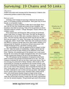
19 Chains and 50 Links
Students investigate surveys as it relates to chains and links. In this math lesson, students relate math to history and surveys done above, below and on the earths' surface. They review vocabulary pertaining to this lesson before moving...
Curated OER
Space Science:Wherever You Go, There You Are
Students explore navigation principles by observing, measuring, and interpreting data to determine locations. Using a compass, compass rose, and a transit, they plot courses and discover the workings of the Global Positioning System...
Curated OER
Boy Scout Merit Badge: Surveying
In this boy scout merit badge: surveying learning exercise, 8th graders research the websites listed to answer 8 detailed questions about first aid, surveying projects, GPS, the impact of surveying and careers.
Georgia Department of Education
Analytic Geometry Study Guide
Are you looking for a comprehensive review that addresses the Common Core standards for geometry? This is it! Instruction and practice problems built specifically for standards are included. The material includes geometry topics from...
Mathematics Vision Project
Similarity and Right Triangle Trigonometry
Starting with similar triangles and dilation factors, this unit quickly and thoroughly progresses into the world of right triangle features and trigonometric relationships. Presented in easy-to-attack modules with copious application...
Curated OER
Finding our way
Tenth graders investigate the use of a GPS. In this math lesson, the students will use a GPS type system to determine positioning in two dimensions. They will complete questions out of a student workbook.
Curated OER
Where in the World?
Students explore how GPS works, the mathematics behind the technology, and how GPS is used. They find positions in one and two dimensions, and participate in a WebQuest that explores how math is used to find a location on Earth using GPS.
Curated OER
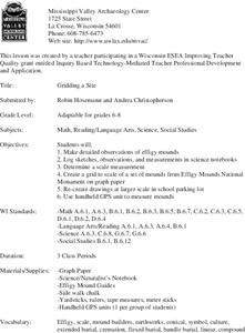
Gridding a Site
Students make observations of effigy mounds and record them in a notebook. In groups, they must determine the scale of measurement and create their own grid to scale part of the Effigy Mounds National Monument. They also practice using...


