Curated OER
Meet Geodesy-The Science Behind GPS
Students discover how a datum of reference points are used to to describe a location. In this Earth Science activity, students will simulate how a GPS accurately determines the location of reference points within a datum.
Curated OER
GPS Scavenger Hunt
Students go on a GPS scavenger hunt. They use GPS receivers to find designated waypoints and report back on what they found. They compute distances between waypoints based on the latitude and longitude, and compare with the distance the...
Curated OER
Basic Mapping Skills
Establish and study the parts of a map with your class and, then they will work in small groups to create their own detailed map, including a legend. There are specific instructions to follow on what needs to be included.
Curated OER
GPS Treasure Hunt for Knowledge
Students examine themselves as being part of a global community. In this global community activity, students investigate GPS systems. Students gain knowledge on how the device works. Students discover that satellites provide information...
Curated OER
Around the Town
In the world of GPS, make sure your kids can still read maps and determine distances between locations. You will need neighborhood street maps, ideally of your class' home turf. Ask kids questions about different locations in relation to...
Curated OER
Hide and Seek with Geocaching
Students locate objects using a Global Positioning System. In this global geography lesson, students explore latitude and longitude using a GPS in order to locate objects.
Curated OER
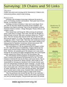
19 Chains and 50 Links
Students investigate surveys as it relates to chains and links. In this math lesson, students relate math to history and surveys done above, below and on the earths' surface. They review vocabulary pertaining to this lesson before moving...
Curated OER
"Where in the World is my School?"
Students learn new vocabulary and discuss what GPS is and does. They locate their school using the equipment.
Curated OER
And a Star to Steer Her By: A Field Trip Guide for the Planetarium Show
In this field trip study guide for the planetarium show lesson, students construct a model of the Earth and describe the relative positions of the continents using latitude and longitude. Students construct a star chart to find...
Curated OER
Latitude and Longitude
In this latitude and longitude instructional activity, learners complete 4 activities to demonstrate understanding. Students use a protractor to measure angles on a map of the earth. Learners fill out a latitude and longitude chart after...
Curated OER
Helping Disabled Dogs
Students read a story called Carts Give Mobility to Disabled Dogs and answer vocabulary and comprehension questions about it. In this current events lesson plan, students respond to literature by answering questions, recalling details,...
Captain Planet Foundation
George Washington Carver and the Sweet Potato
Learn about George Washington Carver's important contributions to agriculture by studying the sweet potato. First graders read about the inventor's observations and prepare sweet potato slips for the class garden. Additionally, they...
Curated OER
Teaching Geography Through Geocaching
Bring geography to life with a real world treasure hunt.
Curated OER
Deep Blue: Exploring the Deep Ocean
Students examine landforms. In this social studies lesson, students bounce a beach ball around in order to discover that seventy percent of the Earth is covered in water. Students
Curated OER
Giants Stalk the High Street
Learners explore consumerism in Great Britain. In this current events lesson, students visit selected websites to determine how shopping habits have changed in Britain throughout the years. They also evaluate changes in market shares of...
Illustrative Mathematics
Illustrative Mathematics: G Mg, G Gmd Global Positioning System Ii
Satellites communicate with a GPS device and establish the distance between them and their locations. The set of points at a fixed distance from a satellite form a sphere so when the GPS receives its distance from a given satellite, this...


