Curated OER
Map Projections: The Grapefruit Activity
Students partcipate in activities in which they examine different map projections. They discover the positives and negatives of each type. They use grapefruits to help them with the different types of map projections.
Curated OER
Map Puzzles
Students make puzzles from world maps, dramatizing how much of the globe is covered by ocean.
Curated OER
Science Inquiry Lesson: Mapping Project
Students explore the methods of creating maps. They create a map of Animas River Park using a compass and measuring tape, develop a single map from the team map sections, and devise another map of the Animas River Park using a GPS unit.
Curated OER
The Crash Scene
Fifth graders explore geography by participating in a mapping activity. In this engineering instructional activity, 5th graders identify the differences between latitude and longitude and practice locating precise points on a globe or...
Midnight Martian
Mars Globe HD
Explore the surface of Mars without leaving the comforts of your home or classroom! Learn about volcanoes, missions to the red planet, view the topography, and more.
Curated OER
Maps Reinforcement
In this map worksheet, students complete 6 multiple choice questions and 5 short answer questions about 3 different map figures.
Curated OER
Where in the Latitude Are You? A Longitude Here.
Students distinguish between latitude and longitude on the map. In this mapping lesson, students participate in mapping skills to recognize spatial relationships, and where to find natural resources on the map. Students create...
Space Awareness
How To Travel On Earth Without Getting Lost
Have you ever wanted to travel the world? Take a virtual trip with a geography lesson that uses longitude and latitude, the position of the sun, an astronomy app, and a classroom globe.
Curated OER
From Pirates to Pilots to Spies
Sixth graders enjoy this introduction to the world of map projections, globes, aerial photographs, and satellite images. This lesson instructs students on the advantages and disadvantages of each earthly representation.
Curated OER
Harvesting Water from Fog
Students analyze the water issues of Cape Verde in the Peace Corp lesson. In this water resources lesson, students analyze the concept of water being harvested from fog. Students explore the Peace Corps project site by watching...
Curated OER
Researching the World's Oceans
Students research and compare important features of the oceans based on current data. They examine the globe or map, determine the major oceans of the world, and record their names on the data sheet.
Curated OER
Weather in Your City
Students observe weather conditions of a particular city. Multiple intelligences are explored within this lesson. They locate their particular city on a United States map. Each student writes about their discoveries in his/her journal...
Curated OER
Honing in on Hummingbirds
Students explore ruby-throated hummingbirds. In this cross-curricular hummingbirds lesson, students listen to the book The Mystery of the Missing Hummingbirds and choose related topics to research with a partner. Students draw or...
Curated OER
Deadly Shadow of Vesuvius
Students view a video clip about volcanoes. They collect data and create maps to see the relationship between volcanoes, earthquakes and plates. They share their maps with the class.
Curated OER
Landforms: Geomorphology of Arkansas
Second graders create large, salt dough maps of Arkansas and the natural regions in the state created by geographical and morphological features.
August House
Go to Sleep, Gecko
Use this multidisciplinary lesson to delve into these subjects: English language arts, math, science, drama, and character education. After reading, discussing, and making interpretations about Go To Sleep, Gecko!: A Balinese...
Teach Engineering
Earthquakes Living Lab: The Theory of Plate Tectonics
Find out if your class agrees with Ice Age: Continental Drift ... or if it's just a fun family movie! Class members research the theory of continental drift, examine evidence of plate tectonics, connect...
Space Awareness
How Light Pollution Affects the Stars: Magnitude Readers
Did you know light can decrease visibility? Light pollution absolutely makes it more difficult to see stars. Scholars build a simple magnitude reader to determine the magnitude of stars. They use these data to estimate the impact of...
Curated OER
Indiana Tornado Project
Learners become familiar with the use of GIS for research, natural phenomena in Indiana, and analyzing collected information.
Curated OER
Snow Cover By Latitude
Pupils create graphs comparing the amount of snow cover along selected latitudes using data sets from a NASA website. They create a spreadsheet and a bar graph on the computer, and analyze the data.
Curated OER
Anza and Font in Search of Latitude
This is an integrated lesson that incorporates Social Studies, Science, and Mathematics. In Social Studies, 7th graders complete an online interview and complete an online worksheet about latitude of sites on the Anza trail. In Science...
Curated OER
Oceans
First graders recognize that nearly three quarters of the Earth is covered by ocean. They locate the Pacific, Atlantic, Indian, Arctic and Antarctic oceans on a map. They describe the difference between ocean water and fresh water.
Curated OER
Star Quest
Learners engage in a instructional activity of using maps in order to find constellations in the night sky. They also conduct research using three constellations. The research is used to create a project to inform others. The teacher...
Howard Hughes Medical Institute
EarthViewer
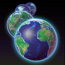
Can you imagine Washington DC and London as close neighbors occupying the same continent? Learners will be fascinated as they step back in time and discover the evolution of the earth's continents and oceans from 4.5 billion...


