Curated OER
Ecological Footprint--How Does The Way We Live Affect Earth?
Learners demonstrate an awareness of the global implications of decisions that individuals and families make about their needs and wants. They identify environmental and health issues related to the production and consumption of food....
Curated OER
Ocean Impacts of an El Nino Event
Students study sea surface height and temperature and other characteristics of an El Nino. In this ocean impacts lesson students examine the factors that influence an El Nino or La Nina.
Curated OER
From Sheep to Rug
Ever wonder where wool comes from? How it is used to make a woven rug? Introduce the Native American craft of rug making to your preschool or kindergarten class with a discussion. Learners examine and discuss images of a Native American...
Curated OER
The Great War Was Not Great Enough To End All Wars
Students examine the causes and military actions of World War I. In this World History lesson, students study the sacrifices made by Americans and Europeans. Students read and analyze primary sources related to World War I....
Curated OER
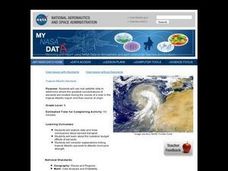
Troical Atlantic Aerosols
Young scholars explore the effect aerosols have upon he weather and climate. They observe NASA satellite images to explore and draw conclusions about aerosol transport. From studying the images, students track the path of aerosols. They...
Curated OER
As the Kids Come and Go: Mapping a Classroom
Map the classroom with your kids to help them understand how maps work and how to read them. The lesson starts off with a story about animals living and moving around the globe, and then kids create maps of their classroom to show how...
Curated OER
Introduction to Maps
Students investigate a variety of maps to explain what each one is used for.
Curated OER
What Do Maps Show?: Lesson 1 Introduction to Maps
Students brainstorm a list of the different types of maps they have seen or used. Using the activity sheet, they look through a social studies book to find all the maps and to determine what they are used for. Using a poster, they review...
Curated OER
Tango Bingo
Students research tango music and dancing and research where it comes from. In this tango lesson plan, students research Argentina and South America while learning about the tango and making posters of it.
Curated OER
A Walk Around the School: Mapping Places Near and Far
After reading Pat Hutchins’ Rosie’s Walk, have your young cartographers create a map of Rosie’s walk. Then lead them on a walk around the school. When you return class members sequence the walk by making a list of how the class got from...
Curated OER
How Do I Get There? Planning a Safe Route to School
One much-needed skill for young learners is direction giving. Have your class plan and draw a safe route for them to travel from home to school. They will also draw places and items that are in between home and school in order to build a...
Curated OER
Reading the Coyote School News: Lives of Ranchers in Southern Arizona
Fourth graders examine the effects of Mexican-American ranching on life today.
Curated OER
Cartogram of the Great Compromise
Students create cartograms of populations during 1790.
Curated OER
What's So Bad or Good About Conflict?
Learners of all ages discuss how conflict can be negative and positive. First, they create a class bulletin board about conflict, and provide their thoughts and connotations surrounding the word. In a class discussion, they ask questions...
Curated OER
Puerto Rico: The 51st State?
Students examine the political status of Puerto Rico. In this global studies lesson, students explore Puerto Rico and consider the feelings of Puerto Ricans regarding their unique political status.
Curated OER
What Are We Going To Do About Baby Six Billion?
Students formulate and evaluate suggestions about government policy using demographic examples and projections. They examine websites and utilize worksheets imbedded in this plan.
Curated OER
Orienteering - Lesson 1 - Maps & Map Scales
Lesson 1 of 10 lessons in this orienteering unit is about maps and map scales. After all, orienteering is all about maps, compasses, and finding ones' way around. It is imperative to be able to read maps and understand the relevance of...
Curated OER
Trembling, Spewing Earth: Impacts on Human Activity
Seventh graders study to identify patterns in earthquake activity and impacts on human behavior. They also develop plans to cope with such natural disasters.
Curated OER
Developing, Developing, Developed!
Students differentiate among and explain various levels of economic development around the world. They see that levels of economic development vary greatly in different countries according to many different measures.
Curated OER
Where is the Trail? The Journey of Lewis and Clark
Students explore the trail followed by Lewis and Clark on their journey across the United States. In this United States History lesson, students complete several activities to establish the Lewis and Clark Expedition, including a class...
Curated OER
We've got the whole world in our hands
Students explore spatial sense in regards to maps about the globe. In this maps lesson plan, students label oceans, locate the continents and poles, follow directions, and explain the symbols on a map.
Curated OER
Westward Ho!
Second graders use a minimum of three maps of Kansas developed during the 1800's. They plot five major settlements that developed near water sources. Students brainstorm reason settlements may have developed near water sources.
Curated OER
Where in the Latitude Are You? A Longitude Here.
Students distinguish between latitude and longitude on the map. In this mapping lesson, students participate in mapping skills to recognize spatial relationships, and where to find natural resources on the map. Students create...
Curated OER
Yo-ho, Yo-ho a Viking's Life for Me
Students complete a unit of lessons on the Vikings. They analyze maps, read and discuss myths, summarize the main ideas from resource materials, watch videos, sing a song, draw a picture to illustrate Norse mythology, and define key...
