Curated OER
South America Map Quiz
In this online interactive geography quiz worksheet, students examine the map that includes all of South America's countries. Students identify the 13 countries in 2 minutes.
Curated OER
Middle East Map Quiz
For this online interactive geography quiz worksheet, students examine the map that includes 26 Middle Eastern countries. Students identify the names of the countries in 4 minutes.
Curated OER
Central America Map Quiz
In this online interactive geography quiz learning exercise, learners examine the map that includes 22 Central American countries. Students identify the names of the countries in 3 minutes.
Curated OER
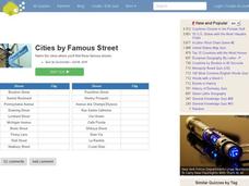
Famous Streets Quiz
In this online interactive geography quiz worksheet, students examine the chart that includes the names of 18 famous streets in the world. Students have 4 minutes to identify the names of the cities where the streets...
Curated OER
State Nicknames Quiz
In this online interactive geography quiz worksheet, students examine the chart that includes the names of 49 states. Students identify the nicknames of the states in 6 minutes.
Curated OER
California Cities Map Quiz
In this online interactive geography quiz worksheet, students examine the map that includes 12 California cities. Students identify the names of the cities in 3 minutes.
Curated OER
Famous Lakes Quiz
In this online interactive geography quiz worksheet, students examine the chart that includes details about 15 famous world lakes. Students identify the names of the lakes in 3 minutes.
Curated OER
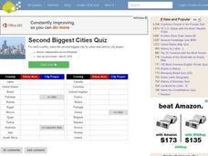
Second Biggest Cities Quiz
For this online interactive geography quiz worksheet, students examine the chart that includes details about 20 major cities in the world. Students identify the names of the cities in 4 minutes.
Curated OER
Canada Map Quiz
For this online interactive geography quiz worksheet, students examine the map that includes 13 Canadian provinces and territories. Students identify the names of the provinces and territories in 2...
Curated OER
Highest Mountain Countries Quiz
In this online interactive geography quiz learning exercise, students examine the chart that includes the elevations of 20 world mountains. Students identify the names of the mountains in 4 minutes.
Curated OER
Past v. Present: Using Geography & Anthropology
Students examine artifacts and documents from their Canadian community. They analyze early Canadian history and make predictions about the future of the country.
Curated OER
A Tour Through China
Students explore the culture, development, inventions, and geography of China in the seven lessons of this unit. The teachings of Confucius are examined and the celebrations for the Chinese New Year are inspected.
Curated OER
America the Beautiful
Students analyze the physical geography of the United States and how we have adapted to or altered the land to create the country we know today. Students complete maps with physical features, states and cities of interest.
Curated OER
Environment: How'd That Pollution Get There?
Students examine how global wind and water patterns aid in the spread of worldwide pollution. In groups, they read articles about the domino effect of pollution and create posters displaying its journey. On blank world maps, students...
Curated OER
Life in Sahara
Students explore the geography of the Sahara region of Africa and identify characteristics of a desert habitat. They explore the culture of the people living there and how it has adapted to desert life.
Curated OER
Filigree Jewelry
Students describe physical and human characteristics of North Africa and the Middle East, plot on a map areas populated by nomadic people in those areas, explain importance of filigree jewelry in Arab culture, and create their own jewelry.
Curated OER
Get Smart
Students study sustainability and smart growth. In this geography lesson students identify the benefits that are expected from smart growth.
Curated OER
Landforms And The Oregon Trail
Fourth graders investigate the historical context for the founding of The Oregon Trail. They conduct research to put together the events that led to the geographical route that was taken. The lesson also strengthens geography skills with...
Curated OER
Taming the Mighty Dragon
Students incorporate the five themes of geography to study the Yangtze river region. They analyze the possible effects of the three rivers gorge damn project on this area and role play a float the entire length of this dangerous river...
Curated OER
Tales From the Crypt
Eighth graders study the people of their community. In this Geography lesson, 8th graders research local history using maps and books. Students create a timeline of tombstones for deceased residents.
Curated OER
Hurricanes and Climate
Students investigate maps and data to learn about the connections between hurricanes and climate. In this exploratory lesson plan students describe and graph the 6 regions where hurricanes happen and discuss how hurricanes have changed...
Curated OER
Canada's Immigration patterns: 1950 to Present
Students examine the changing immigration pattern of Canada. For this immigration lesson, students use statistical data from a web-site to complete a worksheet and graph their findings.
Curated OER
What's The Plan?
High schoolers identify how the human activities in the state of Maryland have changed/ evolved over the last 50 years. They evaluate a land planning document and prepare a fictitious planning document for a given area of land.
Curated OER
Utah's Biomes
Fourth graders discover what a biome is and study biomes that are native to Utah in this series of lessons. They examine how Utah's biomes have changed over time due to the influence of the Mormon pioneers and other human populations.


