Curated OER
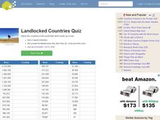
Landlocked Countries Quiz
In this online interactive geography quiz worksheet, students examine the chart that includes details about the population in 44 landlocked countries. Students identify the names of the countries in 5 minutes.
Curated OER
The Equator
Learners investigate cultures located along the equator. In this geography skills lesson, students research the geography, history, culture, and tourism of Ecuador, Indonesia, Kenya, Brazil, and Singapore. Learners write an article based...
Curated OER
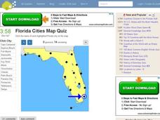
Florida Cities Map Quiz
In this online interactive geography instructional activity, students examine a map of Florida and identify the 12 noted cities on the map using a pull down menu within 3 minutes.
Curated OER
Texas Cities Map Quiz
In this online interactive geography worksheet, students examine a map of Texas and identify the 15 noted cities on the map using a pull down menu within 3 minutes.
Curated OER
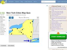
New York Cities Map Quiz
In this online interactive geography activity, students examine a map of New York and identify the 11 noted cities on the map using a pull down menu within 3 minutes.
Curated OER
This is America
Students explore world geography by viewing a documentary film in class. In this national parks lesson, students view the Ken Burns documentary about the subject and identify the contributions of individuals in support of the parks...
Curated OER
Lesson 1: Map Data and the Census
Young scholars learn about the history of the census. In this U. S. Census lesson plan, students develop an understanding about how the United States Constitution grants and distributes power and discover how the spatial organization of...
Curated OER
Terrestrial Ecozones, Population Density and Species at Risk
Tenth graders navigate and use the online Atlas of Canada. They explain the cause and effect relationship between human settlement and the natural environment and wildlife species. They utilize a worksheet imbedded in this plan.
Curated OER
Geography: Mapping Newspaper Coverage
Students examine the locations of stories appearing in newspapers and determine where to assign reporters. Using various maps, they connect the stories to the correct maps and create charts of the story locations. Students explain their...
Curated OER
Barefoot and Pregnant
Students address the problem of a reduction in the world population growth rate being offset by a growing world population base. This problem is particularly true with the rapid population growth in many Third World countries. The lesson...
Curated OER
Objectivity
Help young readers examine historic artifacts to determine if they were designed to help people survive or to create enjoyment. They identify objects that were designed to help people to survive and to enjoy themselves. Then compare and...
Curated OER
Will There Be Subsistence Farmers in the 21st Century?: Feeding the World
Students examine the topic of subsistence farming. They research the future of subsistence agriculture, identify the types and locations of subsistence agriculture, and write about subsistence farming in regards to developing nations and...
Weebly
Ancient China
From China's physical geography and earliest beginnings of civilization to the Qin and Han dynasties, here is a nicely designed worksheet on ancient China, which includes a graphic organizer and timeline to summarize the reading...
Global Oneness Project
Documenting Architectural Heritage
Imagine going from being one of the richest, most important cities in the world to one of the poorest. Imagine the history captured in the architecture of such a city. Imagine these same now abandoned buildings being destroyed. How would...
Curated OER
The Great Depression and Everyday Life
Examine everyday life during the Great Depression, as well as the effects if the Depression on American population, society, and economy. Learners write who, what, where, when, and why summaries of a person who relocated to California...
Curated OER
Who We Are
Students analyze population data and trends in Canada over a given amount of time. As a class, they are introduced to the concept of dependency load and use a population pyramid to calculate the figure. Using the internet, they...
Curated OER
Too Many People Coming a Little Too Fast
Students learn what happens when a city's population grows too rapidly for the city to accommodate it. They examine and discuss examples of cities growing rapidly today, what problems occur with rapid growth, and ways to solve these...
Curated OER
People On The Move
Students describe patterns of internal migration in the United States, past and present and evaluate implications of internal migration. They examine population movement at the state and local levels.
Curated OER
Paul Revere
Young scholars examine Henry Wadsworth Longfellow's, Paul Revere's Ride, and other pieces of poetry to use maps and literature to investigate geographic concepts. They chart Revere's ride on current Massachusetts maps while working in...
Curated OER
Famous Rivers Quiz
In this online interactive geography activity, students examine the descriptions of 16 famous rivers and identify them by name within 3 minutes.
Curated OER
Where in the World is Utah Wheat?
Students examine the role of climate and landforms in the use of Utah's land. In this geography lesson, students analyze the relationship between geography and agriculture in the state as they examine data regarding wheat production in...
Curated OER
Geographic Terms Glossary
In this geography worksheet, students learn 60 common geographic terms. Students read the words that are arranged in alphabetical order along with the meanings. There are no questions to answer; this is a glossary.
Curated OER
Geography of the Study of the Spanish-speaking People of Texas
Students identify the physical features, demographic characteristics, and history of the four Texas towns featured in Russell Lee's photo essay, "The Spanish-Speaking People of Texas." They conduct Internet research, and create a travel...
Curated OER
Who We Are: To Know the Characteristics of a Population Within Certain Domains
Students, through research, discover the characteristics of the population of Quebec and compare them to those of Canada as a whole. They create a class presentation about information they found.
