Curated OER
Geography of Canada
All about Canada! Learners explore the geography and providences of Canada by watching videos, studying maps and conducting internet research. By the end of this lesson, your class should be able to locate major areas and compare and...
Curated OER
Map Skills
Young scholars explore geography by creating a poster presentation in class. In this mapping lesson, students identify the different components featured on a modern day map and how to utilize them in order to navigate. Young scholars...
Curated OER
Play Doh Map of Your State
Learners create a state map using Playdoh. In this hands-on state geography lesson, students work in groups to form a three-dimensional map of their state using Playdoh made at home following a (given) recipe. Learners use four...
Curated OER
Learning European Geography
Sixth graders discover locations and countries in Europe by identifying them on a map. In this European geography lesson, 6th graders read the book The Lost Little Elephant, with their class and discuss the geography referenced in...
Curated OER
Maps Can Help Us
First graders explore the geography of Montana by analyzing geographic maps of the area. In this Native American reservation lesson, 1st graders discuss the similarities and differences between reservations in the state of Montana....
Curated OER
Blank Map of Canada
In this Canadian geography activity, students use a blank map of Canada to color and label important geographical features and cities. Students will need to do their own research before labeling this map.
Curated OER
The Roman Empire-Map Activity
In this Roman Empire worksheet, students complete a map activity in which they label and color civilizations, countries and physical features as instructed. There are no maps included.
Curated OER
U.S. Geography for Children: Michigan
In this Michigan map activities worksheet, students observe an outline map of the state of Michigan, locate and label specific places and areas, and create a map key. Students complete 5 activities.
Curated OER
U.S. Geography for Children: The Northeast
In this map skills of the northeastern United States activity, students observe an outline map, locate and label the states, and designated landforms and bodies of water; and create symbols and a map key for sources of economy and other...
Curated OER
U.S. Geography: California
In this map skills about the state of California instructional activity, students locate and label specific places and areas and create a map key and symbolize the economy and areas of personal interest. Students answer 5 questions.
Curated OER
U.S. Geography for Children: State Capitals
In this United States map skills worksheet, students locate and label specified states and their capitals, and create icons and a map key to show something for each state that is famous. Students answer 5 questions.
Curated OER
U.S. Geography for Children
In this U.S. map activity instructional activity, students observe maps of the continental United States, Hawaii, and Alaska, locate and label landforms and bodies of water, and create symbols for natural resources and places of...
Curated OER
Physical Geography of Africa
Fifth graders investigate the topography of Africa. In this physical geography lesson, 5th graders research the six regions of Africa and complete a physical map. Students locate various landforms in Africa. Students...
Curated OER
Texas: U. S. Geography for Children
In this Texas map worksheet, students locate and label key features of Texas on the map and create icons to symbolize the economy and culture of Texas.
Curated OER
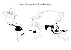
World Map With Rain Forests
In this geography worksheet, students study a map of the world which shows shaded areas indicating where the rain forests are located. There are no labels for countries or continents.
Curated OER
Florida: U.S. Geography for Kids
In this Florida geography worksheet, students locate and label the important features of Florida and create icons for the economy and culture of Florida.
Curated OER
Through the Forest and Home Again: Maps Help Us Find Our Ways
Students read Little Red Riding Hood, focusing on her path home to Grandma's house. In this language arts and geography lesson, students perform a reader's theater, re-creating the walk home and possible routes that could have been...
Curated OER
Idaho State Map
In this Idaho state map worksheet, students color and label important physical features and cities. Students also study the background map to learn the location of Idaho as related to the rest of the U.S.
Curated OER
Hawaii State Map
In this Hawaii state map learning exercise, students color and label important locations and physical features on the map of the 8 islands of Hawaii.
Curated OER
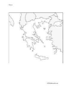
Map And Flag of Greece
In this Greece worksheet, students color and study a Greek flag. Students also color and label a map of Greece. This could be used in writing a report.
Curated OER
Map of Norway
In this geography of Norway worksheet, students color and label a map with major cities and physical features. Students need to do their own research.
Curated OER
Map of Arctic Region
In this Arctic region geography instructional activity, students examine a map of the Arctic and color it. The latitude and longitude lines are shown as well as the labeled countries and oceans. The map shows an overhead view looking...
Curated OER
Map Keys
In this geography learning exercise, students identify who a cartographer is and what they do specifically. They study an outline map of a fictitious island and then, respond to the three questions that follow. Finally, students add...
Curated OER
Pennsylvania State Map
In this geography of Pennsylvania worksheet, learners color and label a map of the state. Students also study the location of Pennsylvania on a grey background map of the entire 50 states.


