Curated OER
Tourism in Northern Ireland
In this tourism worksheet, students label pictures of tourist destinations with the name of the country they are located in, write sentences about pictures showing damage caused by tourists, identify locations on a map, and fill in...
Curated OER
Letters from Rifka
Fourth graders read Letters from Rifka and discuss the feelings of people forced to leave their homes and countries. In this migration instructional activity, 4th graders relate their feelings about moving from their home forever....
Curated OER
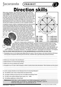
Direction Skills
In this geography worksheet, students read an excerpt on what directions tell someone. They respond to 6 short answer questions related to the neighborhood illustration found on the second page of the worksheet.
Curated OER
Social Studies:
Learners identify various types of breads fromother countries and locate them on maps. In small groups, they make story maps of books that mention bread and make books resembling sandwiches. Students have a bread tasting party and...
Curated OER
What Makes a Tropical Rainforest Special?
Learners examine the characteristics of the tropical rainforest. Using a map, they locate the rainforests found around the world, continents and the equator. Using the internet, they research the various layers of the rainforest and...
Curated OER
Louisiana and Canada: Understanding Acadian Cultural connections
Ninth graders investigate why Acadians moved to Lousiana. In this geography lesson plan, 9th graders research the migration of Acadian to Louisiana and how that influenced the culture. Students analyze a list of cultural...
Curated OER
Washington D.C.
Learners research monuments in Washington, D.C. In this geography lesson plan, students research one monument and use the Internet to gather information. Learners create a three-dimensional model of their monument.
Curated OER
Watersheds: The San Francisco Bay Watershed
Sixth graders make a model of a watershed. In this geography lesson, 6th graders view a shaded relief map of California and locate landmarks. Students examine the San Francisco Bay Watershed by following the journey of water through...
Curated OER
Africa Falls Prey to H.I.V.
Students use maps, statistics, and written texts to recognize the H.I.V. explosion in Africa.
Curated OER
Africa Unite!
Students work in pairs to research assigned African countries. They compile their research to label a continent map of Africa, present their research to the class and design a game of trivia using their findings.
Curated OER
High Five Burger
Fifth graders investigate agricultural sources. In this agricultural instructional activity, 5th graders read the book Have a Hamburger and See the U.S.A. and record each component of a hamburger. Students use a map of the U.S.A. to...
Curated OER
Families Around the World
Students discover the similarities and differences in families from around the world. In this multicultural lesson, students create their own family album and label each family member. There are suggested activities such as investigating...
Curated OER
Many Uses of Plants
Students research and discuss non-food plant products that are in common use, and mark on a world map the name of the country where the plant is grown.
Curated OER
The Olympics
Students will research the geography and designa route form Columbia SC to an olympic competition, then follow local news and current events to track team perfomance.
Curated OER
The Impact of Islamic Culture on the Arts of the Renaissance
Eighth graders examine the linguistic and cultural impact of the Arabic language and Islamic culture on the Spanish language. They analyze and label maps, listen to and differentiate between Spanish and Arabic music, and compare and...
Curated OER
Ancient Civilizations
Sixth graders complete map-work in order to understand the progression of hunter-gatherer societies. In this hunter-gatherer lesson plan, 6th graders label maps with the Equator, the Tropics, and the vegetation. They complete associated...
Curated OER
The Sahara Desert
The children will create a watercolor picture of the Sahara Desert and label it.
Curated OER
Making Globes
Fifth graders construct and design paper mache globes. They paint and draw the continents and oceans, and label each continent and ocean.
Curated OER
Interpreting Aerial Photographs
Students interpret aerial photographs. They view aerial photographs or satellite-produced images to locate and identify physical and human features. They study satellite images and label their images for bodies of water, clouds,...
Curated OER
On the Way Home#122
Students observe the various physical and man-made features that they pass on the route they take on their way home from school. They sketch the features before drawing and labeling a map of the route. They share the maps with other...
Curated OER
Mesoamerica
Learners demonstrate knowledge of early Middle American civilizations. They study Mesoamerican i religions, governments, and achievements. They identify geographies of North and South America.
Curated OER
Learning About Our World
Students explore their world using the book "This is the Way We Go to School." They predict information about the story based on the title and pictures. Students label a world map with the names of continents and oceans. They write a set...
Curated OER
Africa's Geographic Features
Fourth graders work in pairs and use atlases to locate specific geographic features in Africa. They use the Internet to view these geographic features.
Curated OER
Geography of Early China
Students research and identify the primary geographic features of China. They investigate which features isolated China, and identify the significance of the Hwang River to Early Chinese civilizations. Finally, they research the Silk...


