Curated OER
Geography and Climate
Students investigate geographical locations and their own personal experiences with the environment. In this environmental identification lesson, students participate in a match game using certain environmental and geographical...
Curated OER
Where Does Our Food Come From?
Fourth graders identify the state or country that a food product came from and locate it on a map. They identify products that are grown in Hawaii and the factors important in the location of economic activities.
Curated OER
Climatic Zones
Third graders recognize and locate Frigid, Temperate, and Torrid climatic zones on the word map or globe. They explain that plants, animals, and human societies display adaptations to the climates they live in .
Curated OER
Mongolia Geography
Students examine the geography and culture of Mongolia. Individually, they cut out cut-outs of animals to place on their maps and label the grasslands and desert areas. They locate major cities and rivers along with vegetation.
Curated OER
Mapping Your Local Community
First graders take a walking tour of their community to discover the names of numbered locations on a premade map. They then, create their own map of the community on the computer using Kidspiration software.
Curated OER
Geography And Chinese Landscape Painting
Fourth graders label the physical features of China on a map and become familiar with
the content of traditional Chinese landscape paintings in this lesson intended for the forth grade classroom.
Curated OER
Global Lesson: Social Studies On-Line Global Lesson: Social Studies On-Line Continents
In this geography PowerPoint a simple world map on which each continent is represented by a solid green landform is the background for each of the nine slides. The continent names appear in a list on the first slide, followed by one...
Curated OER
Mapping With MapPoint
The class is engaged through a discussion of mapping. They determine what they believe makes a good map and what the essential elements of a map are. Students work independently to complete a worksheet on mapping. They follow clear...
Curated OER
Literature: Mapping the Mockingbird
Students read Harper Lee's To Kill a Mockingbird, focusing on setting. They list items that create mental images of the novel's setting along with location references to characters and events. Using posterboard, they construct physical...
Curated OER
Geography of Ancient Greece
Students are to recognize where Athens, Sparta, and Olympia are on a map. They have to also list the geographical features of each area as well. They do this by using their textbook and a map of ancient Greece
Curated OER
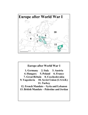
Europe after World War I
In this Europe after World War I map worksheet, students note the 11 regions of the Europe labeled on the map.
Curated OER
2 Cities: Europe's Capital Cities
In this European cities worksheet, students label the countries and then provide an alphabetical key for each country. Students then label each capital city and provide a numerical key for each city.
Curated OER
What in the World?
Eighth graders plot points of longitude and latitude on a world map. In groups, they create a model of the earth's interior and label the parts,
Curated OER
The Physical World: Continents and Oceans
In this world map worksheet, study the map of the continents and oceans. Learners label each of the 12 sections of the world map.
Curated OER
Introduction to China
Seventh graders explore China. In this geography skills lesson, student label maps of the nation, discuss stereotypes about the nation, and research technological innovations of the nation.
Curated OER
Instruments From Around the World
How much does the environment affect how and what man creates? Children explore the effect of the environment on primitive man as they research raw materials from a specific location. They use their findings to write a short essay about...
Curated OER
We Live in an International Community
Students locate the different countries from which their clothing originates. Using a blank map, they identify and color in those areas.
Curated OER
Plotting A Hurricane Using latitude and Longitude
Students explore map and plotting skills by tracing the movement s of hurricanes through the Earth's systems. a hurricane map is developed from daily media reports.
Curated OER
Global Economy: A Simple Activity
Students explore the global economy. In this economics lesson, students examine clothing labels in search of the countries the clothing was made in. Students consider the implications of a global economy.
Curated OER
"We Didn't Start the Fire"
Students extract geographical and historical information from the lyrics of a popular song, make associations between people, places, and events, and plot their information on a map.
Curated OER
Immigration: Creating Change
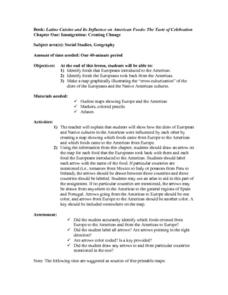
Students explore how immigration has changed the culture of America. After identifying the foods and diets of Europeans and Native cultures, students create a map indicating where foods came from. Students design a restaurant menu,...
Curated OER
On the Road Again
Students trace the migration route of a gray whale. They color and label a map of North America, and using photocopy pictures of a gray whale, they move the whale along the migration route over a ten week period.
Curated OER
Dinosaurs
Second graders classify and analyze living things by structure and function and make predictions based on observations rather than random guesses. They make predictions about where dinosaurs lived and correctly place their databases onto...
Curated OER
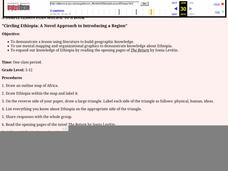
Circling Ethiopia: A Novel Approach to Introducing a Region
Learners read a novel to gain insight into a different region of the world. Using a graphic organizer, they share the information they have already gathered about Ethiopia. They draw an outline map of Africa and read the opening pages of...
