Curated OER
Discovering the Past Using the Future: Remote Sensing and the Lost City of Ubar
High schoolers identify and locate specific locations on the Arabian Peninsula, the Rub al Khali Desert, and present day Oman. They identify other names for the lost city of Arabia as Ubar, the Atlantis of the Sands, Iran, and the city...
Curated OER
Getting to Know the Streets of Honolulu
Students practice identifying the streets names of Honolulu. Using a city map, they identify a main street and two intersecting streets. They research the origin of the name and complete a worksheet. They share their findings and...
Curated OER
Eagle Creek Park (A Hike)
Learners plot a hiking course using aerial photos and a topographic overlay and find the latitude and longitude of absolute locations. They measure the total distance of a hiked area and figure the area of the ground walked using Heron's...
Curated OER
Geographic Information Systems
Students examine the concept of geographic information systems (GIS) and its basic components. They explore an application program using GIS technology and list the various uses for GIS.
Curated OER
Students Become Mapmakers
Students practice making a map of a continent and correctly plotting five cities on that map. They place latitude and longitude lines on a map, determine the need for various map projections and explain why map scales are necessary.
Curated OER
Predicting Nations at Risk
Students explain the "So what?"-or the international implications-of factors that indicate the developmental status of a nation.
Curated OER
Search for Ice and Snow
Students use satellite images to locate areas of ice and snow on the globe. They create a table showing the information they gathered. They present their information to the class.
Curated OER
The Earth is an Orange
Students examine and identify the various types of maps. Using two types of maps, they compare the data that can be gathered from each one. They also identify and locate the continents and the oceans. They review the purposes of each...
Curated OER
How Does Climate Affect Your Environment?
Young scholars access the Global Sun Temperature Project website and research the relationship between the location and climate of a participating school to its building structure. They consider how climate affects the type of structures...
Curated OER
Historical Research on Explorers of Canada
Eighth graders study an online atlas of Canada to research an early explorer.
Curated OER
The Case of the Mysterious Red Light
Students investigate why some sunrises and sunsets are unusually bright red.
Curated OER
Who We Are: To Know the Characteristics of a Population Within Certain Domains
Students, through research, discover the characteristics of the population of Quebec and compare them to those of Canada as a whole. They create a class presentation about information they found.
Curated OER
Nunavut, Our Communities
Students research the Online Atlas of Canada to locate the communities of Nunavut. Students examine the geographic area and characteristics of the communities.
Curated OER
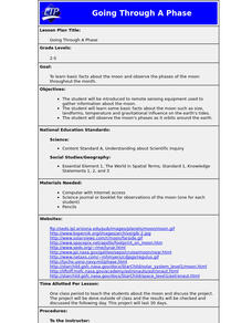
Going Through A Phase
Students are introduced to remote sensing equipment used to gather information about the moon. They learn basic facts about the moon such as size, landforms, temperature and gravitational influence on the earth's tides.
Curated OER
Discovering Dinosaurs: Planning your Summer Vacation
Students utilize the features of the Atlas of Canada website to plan an imaginary vacation from Victoria, British Columbia to Drumheller, Alberta.
Curated OER
African Country Report
Sixth graders describe the relationship between the people of Africa and their environment. They examine the climate, economy and inhabitants of this land. Using maps graphic organizers and writing a report, 6th graders demonstrate how...
Curated OER
Regional Landforms and Native People
Third graders study the Native American tribes of Maidu and Miwok by studying Internet artifacts, culture, language, music, storytelling, architecture, food, clothing, crafts and geology.
Curated OER
Mapping My World
Students are introduced to simple maps and view a map of a classroom and compare distances of items shown.
Alabama Learning Exchange
Our World is Like a Rainbow
Learners create a Venn diagram of people's similarities and differences. They investigate why people relocate to different geographic regions after investigating the positives and negatives of different states.
Curated OER
The World (With an emphasis on the United States)
Fourth graders recognize the different continents. They are introduced to longitude and latitude and how to find locations using these measurements. This series ends with an emphasis on the fifty states of the United States and their...
Curated OER
The Growth of Islam
Seventh graders gain insight into the daily lives of Muslims and to develop empathy for them by studying the Islamic world and creating presentations.
Curated OER
And the Rains Came Down: A South American Rainforest
Students examine the characteristics of a South American tropical rainforest. They analyze maps, develop graphs, listen to the book, The Great Kapok Tree, and create a rainforest mural.
Curated OER
'European Exploration, Conquest, and Trade
Fifth graders examine the motives, progress and results of the European exploration and conquest of Asia, Africa and the West Indies from the 15th to the 17th centuries. They use maps to trace spice routes and research the role of spices...
Curated OER
Life on the Border
High schoolers discuss different types of boundaries. They research the United States/Mexico border and answer questions about their findings. They create collages, posters, or multimedia presentations showcasing various areas of concern...


