Owl Teacher
Imaginary Nation: Constructing a Map
Your young geographers will combine what they have learned about the five themes of geography and their inner creativity to design a physical map for an imaginary nation.
Curated OER
Geographic Landforms
Each slide is a simple notebook page with one landform in blue and its definition in red. There are 26 vocabulary terms in all, some you may want to use, and others easily hidden. It is recommended that you add photos or other graphic...
Curated OER
Geography Booklet
Sixth graders explore geography terms. Students use resources to find real examples of landforms in the world. They create a map showing the landform. students label the surrounding features, countries and states. Students use each...
Curated OER
Canada's Landform Regions
High schoolers use a atlas to identify and describe Canada's Landform region. Using the information they collect, they create a thematic map of the region and describe all of the physiographic regions and the processes that formed them....
Curated OER
Canada's Landform Regions
Students identify and describe the processes that created the landform regions in Canada. They map the regions and research one region to discover more about it. They present their findings to the class.
Curated OER
A Feature Presentation - Geographic Landforms
Students investigate, identify and compare the various geographic terms that can be used to describe the landforms occurring in the Hawaiian islands.
Curated OER
Title: Rivers as Borders
Students are introduced to the concept of borders. They read maps and identify rivers that separate different countries and states. They examine how or why a landform such as a river border might be the reason for different cultures.
Curated OER
Physical Features
Students draw physical land features using ClarisWorks or Kid Pix, write their definitions, create slideshow, and create class geography book.
K5 Learning
Landforms
Valleys, mountains, and plateaus are just a few geographic landforms on our Earth. Read about these types and more in a brief landform passage. After reading, learners respond to six short answer comprehension questions.
Curated OER
Landforms E-mail Project
Students identify and explain geographic terms. They write descriptions of the terms. Students discuss landforms and draw pictures to illustrate them. Students compose and present oral reports about landforms.
Alabama Learning Exchange
Forces that Change the Land
Students conduct Internet research find information about the following landforms: mountains, canyons, and valleys. They create travel brochures of their findings.
Curated OER
Landforms and Bodies of Water
A simple worksheet helps your learners with geographic terms. This could be used as a template for future worksheets which have learners identify some geographic terms, then complete an essay about one of the terms.
Curated OER
Landforms
Second graders identify all the geographical landforms along the pioneer trail. They study, and present to the class, at least one geographical landform along the pioneer trail.
NET Foundation for Television
1850-1874 Homestead Act Signed: The Challenges of The Plains
Start a whole new life in a land known as the Wild Wild West! Learners analyze maps, personal accounts, the Kansas-Nebraska Act, songs, and video clips to uncover life under the Homestead Act. Using their new skills, class members role...
Montana State University
Meet Mount Everest
Learning about one landform might seem boring to some, but using the resource provided practically guarantees scholar interest. The second in a sequential series of eight covering the topic of Mount Everest includes activities such as a...
Curated OER
Wet Water, Dry Land
Students observe and examine relationship between landforms and bodies of water, recognizing differences between them. Students then define island, peninsula, isthmus, archipelago, lake, bay, straight, system of lakes, and identify land...
Curated OER
The Happy Game: Physical Features
Students love to test their knowledge, use this game to see what your students know about landforms and other basic geographic terminology.
Curated OER
Surveying the Land
Students explore the different kinds of maps and the purpose of each. In this Geography lesson, students work in small groups to create a map which includes the use of a map key.
Curated OER
Outlandish Landforms
Seventh graders examine landforms. In this world Geography lesson, 7th graders research and create a physical model of a chosen landform. They then draw a 2-d paper map of that model.
Curated OER
Create a Planet
Students craft planets from clay. In this geography skills lesson, students create model planets that mimic the geographic features found on Earth as well as the other planets. Students conduct research about characteristics of the...
Curated OER
Landforms: Geomorphology of Arkansas
Second graders create large, salt dough maps of Arkansas and the natural regions in the state created by geographical and morphological features.
Curated OER
Overland Trails To The West
Consider the political, physical, and geographical factors that led to and marked the Westward Expansion. Learners will track the various routes developed during the 1800's. They create a first person journal describing what they see,...
Curated OER
Georgia's Regions
Students understand that Georgia has 5 main land regions. They are able to identify the geographic regions of Georgia and describe the regions by completing a research project about a given region with 100% mastery.
Curated OER
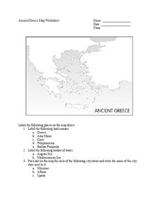
Ancient Greece Map Worksheet
Since the beginning of time, geography has shaped the development of human civilization, and ancient Greece is no exception. This instructional activity supports young historians with exploring this relationship as they first identify...


