Education World
Mystery State #3
In this United States mystery worksheet, students determine which state is described by the 5 clues listed on the sheet and then mark it on the outline map of the United States.
Curated OER
Exploring Florida
Students explore the state of Florida. They study the basic facts associated with the state, such as : the capital, the state bird, and the state song. They locate places in Florida and about the climate, tourism, and agriculture.
Curated OER
Filling Up Florida
Students study factors controlling Florida's population growth and related environmental impacts. They research natural community types and construct maps (including a large-sized map of Florida) to be used for a simulation activity.
Curated OER
Florida: U.S. Geography for Kids
In this Florida geography worksheet, students locate and label the important features of Florida and create icons for the economy and culture of Florida.
Curated OER
Map Scaling
Second graders use a map scale to determine distances between cities in the state of Florida.
Curated OER
Create A Map!
Students examine two- and three-dimensional shapes, and discuss map skills and attributes. They plan and create their own school campus maps using pre-cut building site shapes.
Curated OER
Strawberry Girl: Outdoors in Florida
Students explore nature by researching the state of Florida. In this animal identification lesson, students read a children' story and research the Internet to discover the difference in animal life between the early 1900's and present...
Curated OER
United States All the Way
Learners create patriotic books about the United States and some of its special symbols.
Curated OER
A Look at the Population Density of the United States
Students acquire census information and create maps of the population density of the United States on different scales. They role play the roles of workers of a retail company and they use the population data to market to their customers.
Curated OER
What's Your Temperature?
Learners take a look at the local newspaper and focus on the weather section. They get into small groups, and each one looks at the same map, but of a different part of the country. They must prepare a presentation that shows how...
Curated OER
Discovery, Ship to Shuttle
The history of Florida is explored in this lesson which covers topics from Ponce de Leon to space travel. Learners listen to stories about Ponce de Leon's search for the fountain of youth and then move on to a discussion of the space...
Alabama Department of Archives and History
Alabama BEFORE the American Revolution
Did you know that prior to the American Revolution, Alabama was a part of the British empire and called New West Florida? Class members research the economic, political, and social realities of this territory and compare them to those of...
San Antonio Independent School District
The Not So Big Book of Westward Expansion
From the thirteen colonies to the Mexican cession, your learners will track the territorial acquisitions made by the United States during eighteenth and nineteenth centuries with this printable booklet.
Curated OER
Extreme Weather and Mapping
In this environment worksheet, students read an article about extreme weather conditions and mapping it out. They respond to 10 multiple choice questions about what they read. Then, students explain how droughts can occur and the...
Curated OER
Who's Range is it?
Students investigate the habits of panthers by analyzing radio transmitted data. For this animal life lesson, students utilize computers to view the range of different statistics dealing with Florida panthers. Students complete a...
Curated OER
Bermuda Triangle: Map Activity
In this Bermuda triangle activity, students complete a set of 4 questions using a given map of the Bermuda triangle. Answers are included on page 2.
Curated OER
State My Name
Students study the names of all fifty states, their capitols, location on a map, and an economic resource of each state. They complete a matching game activity.
Curated OER
5th grade social studies geography
In this geography instructional activity, 5th graders complete multiple choice questions about hemispheres, maps, cities, ecology, and more. Students complete 25 questions.
Curated OER
Lesson 3: Seven Day Road Trip
Students plan a seven day road trip. In this travel lesson, students plan a driving trip that includes five major cities or attractions in Florida or another state of their choice. They show the trip on a map, calculate distances that...
Curated OER
It's Time to Rhyme
Students listen to rhyming book, identify rhyming pairs, guess what rhyme words mean, and create list of rhyming pairs on chart paper. They then discuss Fifty States Quarters Program, identify objects on backs of state coins, and...
American Battlefield Trust
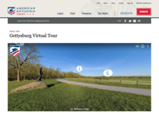
Gettysburg Virtual Tour
Step into one of the most iconic battlefields of the American Civil War with an educational interactive resource. Young historians learn about key moments, locations, soldiers, and turning points in the battle with a clickable map and...
Curated OER
Searching the Net
Students create a Native American Nation flip book. In this Native American lesson, students choose one of four Native American Nations: The Iroquois, Hopi, Seminoles, Sioux. They research them on the Internet using teacher given...
Curated OER
Where In the World Are You?
Fourth graders fill in blank copies of the United States Map and then the World Map.
Curated OER
Scrambled States
Students read or are read the story "Scrambled States". Using a map, they identify their states and time zones. They predict their states representation in the book and discuss it after the book is finished. They discvor the differences...


