Curated OER
Blank Europe Outline Map
In this blank outline map worksheet, students explore the political boundaries of the continent of Europe and those of the countries located there. This map may be used in a variety of classroom activities.
Curated OER
Blank Europe Outline Map 2
In this blank outline map instructional activity, students explore the political boundaries of the continent of Europe and those of the countries located there. This map may be used in a variety of classroom activities.
Curated OER
Europe Outline Map
In this outline map worksheet, students examine the political boundaries of the continent of Europe. The map may be used in variety of activities that individual teachers create to accompany it.
Curated OER
Europe Outline Map
For this blank outline map worksheet, students explore the political boundaries of the continent of Europe and those of the countries located there.
Curated OER
Europe Outline Map (Labled)
In this blank outline map worksheet, students study the political boundaries of the labeled European nations.
Curated OER
Europe Map
In this blank outline map worksheet, students explore the political boundaries of the continent of Europe. This map may be used in a variety of classroom activities.
Curated OER
Europe Labeled Map
In this Europe political map worksheet, students examine the national boundaries. The map also highlights each of the nation's capitals with a star. The countries and capital cities in this map are labeled.
Curated OER
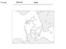
Denmark Outline Map
In this blank outline map worksheet, students explore the political boundaries of Denmark located in Europe. This map may be used in a variety of classroom activities.
Curated OER
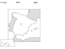
Spain Outline Map
For this blank outline map worksheet, students explore the political boundaries of Spain located in Europe. This map may be used in a variety of classroom activities.
Curated OER
Europe: Political Map
In this Europe political map worksheet, students examine each country's boundaries. The map also highlights each of the nation's capitals with a star.
Curated OER
European Map
In this blank outline map activity, students explore the political boundaries of the continent of Europe and those of the countries located there.
Curated OER
Europe Map Quiz
In this Europe map quiz activity, students examine an outline map of the continent and label the names of each of the countries.
Curated OER
European Country Map
In this Europe political map worksheet, students examine the national boundaries. The country names are labeled on the map.
Curated OER
Romania
In this blank outline map instructional activity, students explore the political boundaries Romania located in Europe. This map may be used in a variety of classroom activities.
Curated OER
World Map Labels
In this geography skills worksheet, students identify the countries and bodies of water labelled on the maps of the world, Africa, Asia, Canada, Europe, the Caribbean, the Middle East, North America, Australia, and South America.
Curated OER
British Isles
In this map worksheet of Britain, students study a detailed outline map of the British Isles. No labels are provided and there are no directions.
Curated OER
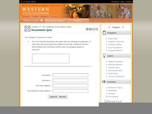
Western Civilizations, Chapter 23: Modern Industry and Mass Politics, 1870-1914
Looking for an interactive way to supplement your western civilization course? Check out this comprehensive website, designed to accompany the Western Civilizations text (although it is valuable independently). Scholars investigate...
Other popular searches
- Outline Maps of Europe
- Medieval Europe Outline Map
- Western Europe Outline Map
- Outline Map of Europe
- Blank Outline Maps Europe
- Outlining Map of Europe
- Medievil Europe Outline Map
- Wwi Outline Map Europe
- Europe Maps Outline
- Europe Outline Map Activity


