Curated OER
Europe Outline Map
In this blank outline map worksheet, learners explore the political boundaries of the continent of Europe and those of the countries located there.
Curated OER
Travel in Europe
In this European travel worksheet, students respond to 11 short answer questions that require them to research travel throughout the countries in Europe.
Curated OER
The "Sick Man of Europe"
An all-encompassing view of the Ottoman Empire, this presentation takes a 300 year journey through the history, culture, and fate of the original "sick man of Europe." Grand photos and detailed maps provide the necessary context to...
Curated OER
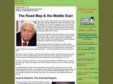
The Road Map & the Middle East
Will walls help? Read to learn how Prime Minister Ariel Sharon proposes to build walls around Isreal in hopes of isolation from Palestine. Complete an online Webquest, analyze maps, listen to audio clips, answer discussion questions, and...
Curated OER
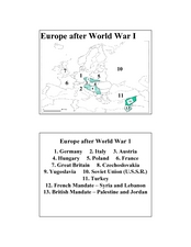
Europe after World War I
In this Europe after World War I map worksheet, students note the 11 regions of the Europe labeled on the map.
Curated OER
Map Studies
Young scholars analyze maps of Europe, and research and discuss current wars in Europe, and compare them to World War I and World War II.
Curated OER
Europe Lakes Map Quiz
In this online interactive geography quiz worksheet, students respond to 10 identification questions about major lakes located in Europe.
Curated OER
Europe Mountain Ranges Map Quiz
In this online interactive geography quiz worksheet, students respond to 6 identification questions regarding the mountain ranges of Europe.
Curated OER
The Protestant Reformation Through Maps
A series of maps and photographs guide viewers through the spread and influence of the Protestant Reformation in Europe in these slides. With several bullet points detailing the causes of the Reformation, the presentation covers the...
Curated OER
Absolutism in Central Europe
Supplementing a class lesson on the Holy Roman Empire and Prussia and the Austrian Empire, this series of images will help contextualize the time period and historical figures for students. Maps and portraits both flesh out the details...
Curated OER
City Life In Europe
Students explore Paris. In this geography skills lesson, students watch "City Life in Europe," and conduct further research on the city of Paris and the country of France. Students create postcards that feature Parisian landmarks.
Delegation of the European Union to the United States
Cultural Identity
How does cultural diversity impact political identity? That is the question researchers face as they continue their examination of the European Union and the programs it has developed in its attempt to achieve unity in diversity. To gain...
Curated OER
Mapping Population Changes In The United States
Learners create a choropleth map to illustrate the population growth rate of the United States. They explore how to construct a choropleth map, and discuss the impact of population changes for the future.
Curated OER
The Path of the Black Death
Students are able to show on a map how the Black Death moved through Europe. They summarize the direct effects of the Black Death in Europe. Students cite evidence from firsthand accounts in developing an argument that connections can,...
Curated OER
Getting to Know France
In this map skills worksheet, students answer 14 questions about the geography of France. Students then draw a rough map of France. It is assumed that access to an atlas is available.
Curated OER
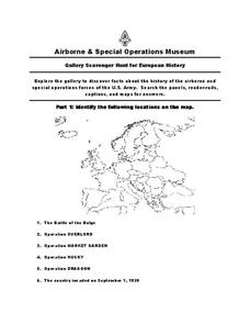
European History
For this world history worksheet , 5th graders look for information related to the history of Europe. They view the facts from a map and apply them to different activities.
Curated OER
Where Is Rome?
Third graders discover Ancient Rome through maps and worksheets. In this world history activity, 3rd graders locate Rome on a world map and identify the scope of the Roman Empire. Students label an entire map of Italy after...
Curated OER
World War I
High schoolers justify how alliances lead to war. They compare the conflicts of war that arose because of imperialist interest. Students explain the cause of World War I. They compare and contrast European maps before and after World...
World Maps Online
Introduction to the World Map
Students identify the differences between maps and globes. In this map skills instructional activity, students are shown a globe and a map and recognize the differences. Students use post-it notes to locate several locations on the world...
Curated OER
Crossing Time Zones
Learners explore the concept of differing time zones. Students refer to maps to identify the time zones in particular regions. They role play phone calls from different time zones. This lesson is intended for learners acquiring English.
Curriculum Corner
Earth Day Book
This Earth Day, celebrate our beautiful planet with an activity book that challenges scholars to show off their map skills, complete a crossword puzzle, write acrostic poems, alphabetize, and reflect on their personal Earth-friendly habits.
Curated OER
Africa Capitals Map Quiz
For this online interactive geography quiz worksheet, students examine the map that includes 53 African countries. Students match the names of the countries to the appropriate locations.
Curated OER
Early Medieval Europe
Students engage in a host of activities during an examination of early Medieval Europe. They draw coats of arms, make collages of architectural designs, and create posters of knights, serfs, and castles. Students role-play as sons of...
Curated OER
Lesson Plan on Map Skills for South Asia
Seventh graders observe and discuss an overhead transparency map of South Asia. In small groups, they label a blank map of South Asia, and listen to a lecture on the realm.
Other popular searches
- Maps of Europe
- Blank Maps of Europe
- Outline Maps of Europe
- Geography Maps of Europe
- Maps of Europe 1914
- Maps of Europe Political
- Maps of Europe Ppt
- Maps of Europe Pot
- Maps of Europe 1919
- Maps of Eastern Europe
- Maps of Medieval Europe
- Western Europe Maps


