Curated OER
Estimating Distances
Fifth graders explore the concept of estimating distances between two places on a map. In this estimating distances lesson, 5th graders interpret maps according to measuring distance. Students choose a place on a map and find the...
Curated OER
Scaling it Down: Caves Have Maps, Too
Measurement and map skills are the focus of this lesson, where students crawl through a "cave" made out of boxes, desks and chairs, observing the dimensions. Your young geographers measure various aspects of the cave and practice...
Curated OER
Pumpkin Science
Here is a nice instructional activity, which includes some good worksheets, on pumpkins and how they grow. It is an ESL instructional activity designed for beginning and early intermediate students. After listening to some books about...
Yummy Math
2015 Macy's Thanksgiving Parade
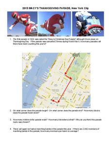
Take a seat on the parade route with a holiday-themed set of word problems. Young mathematicians answer questions based on the annual Macy's Thanksgiving Parade in New York City, including finding the average number of members in a...
Curated OER
How Many Blades of Grass in a Football Field?
Students, by taking a sample count from a small area, estimate the total number of blades of grass in a football field. They use a cardboard from, the inside of which measures 1 square foot to do their calculations.
Curated OER
Introduction to Lego Robotics
Learners utilize computer programs to operate a simple robot. In this technology activity, students create robots using Lego pieces and simple motors to move them. Learners measure the speed of the robots by running Robolab...
Curated OER
Geography: Snow Cover on the Continents
Students create maps of snow cover for each continent by conducting Internet research. After estimating the percentage of continental snow cover, they present their findings in letters, brochures or Powerpoint presentations.
Curated OER
City, County, Community
Students explore issues and situations that make for a city and its local environments. In this local government lesson, students design maps, define issues and create brochures that illustrate their understandings of these concepts and...
Curated OER
How Far Did They Go?
Students create a map. In this direction and distance lesson, students come up with familiar places in the community and calculate the distances from these places to the school. Students create a map that displays these places and their...
Curated OER
Junk Mail Overload!
Students discuss the "junk mail nuisance" with the teacher and share their opinions on the problem. Students collect a week's worth of junk mail, bring to class and complete a chart about the amount and weight. Students then complete an...
Curated OER
Lost at Sea: The Search for Longitude
Middle schoolers research and chart the shortest course to circumnavigate the globe.
Curated OER
Inventors Timelines
Students create a class timeline using the patent year for their selected inventor or invention. Using a piece of yarn, they physically create a timeline, and create and answer math word problems using the years from the timeline.
Curated OER
Jobs and Salaries
In this economics worksheet, high schoolers look for the budgets and go through the practical activities of maintaining a monthly expense sheet.
Curated OER
Earthquake Plotting
Students become familiar with map coordinates. They establish the frequency of earthquake occurrences and study the location and magnitude of earthquakes. To establish the location of plate boundaries.
Curated OER
Where Am I?
Students identify the latitude and longitude of various locations and calculate the distance between two given coordinate points. They read an eBook, explore the City Zen program, and complete a worksheet.
